
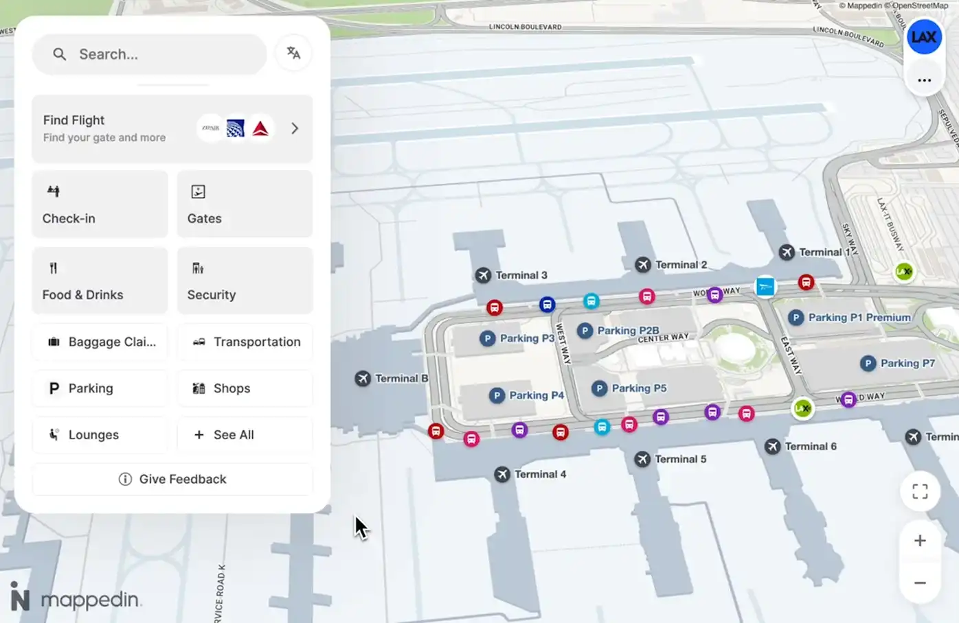
Modern airports run on complexity. It’s time their maps did too.
Airports need more than wayfinding. They need one platform that connects systems, partners, and passengers.


We’re introducing a new passenger experience that connects every part of the airport, unlocking commercial opportunities and delivering real-time insights where they’re most valuable.


Capture demand
Put revenue on the map
Highlight retail and dining when passengers are deciding where to go next. Turn navigation moments into opportunities to discover and spend.
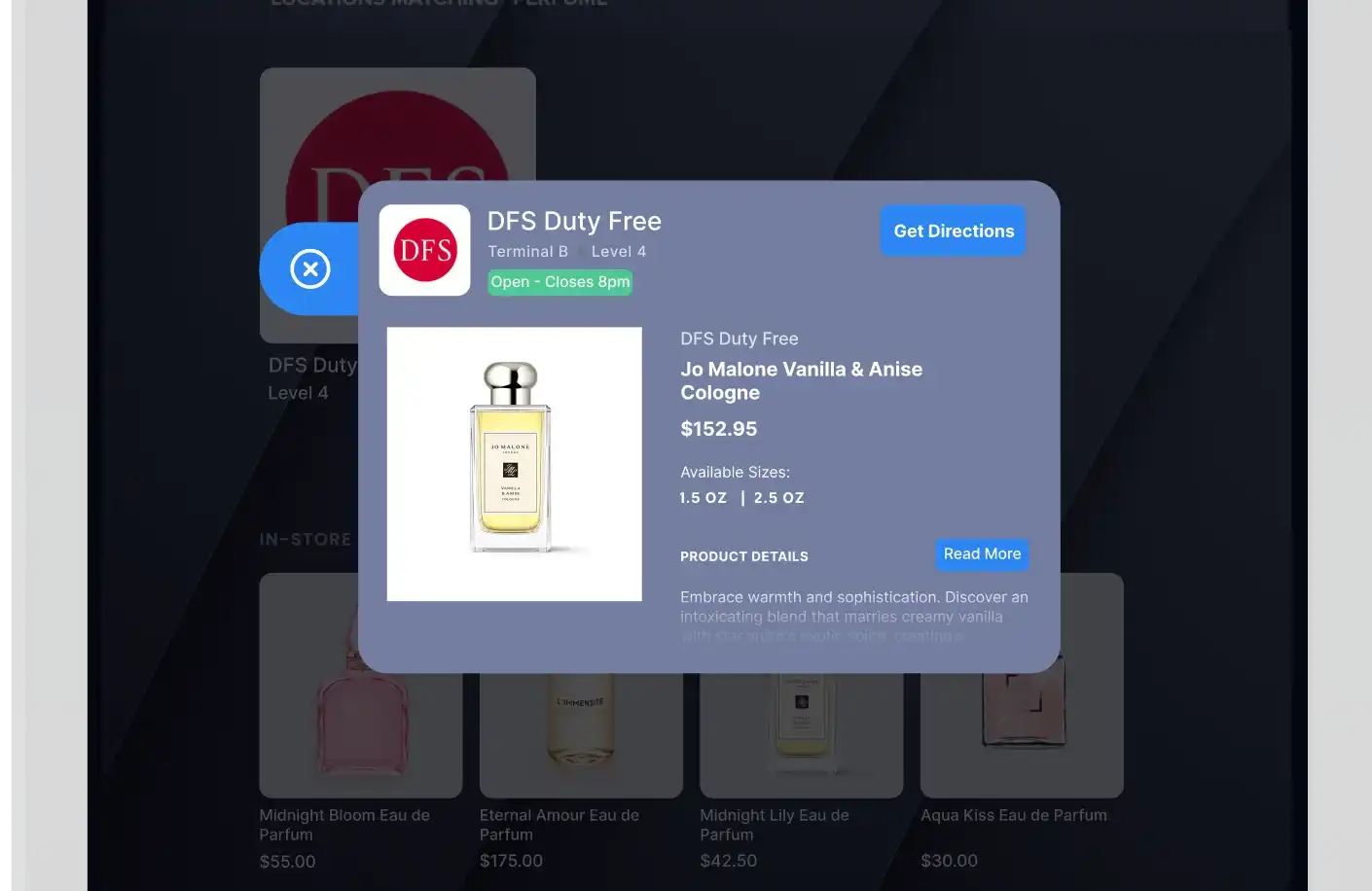
Shop smarter
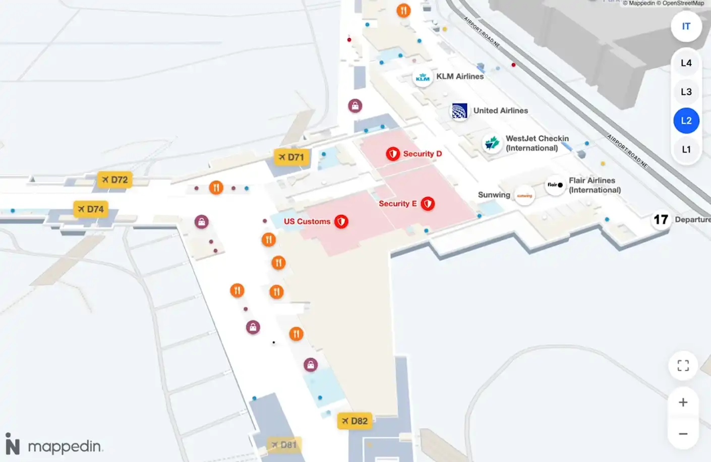
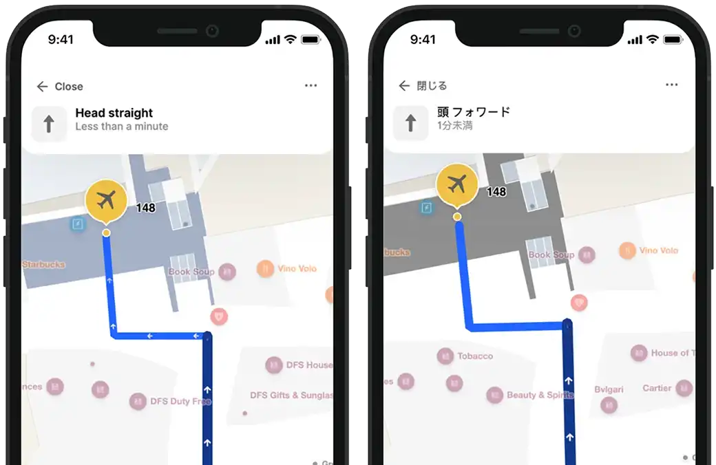
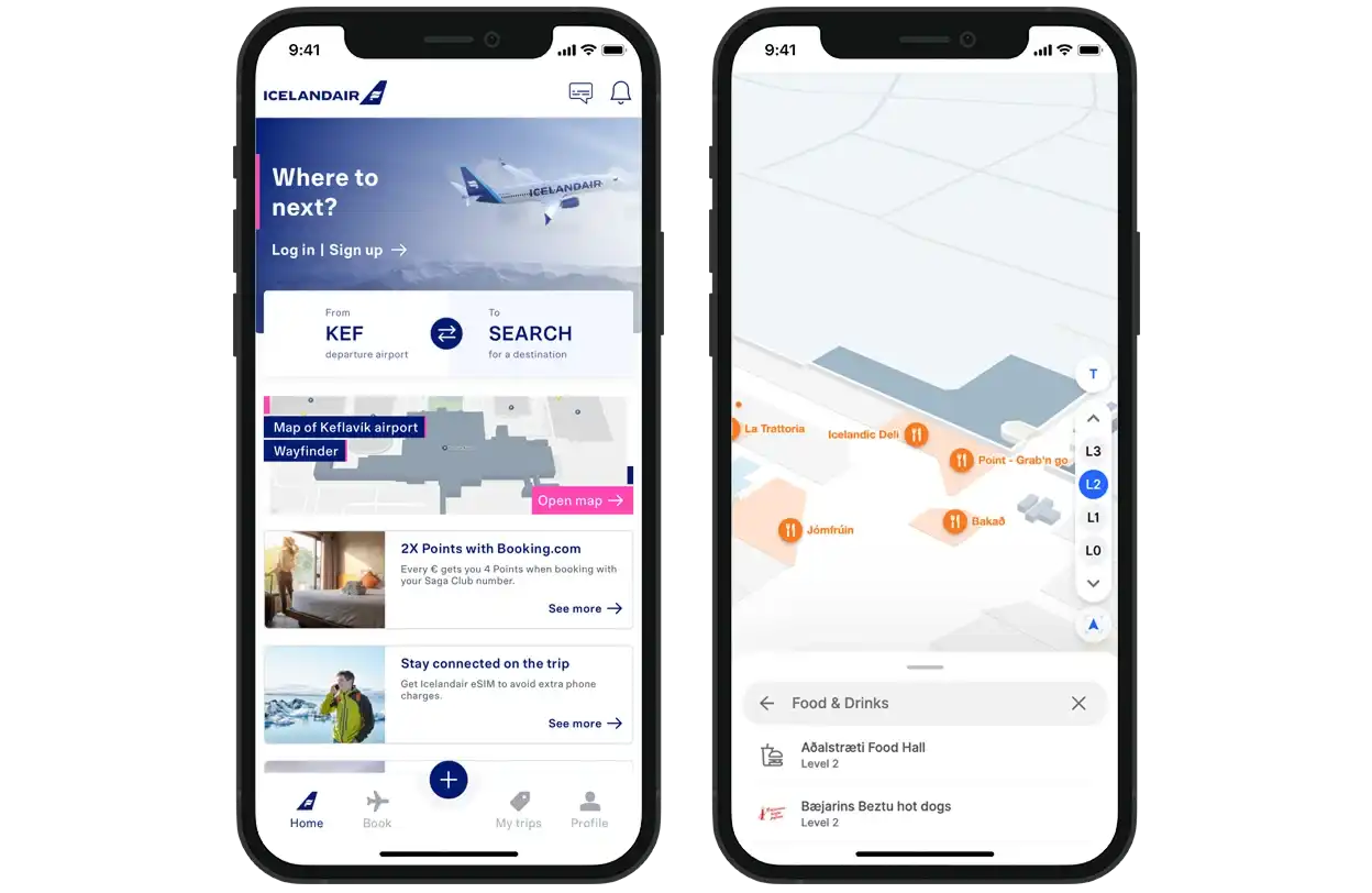
Passengers search for items they need and get routes to the specific retailers or duty-free locations that stock them.

Never miss a thing
Surface promotions and events on the map so passengers discover timely opportunities to engage and spend.
Prioritize profitable spaces
Commercial locations stay visible while amenities appear on demand, keeping passenger attention on destinations that matter to your bottom line.
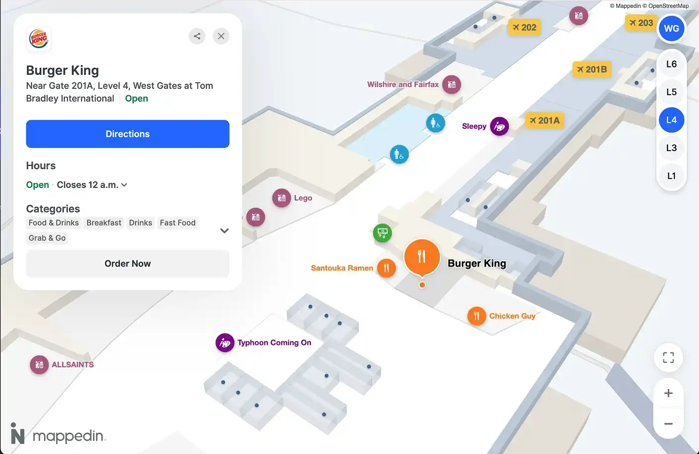
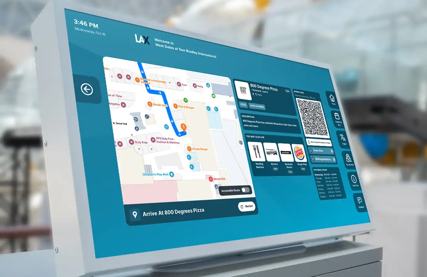
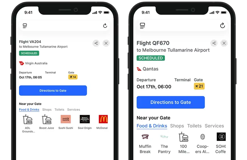
Convert with locations
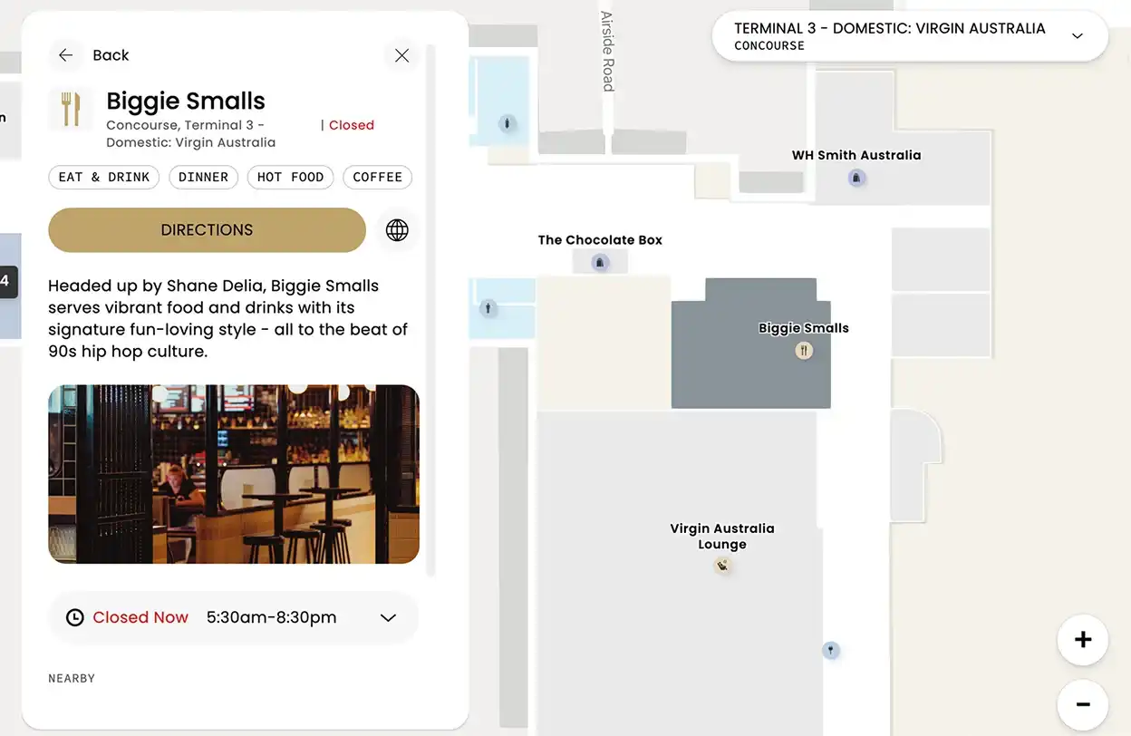
Location details, business hours, and purchase options in one place so browsing turns into action.
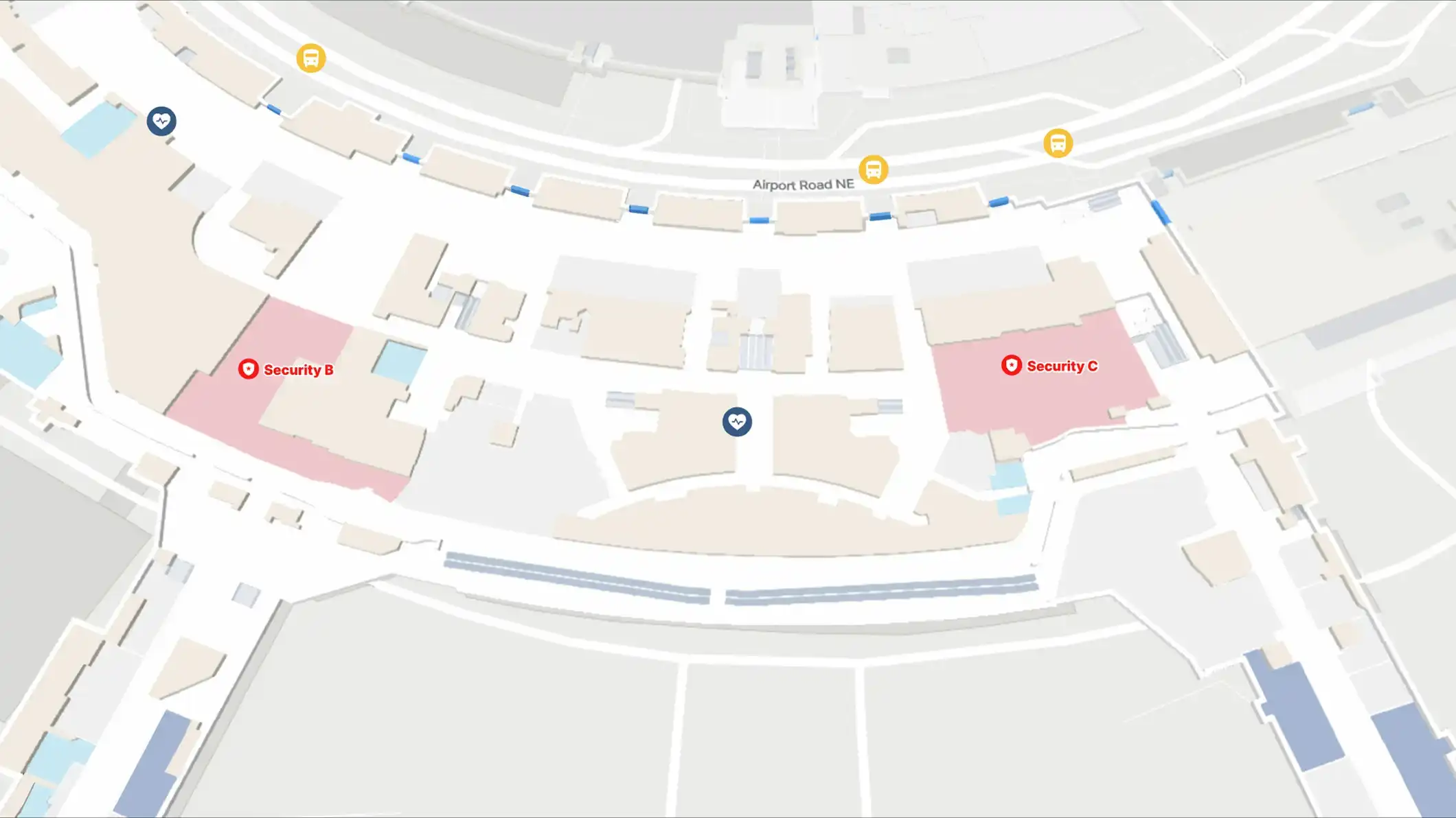
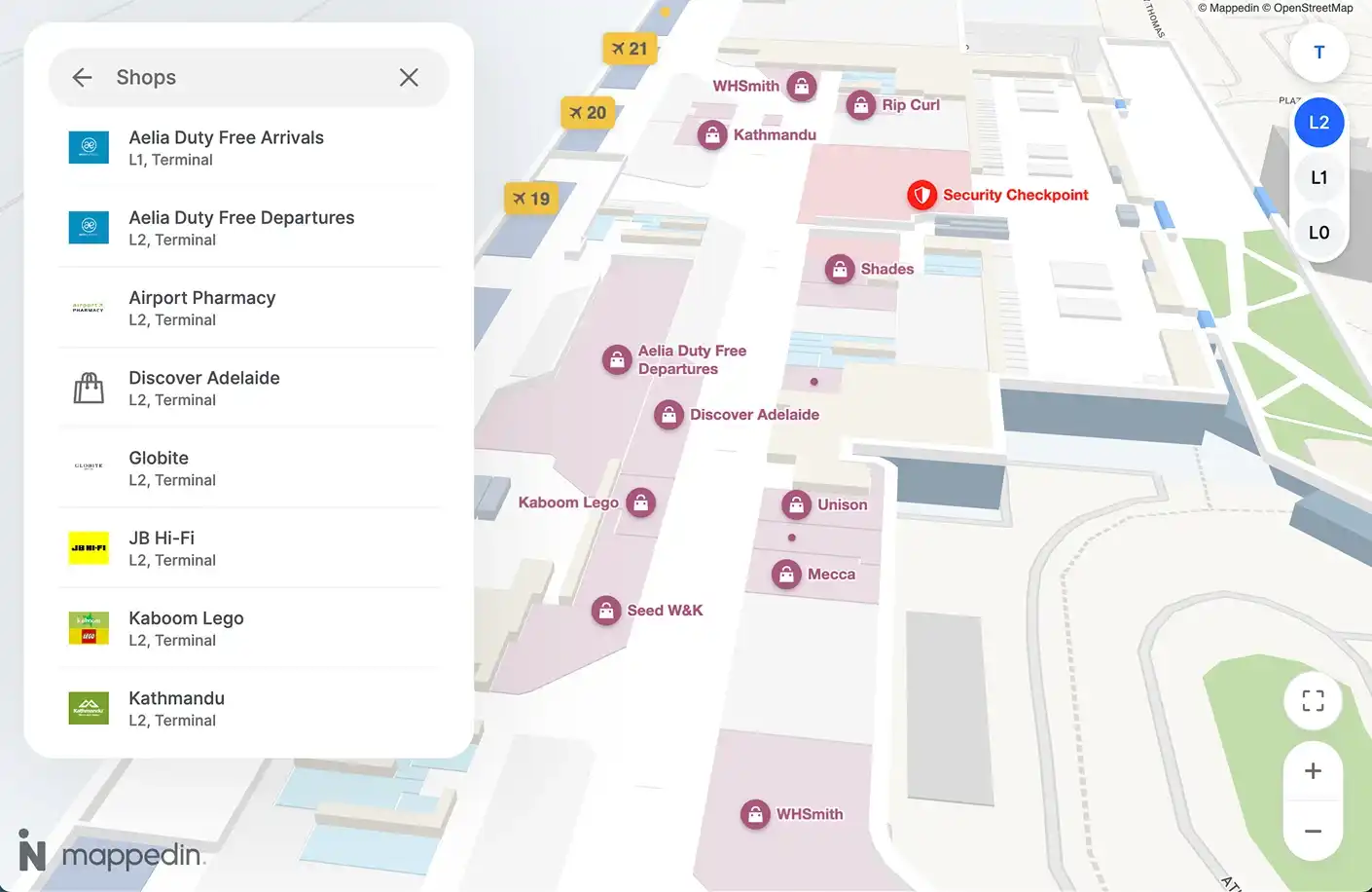
Cut through the noise
Tags and focus mode help passengers zero in on what they want without visual clutter or irrelevant results.
Shop smarter
Passengers search for items they need and get routes to the specific retailers or duty-free locations that stock them.
Never miss a thing
Surface promotions and events on the map so passengers discover timely opportunities to engage and spend.
Prioritize profitable spaces
Commercial locations stay visible while amenities appear on demand, keeping passenger attention on destinations that matter to your bottom line.
Convert with locations
Location details, business hours, and purchase options in one place so browsing turns into action.
Cut through the noise
Tags and focus mode help passengers zero in on what they want without visual clutter or irrelevant results.
Airport Premium Directory
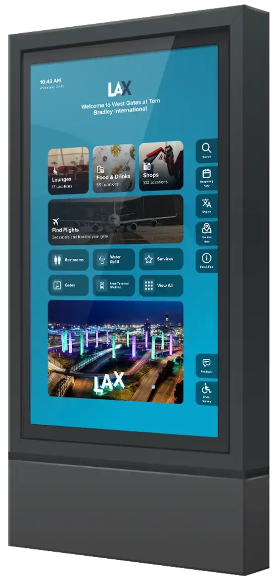
More than directions
Guide passengers to their gates while driving them to your concessions.
Personalized design
Show only what's relevant to each area, from land-side to air-side.
Mobile pass
Passengers scan and go, taking their route with them on their own device.
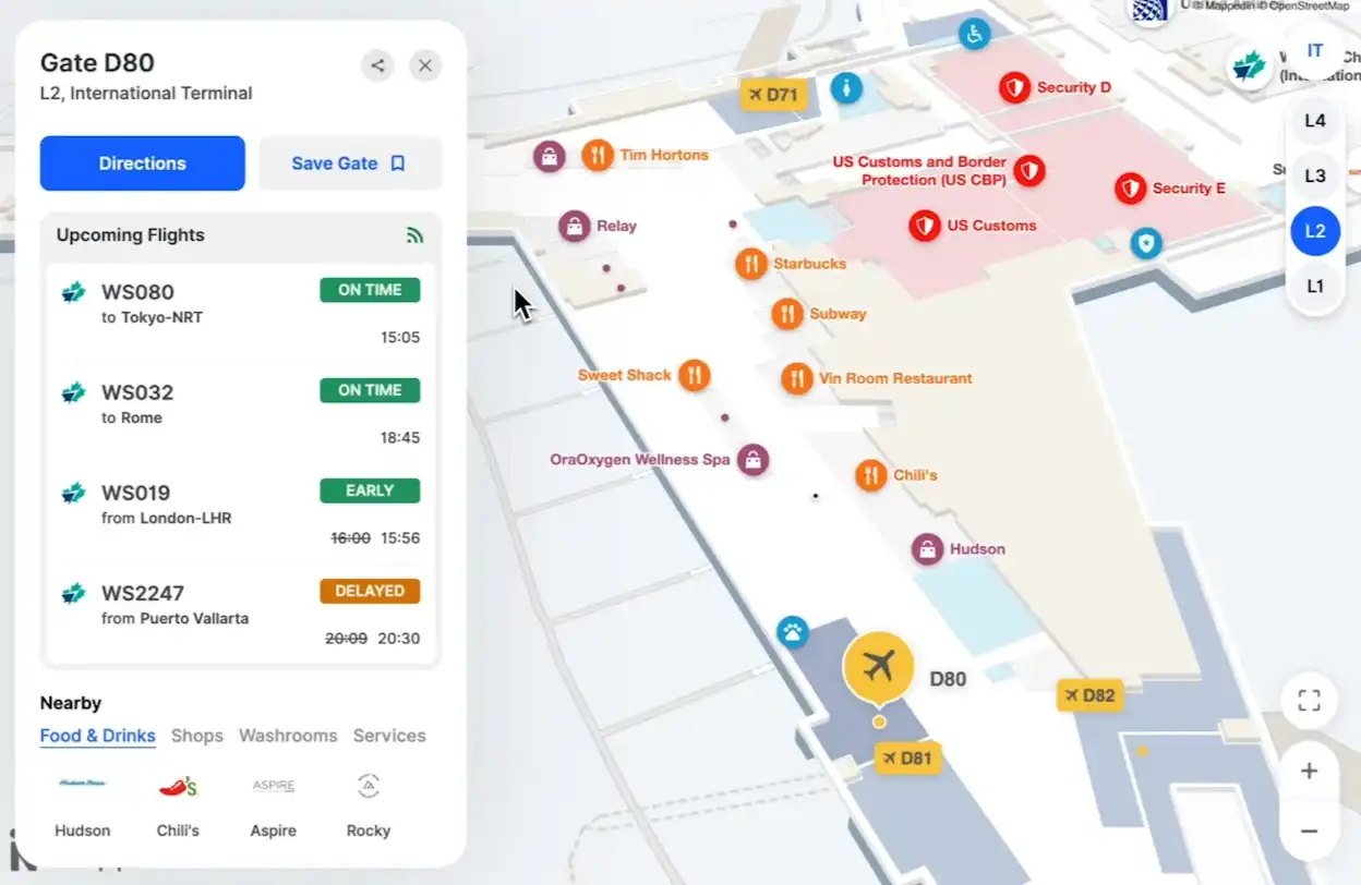
Live flight information
Keep passengers informed with real-time flight status and boarding updates.
Full screen ads
Monetize every moment with advertising that activates during kiosk downtime.
Integrations
Works alongside your stack
No data silos means operations, leasing, and customer service all work from the same always-current information. Proven at scale at Schiphol, Keflavík, and LAX with seamless partner integrations that keep teams aligned.
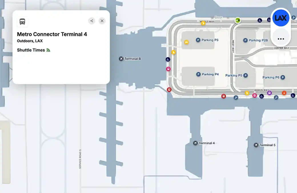
Your world, in real time
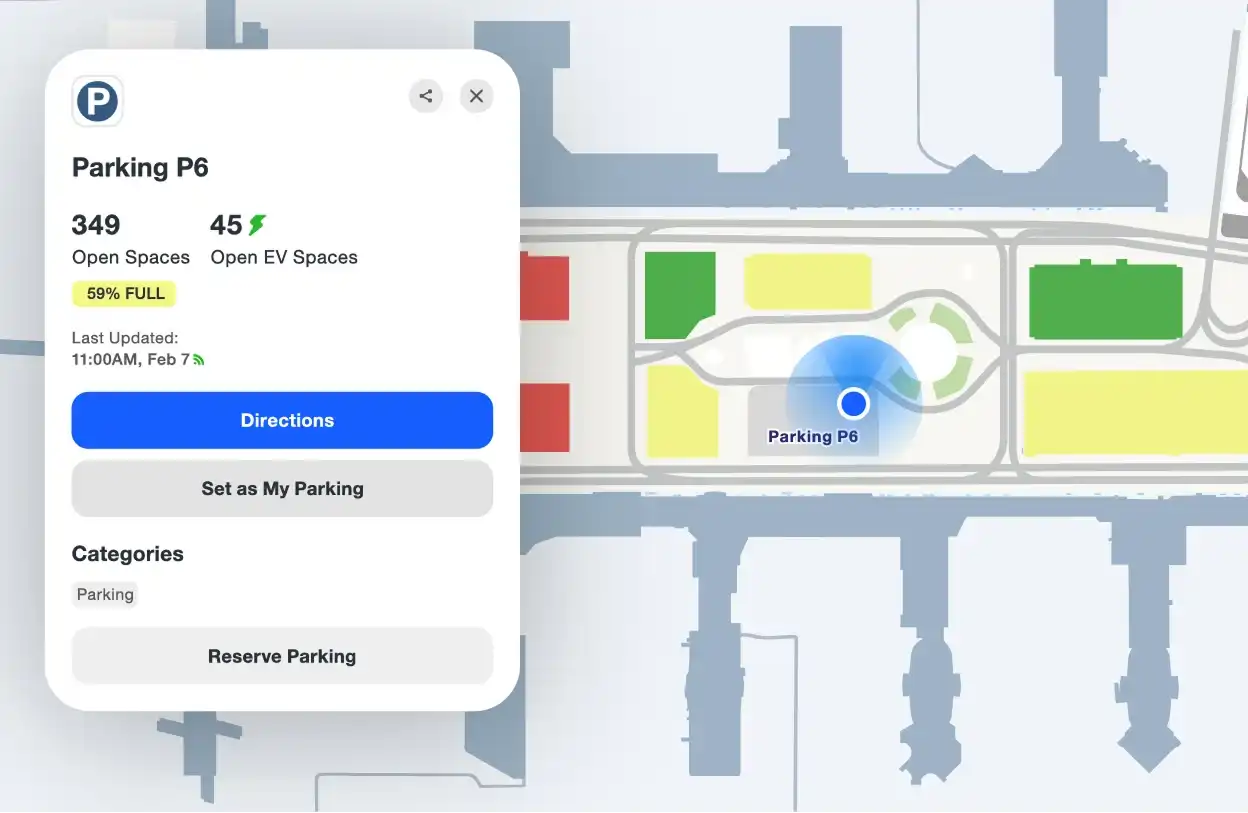
Flight info, security waits, parking, and shuttle times all update in real time, giving passengers current information wherever they look.
![Image placeholder]()
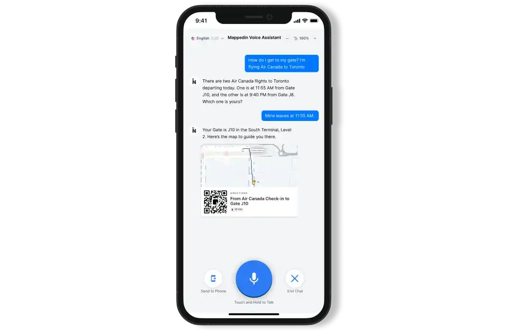
Data that powers more
Feed live map data into chatbots, apps, and other systems so passengers get accurate answers and directions wherever they ask.
![Data that powers more example]()
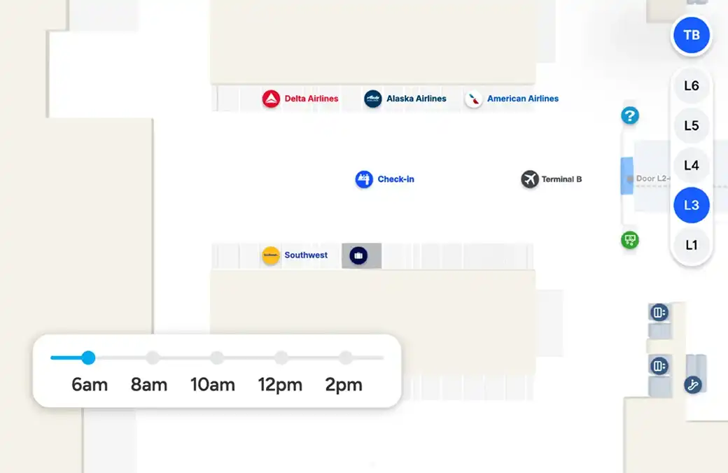
Plug in to your analytics
Send navigation data, search trends, and flow patterns directly to Snowflake and existing analytics platforms.
![Plug in to your analytics example]()
Stay in-sync
Automatic geo-sync with GIS and vendor systems keeps maps current across all platforms without anyone lifting a finger.
![Image placeholder]()


Accessibility
Inclusive journeys start here
Every passenger navigates differently. Meet accessibility compliance standards including WCAG 2.1, reduce assistance requests, and ensure every traveler navigates your venue with confidence.
Screen reader ready
Maps work seamlessly with screen reader technology, giving passengers with visual impairments independence and confidence.
![Image placeholder]()
Speak every passenger’s language
Support 40+ languages so international travelers navigate with confidence in their native language.
![Speak every passenger’s language example]()
Readable at any scale
Passengers choose what works for their vision with an interface that adapts to selected text sizes without breaking or hiding information.
![Readable at any scale example]()
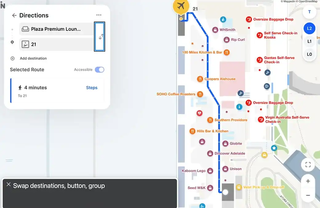
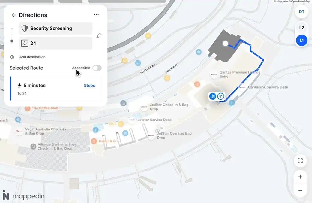
Mobile-first routing
Automatic routing that removes barriers and prioritizes elevator routes for passengers with mobility needs, families with strollers, and travelers with heavy luggage.
![Image placeholder]()
Trusted by the world’s most traveled airports


Real-time everything
Solutions for every airport
Discover everything you can do with Mappedin for Airports.
Analytics
Movement flow
Understand your customer journey by measuring indoor engagement and interactions.
Search data
Learn what visitors are searching for and identify new opportunities to better serve your guests.
Ad performance
Get a better understanding of how your ads and directory perform to improve your opportunities.
Analytics API
Integrate map and directory data directly to your preferred application using our API.
Integrations
Geo data sync
Synchronize and validate geometry automatically on a daily basis. A game-changing solution built for the complexities of airports.
Content sync
Integrate with any CMS and automatically keep your maps and service information up-to-date with real-time location data.
Google / Apple maps
We handle your map data—seamlessly delivered to the most popular map providers.
Real-time data display
Integrate transportation data allowing for a deeper integration and a more comprehensive experience for passengers.
Airline integration
Easily share your airport map information with your preferred airline partners.
Developers
Web & Mobile SDKs
Our SDKs enables businesses to build custom indoor mapping apps with ease and integrate with any 3rd party software.
Data visualization
From heat maps to scatter plot, visualize any map or directory data to make more informed decisions.
Documentation
Everything you need to build—docs, tools, and more—all in one dev portal.
Security
Safety markers
Display essential emergency icons—like AEDs, fire extinguishers, and first aid stations—right on your map.
Dynamic routing
Draw exclusion zones around an incident or construction zone and automatically reroute shoppers to safety.
Live alerts
Get real-time alerts for security updates and emergencies.
Crowd management
Terminal employees can adjust the flow of people in real-time with our Airport Manager app.
Professional services
Professional designs
Get beautiful, accurate maps—without lifting a finger. Our team of expert map designers works with you to create custom maps that stand out.
Dedicated support
Need to update your maps or clarify something? Our team is ready to help—quick answers, seamless changes, no hassle.
Custom development
Get a mapping solution that adapts to your needs. We build custom apps and tools that let you visualize, edit, and interact with your data—your way.
Airports in action
According to ACI, global passenger traffic will reach 9.7 billion this year. Learn how to deliver a smooth travel experience with indoor maps in our helpful airport guide.
Contact our sales team
Yuval Kossovsky brings three decades of expertise in program and product management. He spent the last decade in the nascent indoor mapping space, developing the enterprise indoor mapping program for Apple and driving the global adoption of IMDF as an exchange standard for venue maps.


Yuval Kossovsky
Managing Director, Transportation