Mappedin for Trade Shows and Conferences
Indoor mapping software for trade shows & events
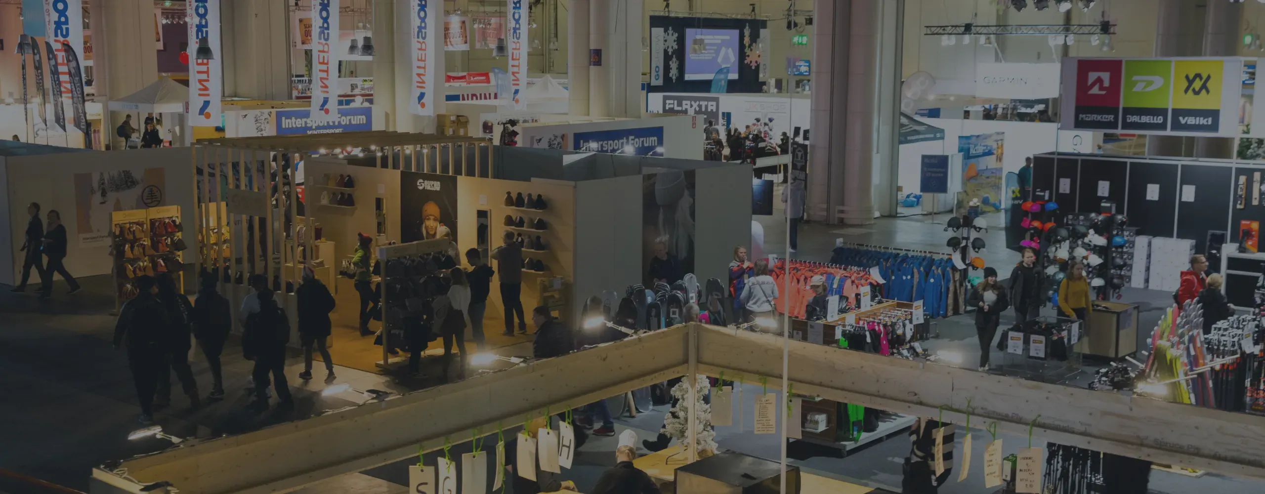
Our maps effortlessly guide attendees through sprawling trade shows, conferences, events, and exhibitions.
Platform
Solutions
Use Cases
Developers
Resources
Mappedin for Trade Shows and Conferences
Our maps effortlessly guide attendees through sprawling trade shows, conferences, events, and exhibitions.
Indoor Mapping for trade shows and conferences
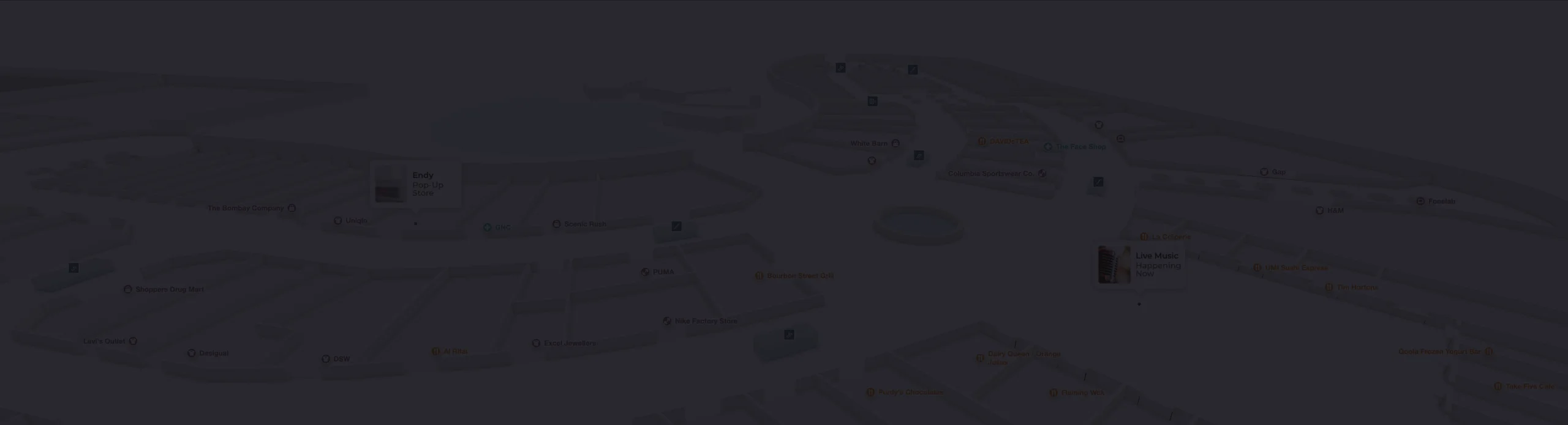
With digital interactive maps, event organizers can create exciting visitor experiences while efficiently guiding attendees through bustling trade shows. These maps showcase vital event information such as show hours, special events and exhibitor details—all on a single platform. Event organizers can also edit the maps in real time, ensuring attendees can rely on up-to-date information throughout the duration of the event.
Ensure that attendees always have access to the latest event information, helping them make the most of their visit.
Help attendees easily find their way through the exhibition grounds and discover what interests them most.
Gain insights into how attendees move through the venue, optimizing event layouts, improving traffic flow, and driving additional revenue.
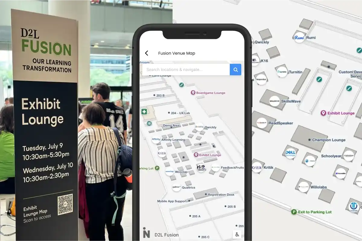
Mappedin’s wayfinding solution has made a real difference in helping conference attendees their way around the event -- from key note sessions, to workshops, to snack time! The ability to update maps on the fly helped ensure attendees always had the most up-to-date information. Using QR codes on signage helped attendees scan and quickly find their way.
Andrea Cayon
Partner Manager, D2L
Mappedin has a wide range of product offerings for trade shows, conferences, and exhibitions. Use them to facilitate visits for onsite visitors and web users and manage maps across multiple venues. Pick the products that meet your needs and customize your own package.
Integrations
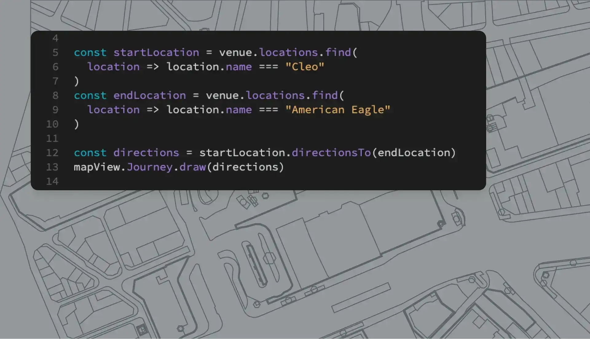
Start making maps quickly with Mappedin and seamlessly integrate those maps into any existing or custom application using our APIs and Software Developer Kits (SDKs). Our solution also includes developer support from our team of experts.
Why do I need trade show map software?
An indoor map and digital navigation solution make it easy for attendees to navigate large, complex venues. An accurate venue map is also the foundation for a variety of other experiences, including blue dot navigation and proximity messaging. With indoor mapping solutions such as Mappedin's powerful mapping platform, it is easy to maintain up-to-date exhibition maps. In the Map Editor, apply the same core and structural elements of your venue across all maps, while enjoying the flexibility to change booth locations and details, the location of various stages, meeting rooms, or food vendors for each unique event.
Why is indoor mapping important for trade shows and exhibitions?
The implementation of indoor mapping technology for large-scale venues is extremely important to reduce stress and optimize efficiencies. Working with hybrid positioning systems enables blue-dot indoor navigation. These technologies can be integrated with event engagement apps to provide accurate turn-by-turn directions and also allow event professionals and attendees to search for directions to locations, events at exhibitions, and more.
How does 3D mapping work for trade shows and exhibitions?
Similar to other industries, 2D trade show maps are transformed using indoor mapping software into digital, interactive, and 3D maps. Regardless of device, users can pan, zoom, and rotate the map or use interactive features such as Smart Search, Mobile Pass, category listings, and more. These features provide a stress-free navigation experience for your next exciting event.
How do I make a trade show navigation map?
To start mapping your trade show, event, or conference, simply sign up for Mappedin. Find the event building's floor plans and upload them to start. Use our advanced AI mapping to quickly create maps and add detail and information to enrich your maps. Share interactive 3D maps with your visitors, staff, and operations. To map your large and complex events at scale, integrate maps into an app, or integrate with other event platforms, get in contact with our team.