Start Here
Mappedin JS is the official release of our indoor mapping toolkit, featuring up to 10x faster performance and enhanced customization features. Built on open standards, developers can create seamless indoor-outdoor wayfinding experiences with real-world coordinates, custom styling, and advanced spatial data integration for enterprise applications.
We’re excited to announce the official release of Mappedin JS (version 6.0)—a major leap forward for developers building interactive, real-world mapping experiences. Whether you’re creating wayfinding for a shopping mall, visualizing assets in a warehouse, or integrating rich spatial data into your app, it delivers a powerful, flexible foundation to bring your vision to life.
Why upgrade to the latest Mappedin JS?
The latest Mappedin JS is a ground-up rewrite, built on a modern GeoJSON-based rendering engine. This means faster performance, easier customization, and a platform that’s ready for the future of spatial applications. Here’s why developers are making the switch:
- Performance: Enjoy up to 10x faster map processing, improved memory usage, and smoother interactions.
- Real-World Coordinates: Mappedin JS uses latitude/longitude for all geometry, making it easier to integrate with external data sources and real-world positioning systems.
- Customization: Full control over map styling, data layers, and user interaction—indoors and outdoors.
- Rapid Feature Development: The new architecture allows us (and you) to build and test new features faster than ever before.
- Seamless Indoor/Outdoor Integration: Effortlessly blend detailed indoor maps with rich outdoor context, powered by MapLibre for advanced data visualization.
What’s new in Mappedin JS?
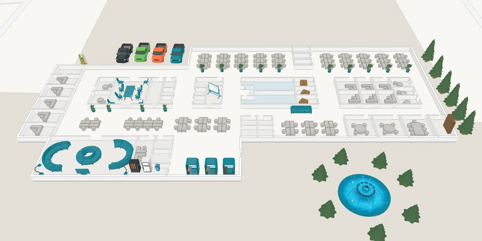
Multi-floor view and stacked maps
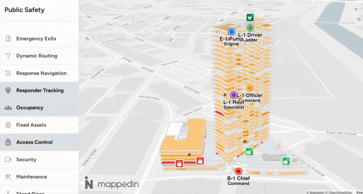
Visualize entire buildings at a glance! Multi-floor view displays all floors stacked vertically, letting users see the building’s structure and navigate between levels with ease. You can even overlay data across multiple floors—perfect for asset tracking, security, or maintenance applications. Learn more and see the code
Outdoor map customization
Mappedin JS gives you direct access to the underlying MapLibre layer for outdoor maps. Go beyond basic context—add custom layers, draw GeoJSON geometry, integrate satellite imagery, or visualize 3D buildings. This unlocks endless possibilities for outdoor/indoor hybrid experiences.
Learn more and see the code
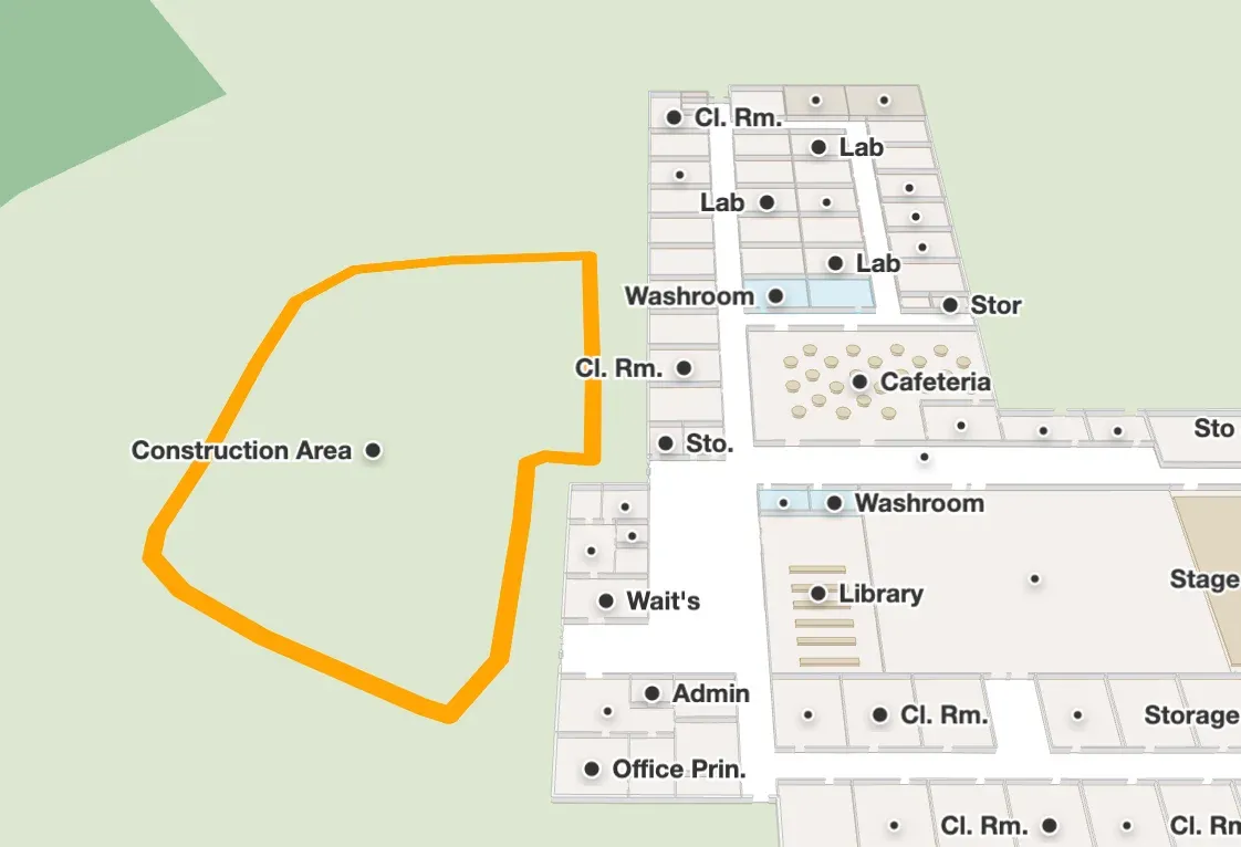
Areas and shapes
Define logical regions on your map (like “off-limits” zones, event spaces, or custom overlays) and use them to trigger events, affect wayfinding, or visualize data. Draw 3D shapes anywhere using GeoJSON—great for highlighting zones, drawing routes, or visualizing sensor coverage.
Learn more and see the code
Images, textures and colors
Bring your maps to life with custom images, textures, and colors. Add branded graphics, highlight important features, or theme your map to match your app. Apply textures to floors, walls, doors, and objects for a truly immersive experience.
Learn more and see the code
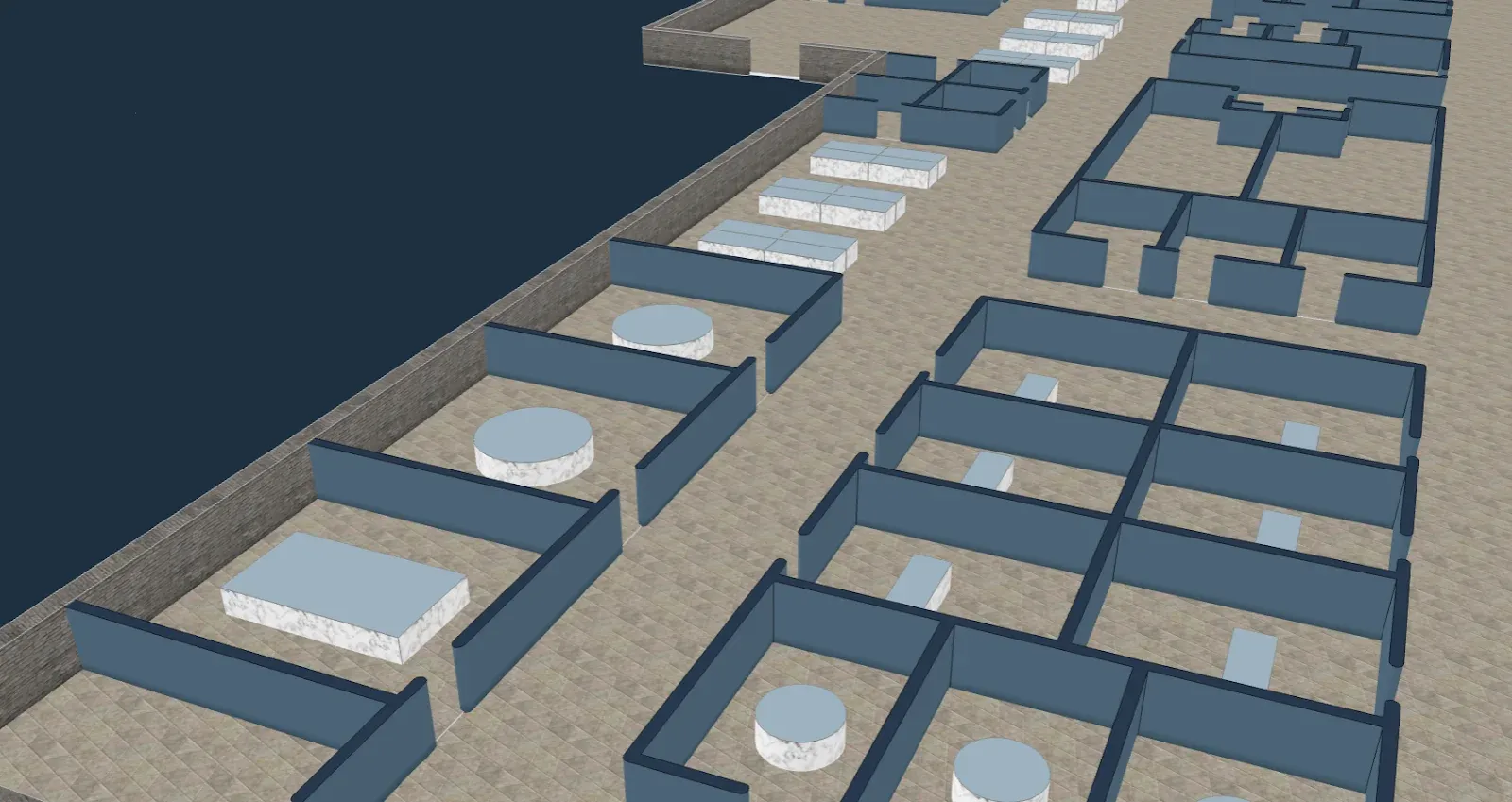
3D models
Add interactive 3D models—like furniture, kiosks, vehicles, or landmarks—directly to your map. Use your own GLTF/GLB files or choose from the Mappedin 3D Model Library. Models can be placed, styled, and made interactive for rich, real-world context.
Learn more and see the code
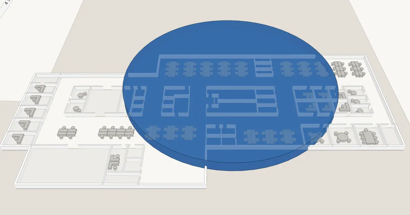
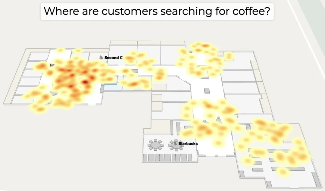
Enhanced data visualization
With Deck.gl integration, overlay heatmaps, traces, sensor data, and more—indoors and outdoors. Visualize foot traffic, delivery routes, or IoT sensor coverage right on your map.
Learn more and see the code
Improved interaction and usability
- Awaitable animations for smooth transitions
- Real-time collision engine for labels and markers
- Better event handling (hover, click, multi-button support)
- Faster load times
Built for developers
Mappedin JS is designed with developers in mind:
- Testability: Write and run more unit tests with confidence.
- Flexible styling: Swap styles at runtime, experiment with live previews, and control every layer.
- Open standards: Built on open-source technologies (GeoJSON, MapLibre, Deck.gl) for maximum compatibility and extensibility.
- Beyond wayfinding: Build solutions for logistics, safety, planning, customer experience, and more.
Ready to upgrade? Start here
Upgrading from a previous version? We’ve got you covered with a comprehensive Migration Guide. It covers:
- Initialization and API changes
- Component and UI updates
- New ways to access and style map data
- How to leverage new features like Multi Floor View, 3D Models, and more.
Try it today
Mappedin JS is available now for all developers. Use your own maps (Pro license required) or try out our demo maps for free.
Build the future of indoor mapping with Mappedin JS
Have questions or want to see what’s possible? Contact us, check out our developer documentation, or join our Community Forum.
Share


