

In July, we focused on what matters most: making things better for your visitors and easier for you. Here's what's new and how these updates help you get more value from every visitor interaction.
Mappedin Solutions
Improved User Experience & Accessibility
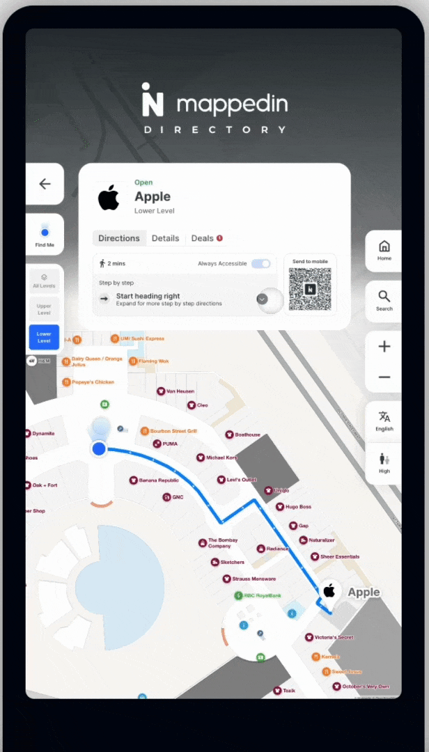
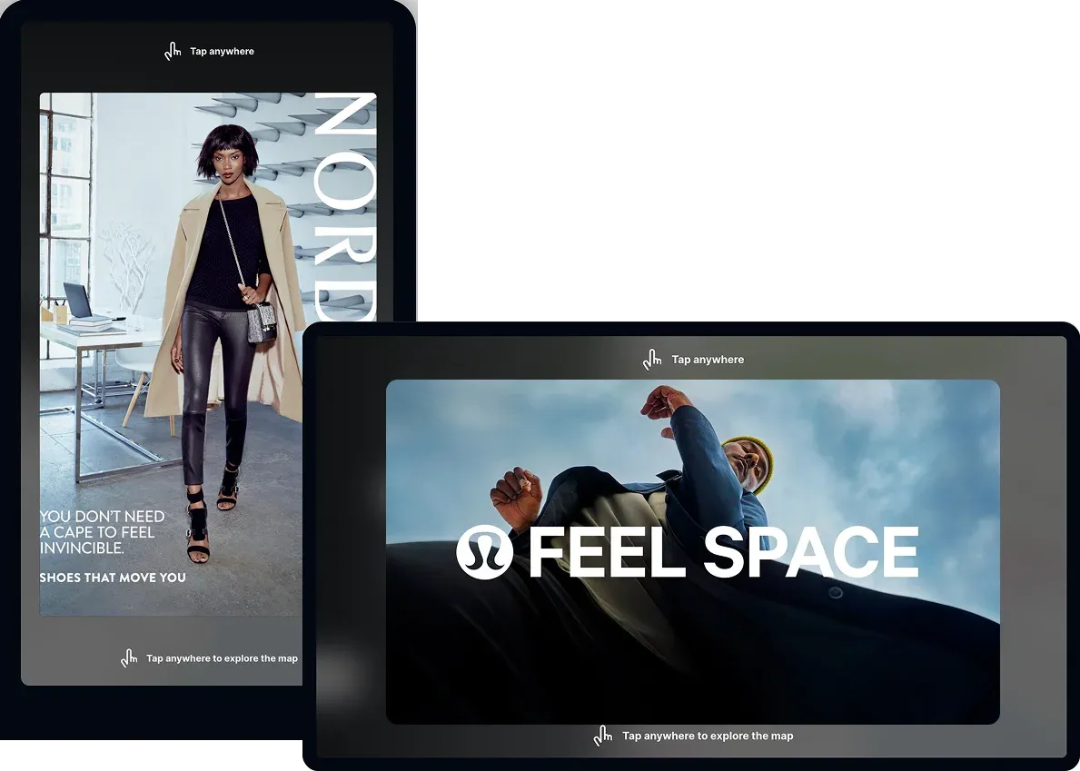
Navigate faster with less screen clutter: We’ve redesigned our directory cards to make your maps cleaner and easier to use. The new cards take up less space, so your maps stay clear and unobstructed. Directions are now collapsible, and details or promotions are just a tap away, making it simpler than ever for visitors to find what they need.
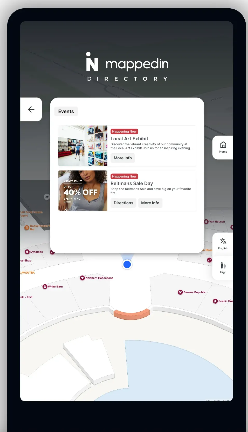
Streamlined events and deals: The new events and deals screen displays more offers at once, making it easier for visitors to discover, browse, and compare promotions.
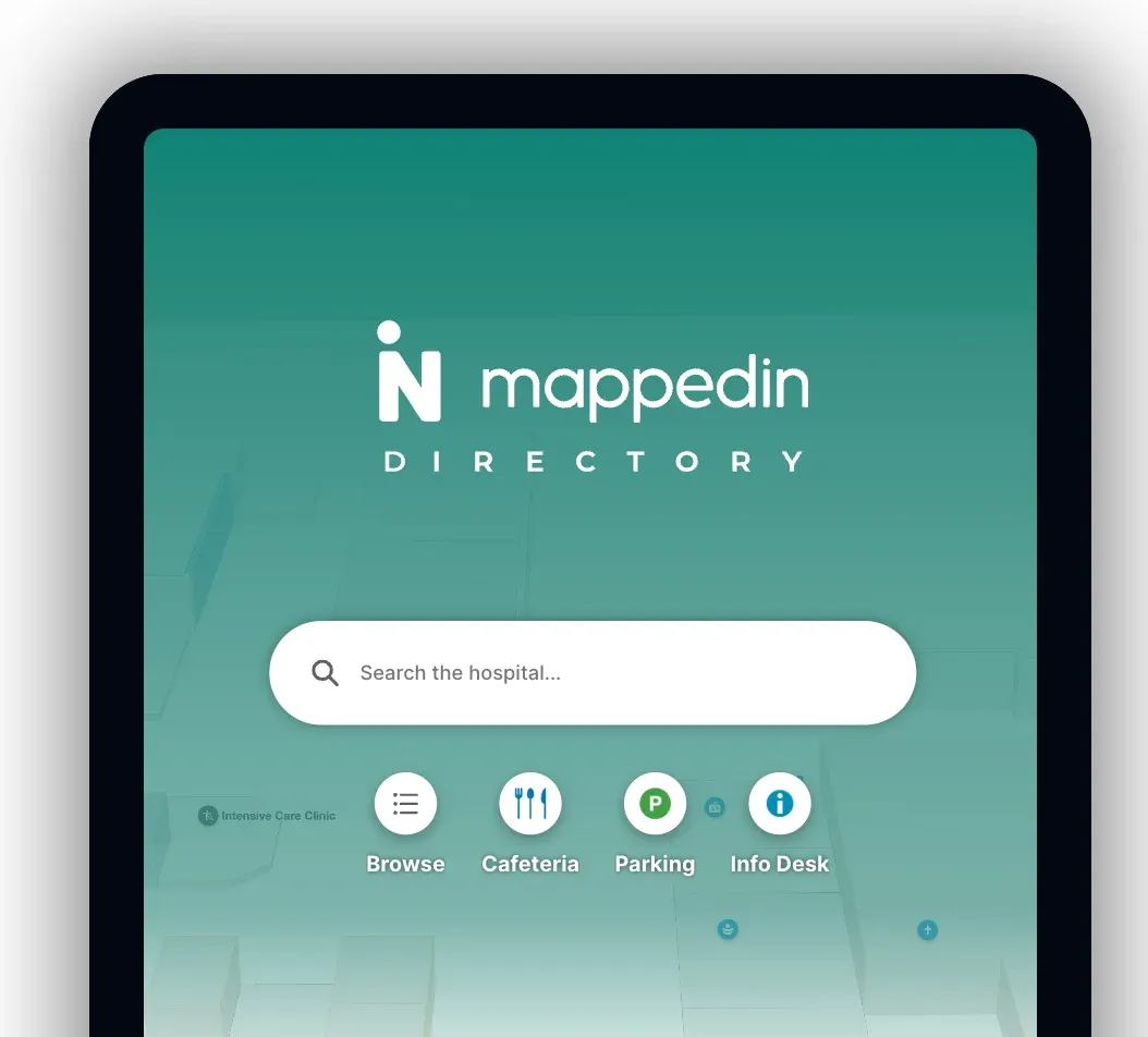
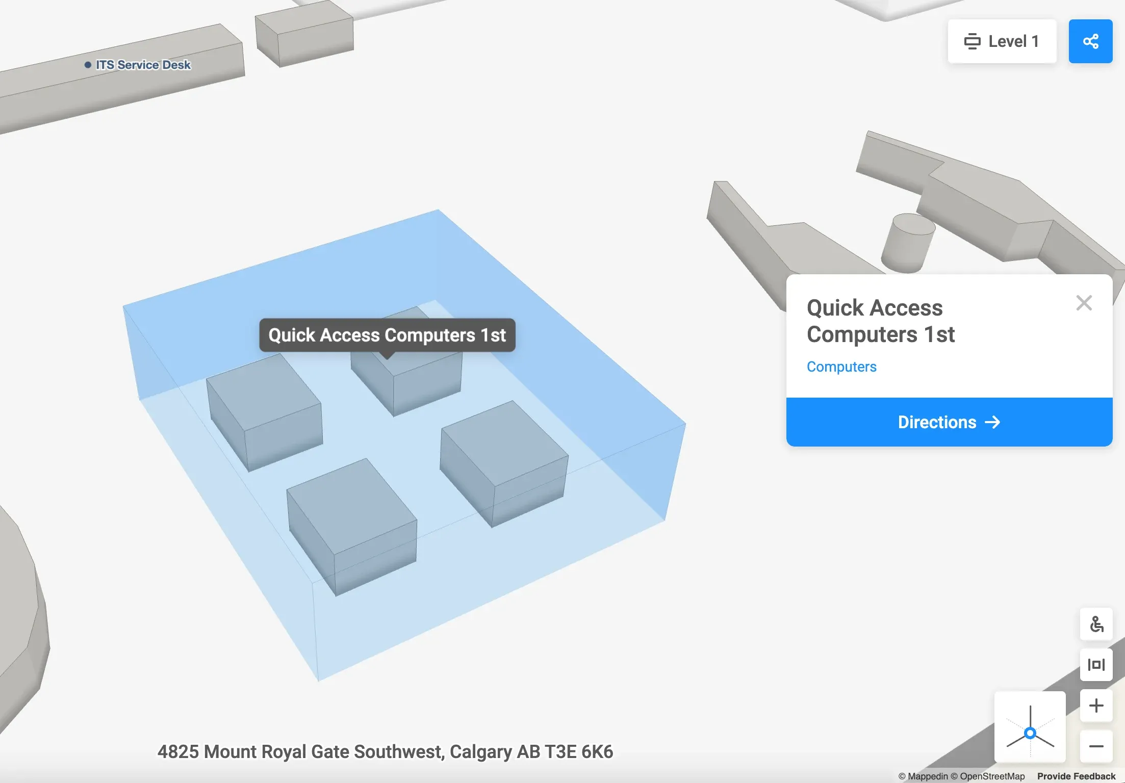
Personalize your quick access buttons: Visitors can now instantly identify and access key features with custom icons, speeding up navigation and supporting consistent branding.
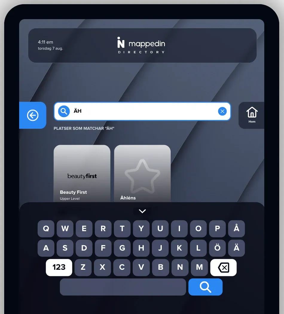
Seamless typing for Swedish language visitors: Mappedin Premium Directory now supports Swedish (Finland) keyboard layout, enabling accurate native input for Swedish language visitors.
Increased Engagement & Revenue Opportunities
Maximize impact on any display: Fullscreen Ads now support both portrait and landscape screens, giving you more ways to reach and engage your audience—wherever they are.
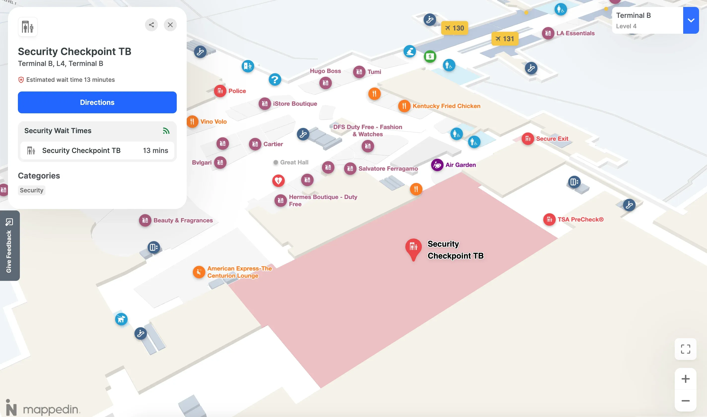
Live security wait times for stress-free travel: Airport passengers can now see real-time security wait times directly on the map, helping them plan ahead, relax, and enjoy more time in airport shops, restaurants, and lounges.
Platform
Enhanced Productivity & Efficiency for Admins and Editors
QoL improvements to QAing your maps: Map labels can now be viewed in the map editor. This makes it easier to check for labeling errors or gaps anywhere on your map at a glance!
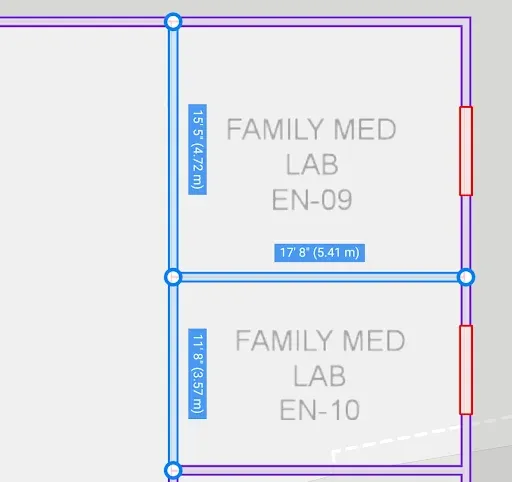
Accurate measurements for your maps: You can now view wall lengths directly in the map editor, making it easier than ever to draw buildings to scale. With both imperial and metric units, you can match real-world dimensions precisely.
View your buildings’ satellite footprints: Satellite imagery is a useful alternative when mapping areas with limited OpenStreetMap (OSM) coverage. By default, building footprints and world geometry are created from OSM, the open-source map. Give it a try if your building footprint is missing or inaccurate!
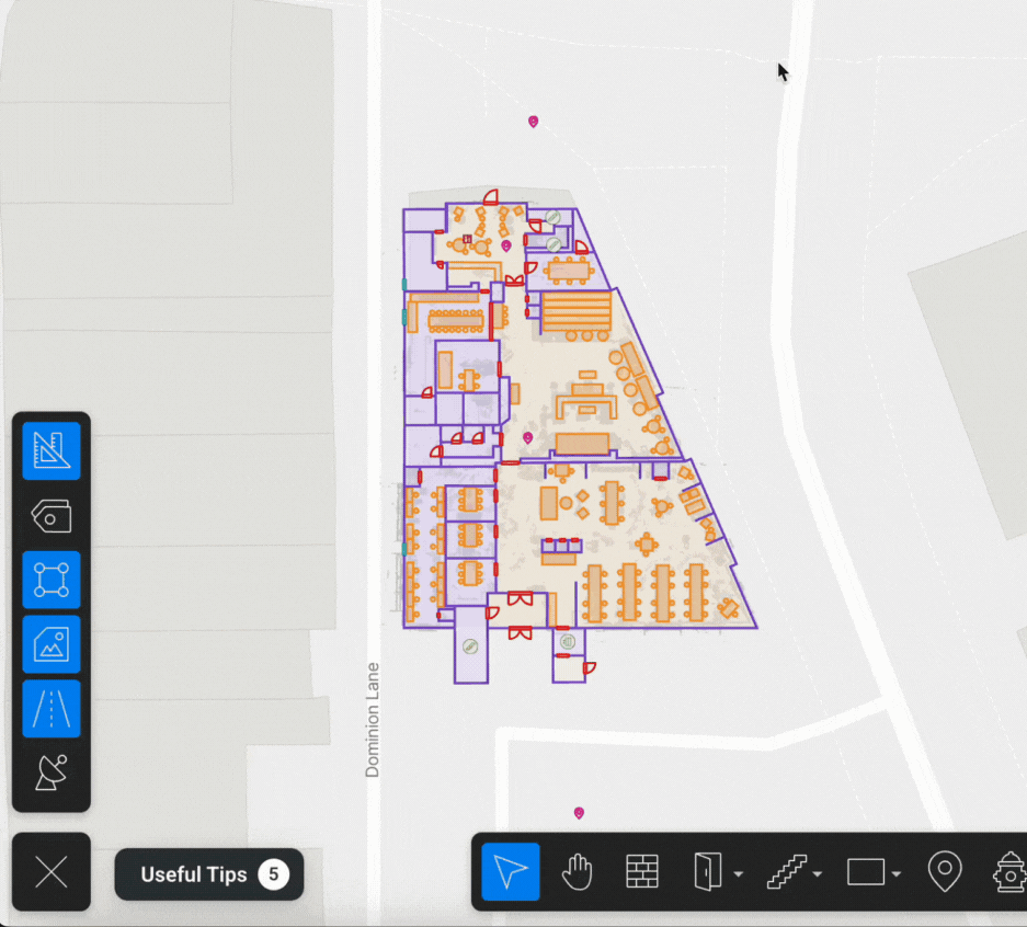
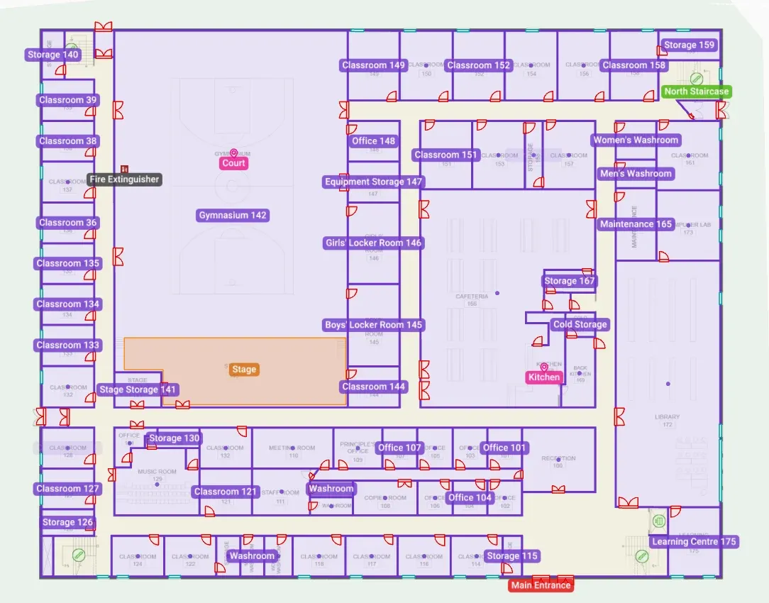
Areas are now viewable: You can now see the areas you’ve drawn on your map, not just use them behind the scenes for navigation. Until now, areas were invisible, making them hard to manage despite their usefulness. With this update, it’s easy to mark rooms, zones, or sections of your venue and instantly see them on the map for better clarity and control.
We’re always working to make Mappedin better for you. These updates are designed to help you get more out of your maps—faster, easier, and with less hassle—and to make your venue more discoverable for visitors. Stay tuned for next month, there’s more to come! Ready to get started? Start mapping free today or get in touch to talk to an expert about your project.
Share


