The space inside a warehouse is constantly changing as new inventory comes and goes and dangerous obstacles are shifted around the facility. With traditional maps, it can be difficult to track these daily adjustments. Architectural diagrams are often made obsolete as soon as they’re drawn and the time and effort of upkeep can seem impossible.
Thankfully, Mappedin provides state of the art tools for maintaining your maps in a way that’s simple and powerful. Our Map Editor allows for quick modifications which publish live to your application. To assist, we provide onboarding and training to empower you in creating accurate maps of your indoor spaces. Integrating Mappedin indoor maps into your Warehouse Management System (WMS) dashboard will help you optimize and manage your assets and employees safety with as little friction as possible.
Indoor location context for your logistics
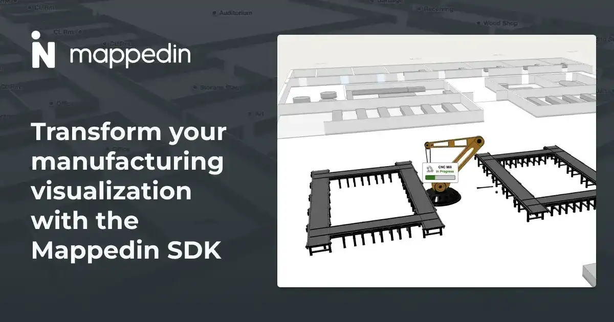
With a digital twin of your facility, you unlock dynamic avenues for monitoring logistics at a glance. Everything that occurs in a warehouse has location context and there’s no better way to visualize that than on a map. Display high traffic or high time-spent areas with a heat map; track assets in real time as employees load and unload transport vehicles; and pinpoint potential safety concerns as they appear in the distribution center.
Layering data to create actionable data visualizations
Mappedin map data can be exported as Mappedin Venue Format (MVF). This bundle contains GeoJSON files for all the properties of the structure and is adaptable for most front end renderers. Using MVF, you have full control from map creation to presentation.
The following interactive demo showcases a map created using Mappedin’s Map Editor and exported in MVF. To render it, we chose the highly performant and open source deck.gl library which is purpose-built for data visualization. Using these tools, we layer a heat map of high-traffic areas and safety information on top of the warehouse facility. Combining the rich data from your WMS with the map and visualization tools is a straightforward process due to the flexibility of the components.
Click here to open the demo full screen, or click here to browse the code to see how it works.
The best part of having an up-to-date map with Mappedin is the extensibility. You only need to maintain one map which you can apply across many different use cases. From data visualization to wayfinding, the changes you make will be instantly reflected in all applications.
Interested in learning more? Do not hesitate to reach out to our team and find out how Mappedin can help optimize your facility with indoor maps.
Share