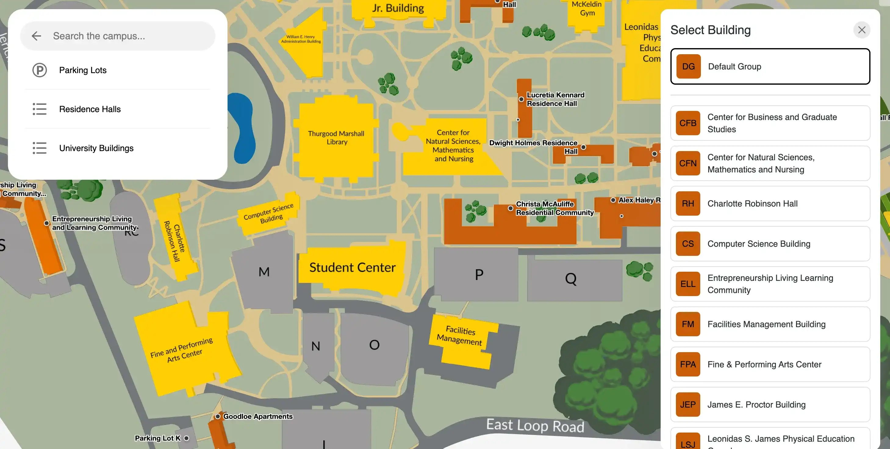
Queensborough Community College Interactive Map
CUNY's QCC. A 37-acre campus with 14 major buildings in Bayside, Queens, serving 10,000 students from 110 nations.


Explore Queensborough Community College's 37-acre campus in Bayside, Queens including every instructional building, the library, performing arts centre, athletics facilities, parking areas, and bus stops. QCC's 14 buildings are spread across a former golf course site, and finding a specific classroom, office, or service point can be non-obvious on arrival.
Use the map to locate a building by name or number, find accessible routes between facilities, or identify the nearest Q27 bus stop to your destination.
About Queensboro Community College
Queensborough Community College (QCC) is one of seven community colleges within the City University of New York (CUNY) system, established in 1959 on the 37-acre site of the former Oakland Golf and Country Club in the Bayside neighbourhood of northeast Queens, approximately 15 miles from Manhattan. It enrolls more than 10,000 students representing 110 nations and 84 native languages, reflecting the multicultural character of Queens — the most ethnically diverse county in the United States.
The campus comprises 14 major buildings spanning instructional, cultural, athletic, and administrative functions. Instructional facilities include multiple science laboratory complexes, studio and design spaces, and a professional sound recording studio.
Cultural facilities include:
- Queensborough Performing Arts Center and the Shadowbox theatre for intimate productions
- QCC Art Gallery
- Kupferberg Holocaust Resource Center and Archives (one of the leading Holocaust education institutions at a community college in the United States)
The campus also features the only planetarium in Queens, an astronomy observatory, an Olympic-sized aquatic centre, and a professional-quality running track. The Kurt R. Schmeller Library holds more than 150,000 volumes and houses the college's Academic Computing Center.
QCC serves a predominantly first-generation college student population, with a significant proportion of students transferring to four-year CUNY institutions on completion of associate degrees. The college's 2+2 guaranteed admissions programs with CUNY senior colleges mean the campus regularly receives prospective students, transfer advisors, and new enrollees navigating the buildings and services for the first time.
Accessibility across a 37-acre multi-building campus is a practical consideration for all students and a priority consideration for students with mobility needs.
Why interactive wayfinding matters here
Queensborough's 14 buildings are spread across 37 acres of former golf course terrain — which means the campus has real elevation changes, indirect paths between buildings, and no obvious central reference point for a student arriving on their first day. The Q27 bus stops directly on campus, which means a significant portion of students arrive at a single bus stop and need to navigate to multiple buildings across the site without a car.
For a campus serving over 10,000 students from 110 nations — many of them first-generation students unfamiliar with US campus conventions — a searchable interactive map is a meaningful accessibility tool, not a feature.
Details
- The City University of New York
- Bayside, NY
- Queensboro Community College Website