

Picture this: A visitor lands at the wrong concourse in a large airport, opens a map, and sees a blue dot floating somewhere between a gate lounge, a retail cluster, and a service corridor. In a shopping mall, the same issue sends a customer past the store they meant to visit, causing friction and frustration.
In a hospital, that same ambiguity can become an operational risk.
WiFi indoor positioning often comes up early in these projects for a simple reason. Most large venues already have WiFi, and most visitors already carry phones. On paper, reusing that infrastructure for indoor wayfinding looks efficient.
The challenge is getting a location estimate that's accurate enough to be useful.
A dot that is almost right can still be wrong in practice, especially in venues with parallel corridors, stacked floors, enclosed departments, mirrored layouts, or safety-sensitive destinations.
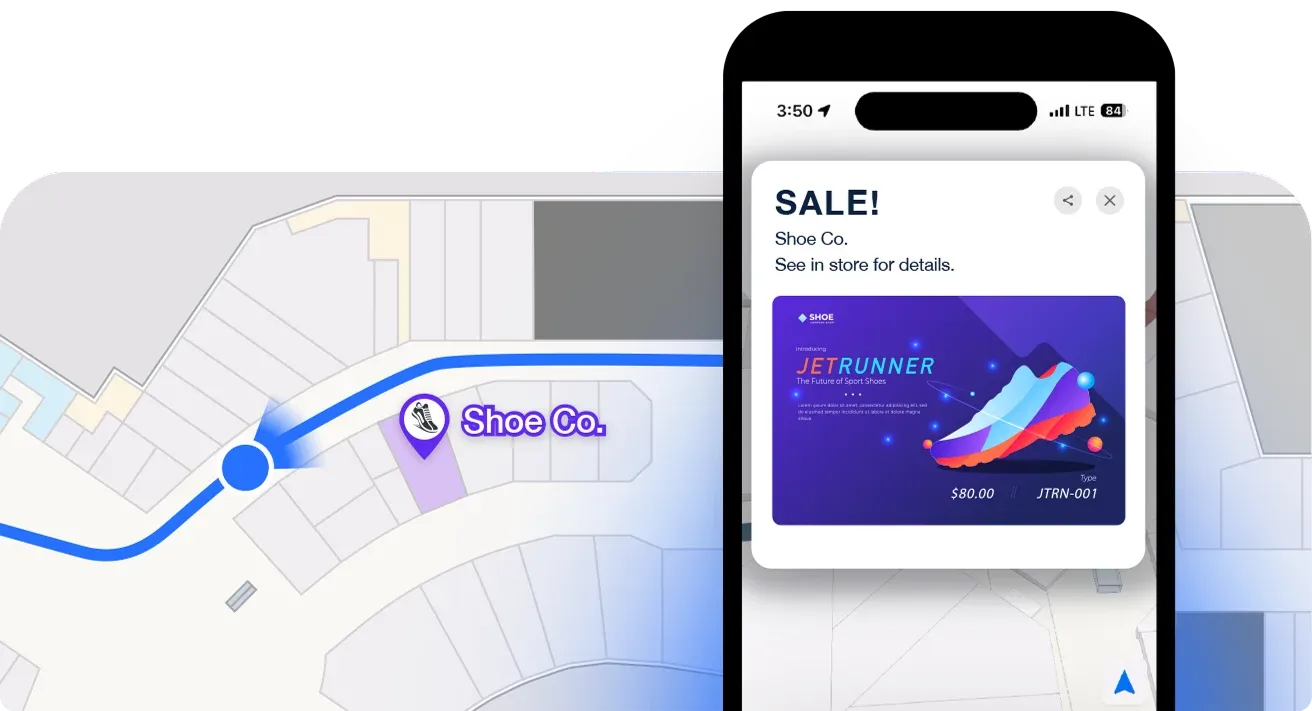
The blue dot problem in large venues
A passenger leaves security in a large airport, opens the venue map, and sees the blue dot hover between two parallel corridors. One path leads to the gate, while the other leads into a dining concourse.
If the position estimate is off by only a few meters, the map can still look believable. But the user can still make the wrong decision. That's the core issue with indoor wayfinding in large venues.
A location estimate does not need to be wildly wrong to fail. It only needs to be wrong enough to put someone on the wrong side of a storefront, corridor branch, elevator bank, or reception desk.
The impact varies by venue, but the pattern is similar:
- Malls and shopping centers: A missed turn can reduce store visits and weaken promotion performance.
- Airports: More people ask staff for directions, which creates queues and interruptions.
- Healthcare: Visitors can end up at the wrong department, delay appointments, or miss a handoff.
Watch-outs of WiFi for indoor positioning
WiFi is often the first option teams consider because it appears to reduce deployment friction.
The access points are already installed. IT already manages the network. Procurement can see a path that reuses existing infrastructure instead of funding a new sensor layer.
But there's a catch. Coverage for connectivity is not the same as coverage for positioning.
A WiFi network designed to keep phones online does not automatically deliver the precision needed for blue dot navigation. In practice, standard WiFi approaches based on RSSI and fingerprinting often provide coarse location estimates rather than doorway-level guidance.
The gap matters because a 5-meter error and a 1-meter error create very different outcomes.
Here's what that looks like in practice:
- In a mall: 5 meters can place the user at the neighboring tenant, in front of a kiosk, or in the middle of an atrium. At 1 meter, the app has a much better chance of confirming the correct entrance.
- In an airport: 5 meters can put the dot on the wrong branch of a concourse, the wrong side of a moving walkway, or near the wrong gate cluster. At 1 meter, the app can support finer decisions.
- In a hospital: 5 meters can mean the right wing but the wrong check-in desk. That is not a minor usability issue.
If the system cannot reliably answer questions like these, the blue dot should be treated as coarse guidance, not precise navigation:
- Which entrance?
- Which side of the corridor?
- Which room threshold?
Many teams run into trouble here. The demo looks convincing because the dot moves and the map responds. The live rollout looks less convincing when people use it in dense, real buildings with mirrored corridors, stacked floors, metal fixtures, changing layouts, and crowds that alter signal behavior.
Operators usually hear the same complaint in different words: "The map is close to accurate, but not close enough to trust."
The trust gap has real costs. Users abandon the feature, staff step in to compensate, and tenants question the value of wayfinding. Internally, operations teams stop treating the system as dependable.
Before rollout, teams should test the experience against real user paths and real decision points, not just against a technical average. This guide to generating blue dot testing data is a practical reference for validating whether a blue dot experience holds up inside a live venue.
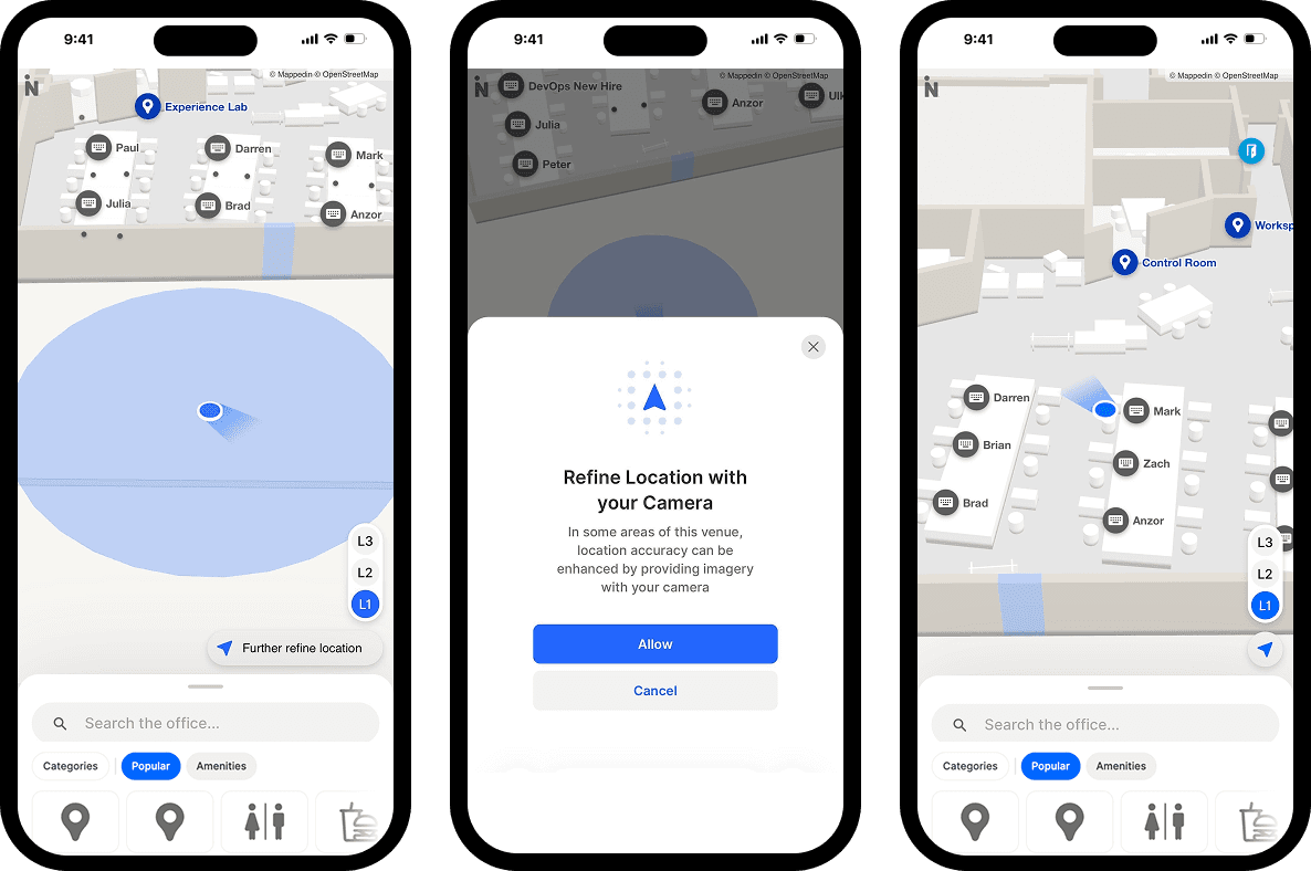
How WiFi positioning works
When teams compare WiFi positioning products, they are usually trying to answer a practical question.
The answer starts with the method underneath the label.
"WiFi positioning" is a category, not a single technique. The experience, accuracy, and operating cost can vary a lot.
RSSI fingerprinting
RSSI, or received signal strength indication, uses the strength of nearby WiFi signals as a clue to location. A phone near a pharmacy entrance, elevator core, or gate lounge will hear a different mix of access points and signal levels.
Fingerprinting turns those differences into a positioning system. The process usually looks like this:
- Survey teams collect signal readings at known points across the venue.
- They build a radio map from those readings.
- During operation, the software compares the live signal pattern from a device to the stored patterns.
- It selects the closest match.
It works a bit like recognizing a room by its acoustics. One sound may not tell you the exact coordinates, but a combination of echoes and background noise can help identify the room.
WiFi fingerprinting applies the same idea to radio signals. The trade-off is maintenance. Venues change all the time: shelving moves, partitions go up, kiosks appear for seasonal traffic, etc. Each change can make the radio map less representative of the building people are actually walking through. For operators, that usually means:
- Recurring survey work
- Performance drift between recalibration cycles
- More risk in dense or high-stakes environments
In retail, a few meters of drift can push the blue dot to the wrong storefront. In a hospital, the same drift can send visitors to the wrong reception zone and increase staff interruptions.
RTT and other time-based methods
Time-based methods ask a different question.
Instead of matching a signal pattern to a known location, they estimate how far a device is from access points by measuring signal travel time. WiFi RTT, based on IEEE 802.11mc Fine Timing Measurement, estimates distance from the round-trip time between a device and an access point.
The rough idea is similar to sonar:
- Send a pulse
- Measure how long it takes to return
- Estimate distance from that delay
With enough measured distances, the system can calculate position using geometry rather than pattern matching alone.
That creates an operational advantage. It reduces dependence on a radio map that must be rebuilt as the venue changes.
But RTT has its own constraints. It depends on compatible infrastructure, compatible client devices, careful access point placement, and an indoor environment that does not distort timing measurements too heavily.
A deployment can look strong in a controlled pilot and still fall short in a live concourse with reflective surfaces, dense foot traffic, and uneven handset support. Google's overview of Wi-Fi RTT on Android is a useful reference for the device and platform requirements behind this approach.
For project leads, the practical takeaway is simple.
Better ranging can reduce the gap between close and pinpoint accuracy, but only if the venue can support the hardware, calibration, and device mix needed to keep those measurements reliable.
Other WiFi positioning methods, explained
Some systems add more signal processing on top of standard WiFi.
Common examples include:
- Time Difference of Arrival, which compares when a signal reaches multiple receivers
- Angle of Arrival, which estimates the direction a signal came from, usually with specialized antenna arrays
- Hybrid fusion, which combines WiFi with inertial sensors, map constraints, Bluetooth, or other signals to stabilize the blue dot
These methods can improve results, but they also add complexity. More infrastructure often means more installation planning, calibration work, and failure points to monitor over time.
That cost can make sense in high-value workflows such as staff assist, asset tracking, or clinical routing. It's harder to justify when the venue only needs coarse zone guidance.
A practical test is to ask what the method requires from the building, the network, the mobile devices, and the operations team after launch.
This overview of solutions for indoor positioning is a useful reference for how WiFi-based approaches fit into a broader indoor wayfinding stack.
Setting realistic accuracy expectations
Most confusion around WiFi indoor positioning starts with one word: accuracy.
Vendors may cite lab performance, device-specific tests, or ideal conditions. Operators have to run systems in terminals, concourses, clinics, malls, and event spaces that are crowded, reflective, and constantly changing.
What standard WiFi usually delivers
Teams using standard WiFi positioning in a large public building should set expectations carefully.
Standard WiFi positioning in real-world deployments — think a typical airport or mall relying on RSSI signal strength without dense calibration — typically delivers only 5 to 10 meter accuracy. That's usable for general wayfinding, but it's far from precise enough for turn-by-turn guidance or blue-dot navigation.
The gap matters because WiFi's ceiling is actually much higher than that: research using fingerprinting techniques has demonstrated sub-2-meter accuracy in controlled indoor environments, and WiFi RTT can hit 1 to 2 meters in optimized setups. The 5-10m range reflects what most venues get with minimal tuning — not what the technology is capable of when properly deployed.
That's the case for BLE, UWB, or fingerprinting-based systems layered on top: they close the gap between "good enough" and "actually precise" wayfinding.
Why accuracy degrades inside real buildings
Signals bounce off metal, weaken through concrete, and distort around mechanical systems. A phone in a pocket will not behave exactly like the same phone held upright in a hand. Crowds also change propagation.
Common causes of degraded performance include:
- Building materials: concrete walls, metal studs, glass, and service shafts change signal paths
- Poor access point geometry: access points placed in straight lines make trilateration less stable
- Mixed infrastructure goals: networks built for data coverage are not automatically good for location
- Operational churn: tenant fit-outs, temporary walls, and equipment moves alter the RF environment
The difference between theoretical accuracy and practical, everyday navigation matters when mapping teams turn location data into real user experience. A blue dot that updates on a web map still needs underlying position quality that matches the use case.
Comparing positioning technologies: WiFi vs. BLE vs. UWB vs. visual
Positioning technology comparison is really a business decision about risk, operating cost, and where mistakes become expensive.
WiFi, BLE, UWB, and visual positioning each solve different problems. The right choice depends on how wrong the system can be before users lose trust, staff lose time, or the venue takes on safety exposure.
WiFi: Wide-area map
It helps identify which part of the building someone is in, and sometimes which corridor or doorway they are near, if the network was designed with location in mind. For guest wayfinding in malls, airports, campuses, and convention centers, that can be enough to launch without adding hardware everywhere.
BLE: More consistent proximity cues than WiFi alone
You can add beacons near escalators, clinic entrances, queueing areas, and complicated intersections.
That can improve the experience in targeted places, but it also creates a maintenance program. Someone has to track beacon health, replace batteries, and update maps when spaces change.
UWB: High-precision location tasks like asset tracking
If a hospital must confirm which room a wheelchair is in, or a manufacturer must know which side of a workcell a tool is on, a few meters of error is not a minor inconvenience. It breaks the workflow.
Visual systems: Location or movement analysis in camera-covered areas
Vision introduces a different approval path. Legal, privacy, security, and infrastructure teams usually get involved early because retention, camera placement, line of sight, and analytics processing all affect deployment speed.
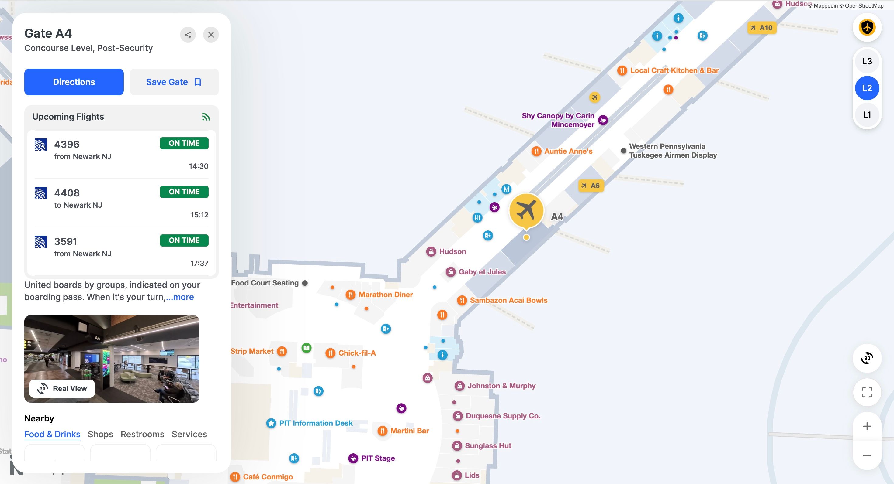
How to choose a positioning system by use case
A better evaluation starts with four questions:
- How much error can the workflow tolerate before people make the wrong decision?
- Which infrastructure already exists, and was it designed for location or only for connectivity?
- Can operations support calibration, battery replacement, and periodic validation after opening day?
- Does the system need to work on ordinary visitor phones, managed enterprise devices, tags, or all three?
Many deployments end up hybrid because the venue has mixed requirements. A common pattern looks like this:
- WiFi covers the full property
- BLE tightens guidance at turn points and entrances
- UWB is limited to pharmacy storage, equipment tracking, or staff duress zones
- Vision supports analytics rather than user-facing navigation
Users judge the result, not the radio. If the blue dot points to the wrong storefront, wrong gate, or wrong patient room, confidence drops fast. Once that trust is gone, every support ticket, missed task, and abandoned wayfinding session raises the true cost of the system.
Deployment and calibration best practices
A mall can install WiFi that delivers excellent internet access and still produce a blue dot that jumps between stores. A hospital can cover every corridor with signal and still fail to place a nurse call in the right room cluster.
Deployment quality determines whether indoor positioning becomes a useful operational system or an expensive source of doubt.
The reason is simple.
Network coverage and location geometry are related, but they are not the same design problem. Access points placed to maximize throughput often leave weak angles for position calculation, especially near edges, vertical transitions, and dense interiors with glass, metal, or moving crowds.
Site survey first, not last
A live RF survey should happen before rollout decisions are locked.
Planning software can estimate coverage, but a real venue behaves more like an echo-filled room than an empty diagram. Reflections, shelving, kiosks, seasonal displays, and human bodies all distort the signal patterns that positioning depends on.
That matters financially. If the location error widens from about 1 meter to several meters, the business impact changes category.
For example:
- Retail: The app may send a shopper to the wrong unit, reducing conversion and increasing abandonment near the point of purchase.
- Healthcare: The same error can blur room boundaries, which keeps manual confirmation steps in place and reduces the value of the system.
Survey work should test the venue as people actually use it. Busy concourses, queues, food courts, loading areas, and waiting rooms often behave differently from quiet test conditions.
What teams should validate before rollout
A good acceptance process checks movement, edges, and exceptions, not only a few static points on a map. Validate these items before launch:
Coverage along real paths
Confirm that devices are detected where visitors and staff walk, pause, and turn.
Access point geometry
Check whether placement supports usable triangulation or whether signals come from poor angles that increase uncertainty.
Blue dot behavior in motion
Test continuous walking routes to see whether the position lags, snaps sideways, or oscillates between nearby zones.
Vertical transitions and boundary areas
Elevators, stairs, atriums, escalators, and entrances between adjacent tenants often expose the largest errors.
Device mix
Validate on the phones, scanners, tablets, or tags that the venue will actually use.
A positioning system can look accurate in a controlled demo and still fail in the places that shape user trust. Those failure points usually sit near decisions like gates, storefronts, nurse stations and rooms.
Calibration is an operating model
Calibration is not a one-time project task, but rather, closer to map maintenance.
If facilities teams move partitions, leasing changes store frontage, operations adds kiosks, or clinical areas are reconfigured, the radio environment changes with them. Fingerprint-based systems feel this most because the reference map can age out of sync with the building.
That creates a budgeting issue many teams underestimate. The cost is not only hardware and installation. It is also staff time, vendor support, test runs, and periodic resurvey work.
The practical questions are these:
- Who owns accuracy after opening day?
- How often will they verify it?
- What happens to the business when they do not?
Teams that reduce calibration effort usually do not remove cost. They move it somewhere else like support tickets, staff workarounds and lower adoption.
Privacy, security, and enterprise integration
Indoor positioning is a data governance, application integration, and a trust problem. A venue may use location in two different ways:
- Aggregate analytics, where operations wants anonymous movement patterns, dwell behavior, or zone utilization
- Individual guidance, where a person consents to seeing their own location on a map for turn-by-turn help
Those are not the same use case, and they shouldn't be governed the same way.
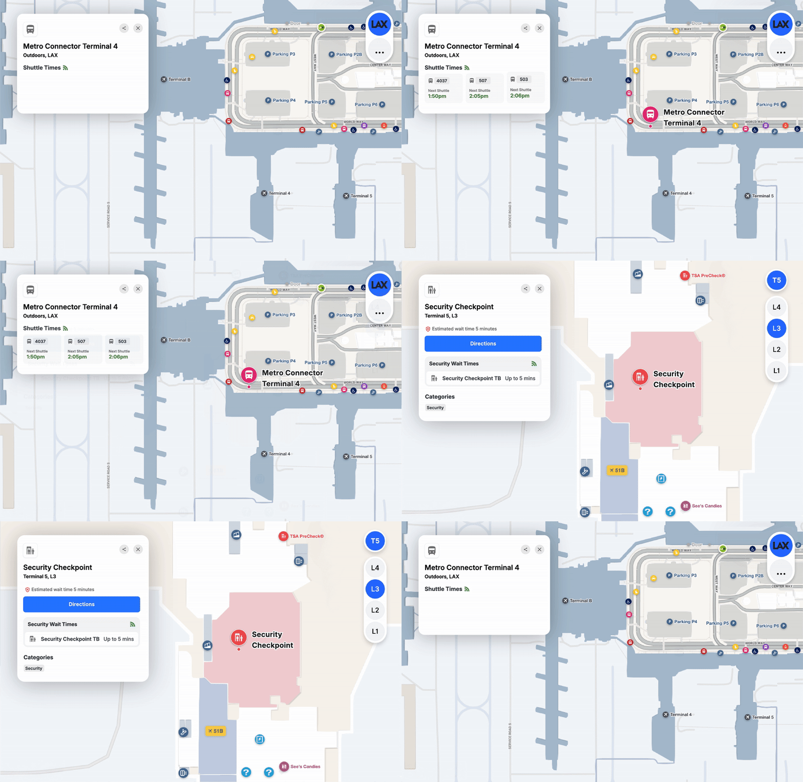
Privacy and security controls
Enterprise teams usually ask four questions early:
- What identifier is being collected?
- How long is it retained?
- Who can access it?
- Is the data needed at individual level, or only in aggregate?
Those questions matter even more when fingerprint-based systems are involved, because maintenance often means repeated collection and recalibration in changing environments.
The blue dot is only one layer
A blue dot by itself is not a product or solution.
For it to be valuable to venue experience and operations, it has to feed an indoor map, a routing engine, and an analytics or operations layer.
A location point without map context is just telemetry. The value appears when the system can place that point on the right floor, connect it to a destination, and apply business rules around access, routing, or incident response.
That means enterprise buyers should evaluate these elements just as seriously as positioning accuracy:
A venue may tolerate moderate error in anonymous flow analytics. It usually will not tolerate poor integration with maps, search, accessibility routes, or security workflows.
How Mappedin approaches indoor positioning
Mappedin focuses on the map, blue dot experience, navigation, and user interface layers. The positioning signal itself can come from different methods, depending on what the venue needs.
Mappedin indoor positioning systems
If the experience requires live blue dot movement across a property, turn-by-turn guidance, or ongoing location updates for user-facing navigation, the application needs an indoor positioning system, or IPS, to supply that location data.
For Mappedin, that distinction is important.
The Mappedin SDK is a consumer of positions, not a location platform itself. It is not aware of where the user is, so it cannot provide location data on its own. Instead, that data must be supplied by an indoor positioning provider, including Apple Core Location and IndoorAtlas.
Mappedin doesn't use or require any particular IPS technology. Customers use the IPS of their choice based on their venue, device mix, and accuracy requirements. Mappedin SDKs provide APIs that allow an app to pass the user's location into the map experience, where it's then used to display the blue dot and provide directions.
Indoor positioning providers can use a variety of sensor data, including GPS, WiFi, BLE, RTT, geomagnetic signals, barometric pressure, and inertial movement data from the phone. In practice, that flexibility matters because no single signal source performs best in every building or workflow.
Mappedin's key partners for indoor positioning are Apple and IndoorAtlas. For teams planning a deployment, that means the wayfinding layer and the positioning layer can be evaluated together, while still remaining distinct parts of the overall system.
Evaluating how positioning data fits into real wayfinding, operations, and analytics workflows? Book a demo to see how this can work for your venue.
Related resources:


Share