Start Here
Indoor mapping technology transforms transportation hubs by providing wayfinding solutions for airports, train stations, bus terminals, and ferry ports that enhance passenger navigation and operational efficiency. These indoor positioning systems enable real-time asset tracking, emergency pre-planning, and data-driven space planning while driving revenue through promotion and passenger discovery. Digital wayfinding reduces traveler stress, improves safety measures, and delivers personalized journey experiences across complex transit venues.
With millions of travellers arriving and departing through transportation hubs, there is great potential for cutting-edge technology such as indoor mapping and indoor positioning. From bus and train stations, to airports and ferry terminals, let’s explore how these transit hubs can simplify and improve operations, all while providing an enhanced travel experience.
Train stations
All transit hubs, including train stations, can benefit from indoor navigation and wayfinding. Navigating crowded train stations is stressful, and many of us worry about missing our scheduled train departure. Fortunately, indoor mapping provides travellers with a way to visualize services, locate train terminals, search for various route schedules, and much more. Step-by-step directions are accessible through any device, whether mobile, web, or digital directory displays. This allows travellers to quickly get acquainted with the venue as they pan, zoom, and rotate the interactive map. Moreover, facilities teams and managers can edit maps in real-time, meaning that visitors can always rely on up-to-date directions to their destination. This way, passengers can find their way around the train station with no stress involved!

Along with offering indoor navigation and wayfinding, your train station needs a digital mapping solution because it can drive traveller spending by highlighting the availability of shops, restaurants, and other areas that motivate purchases. With indoor positioning enabled, train stations can also utilize location-based notifications to drive revenue. For instance, they can notify passengers of a vending machine nearby, or call attention to ticket counters that increase passenger spending. Alternatively, notifications can be used to engage with travellers throughout their journey with triggered greetings, live updates on train times and delays, ongoing deals and promotions, and more.
Bus stations
As one of the most frequently used methods of travel, bus stations can greatly benefit from indoor mapping to help prevent overcrowding and improve operations. By enabling indoor positioning at your bus station, you can gather insights on travelling volume and flow patterns. For instance, you can find out how travellers move through the space and analyze search data to determine the most popular destinations. Facility managers can leverage this real-time information to maintain their maps for better user experience, space efficiency, and safety. This can help with bus boarding zone allocation, optimizing routes, and managing the flow of traffic.

Busy transportation hubs like bus stations can also benefit from digital maps to enhance their safety measures. It is already difficult to navigate a complex bus station, and in emergency situations, it can be extremely hard for travellers to receive timely help when they don’t know where to find it. However, with indoor maps and indoor positioning, passengers can request help from the map application, and staff will be able to assist them with turn-by-turn directions to their exact location. With an employee-only map view, staff and security can monitor, locate, and visualize all incidents on the map in real-time, ensuring that passengers receive help immediately. This eliminates barriers to receiving aid and ensures that individuals feel safe at all times.
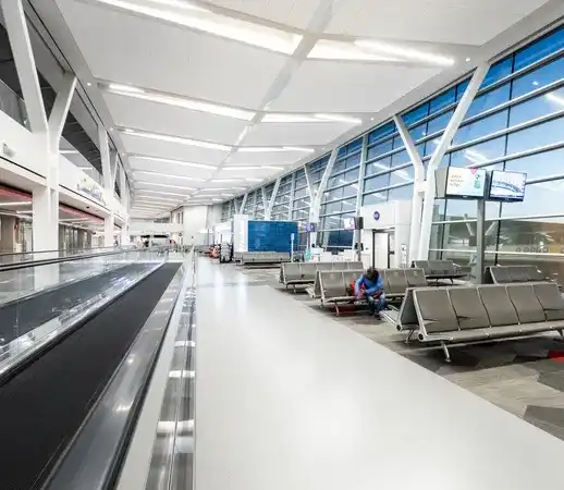
Airports
An indoor navigation system for airports is crucial, as it helps passengers locate their appropriate gate, terminal, baggage claim, security, or ticketing counter. Airports are arguably one of the most confusing transportation centres and indoor mapping allows passengers to plan their trip to the airport ahead of time, determining the amount of time it takes to get to security checkpoints, their boarding gate, and other important airport checkpoints. Indoor positioning also enables visitors to visualize and access parking spots, and with smart technology, they can reserve available spots directly from the map. Along with guided parking, indoor maps ensure a seamless connection from the airport to your hotel through shuttle services. After a long and tiring flight, and patiently waiting through baggage claim, being equipped with a tool that leads you directly to your shuttle bus drastically improves your travel experience.

Moreover, airports can improve operational efficiency through data-driven space planning and asset tracking. While highlighting retailers, food courts, restaurants, and airport lounges, indoor maps allow you to oversee the logistics of the spatial layout of amenities. If certain services are more popular than others, you can ensure that they are in the most optimal location. For instance, if passengers gather around a specific area in your airport, you can drive business by adding more retailers. Asset tracking is also valuable in an airport, as employees are constantly hunting down equipment in various airport zones. Indoor positioning and mapping helps you accurately track and visualize the location of wheelchairs, baggage trolleys, ramp leaders, and more. This is one of the many use cases for indoor positioning at an airport.
Ferry terminals
With indoor mapping technology in ferry terminals, visitors can receive a personalized journey with detailed access to travel information. As ferries bring passengers from one shore to another, and through countless stops, it’s important for passengers to stay informed of conditions and schedules. By integrating indoor maps with public transport schedules, passengers can receive real-time information regarding their departure and arrival times, delays, weather conditions, and more. For instance, personalized messages can be sent to inform passengers that their scheduled departure time has been pushed back by half an hour or that they can begin bringing their cars onto the ferry. With travellers from all over the world, an indoor mapping solution can also accommodate various languages and account for accessible routes for those who need to be directed to elevators, wheelchairs, and more.
Along with enhancing the traveller experience, indoor maps can also be used to improve employee satisfaction. Passengers can refer to maps for directions and questions, limiting the amount of time employees spend answering inquiries. Even more, multiple map views of your ferry terminal can be implemented, with varying control and access based on user (i.e., staff-only, travellers, security teams, etc). An employee view of the map may look different from a visitor map, for instance, as staff have access to employee-only hallways, storage rooms, and other blocked-off areas. In comparison, a visitor map will take passengers down routes that avoid employee-only areas.

All transportation hubs, from train and bus stations, to airports and ferry terminals, can benefit from indoor maps and indoor positioning. Not only does it make navigation simple by providing helpful directions and additional context to travellers, but it improves asset tracking and safety measures, yields valuable information on how travellers interact with your venue, drives revenue, and much more.
To learn more about this technology, and how you can deliver an enhanced digital experience for passengers and staff travelling through your transportation hub, contact us and contact us today.
Share