Make maps in minutes
Indoor mapmaking for everyone, everywhere.
🎉 NEW 🎉 Introducing Mappedin Plus for workspace collaboration and enhanced location data overlays. Read our blog →
products
pricing
developers
solutions
company
contact us
Indoor mapmaking for everyone, everywhere.
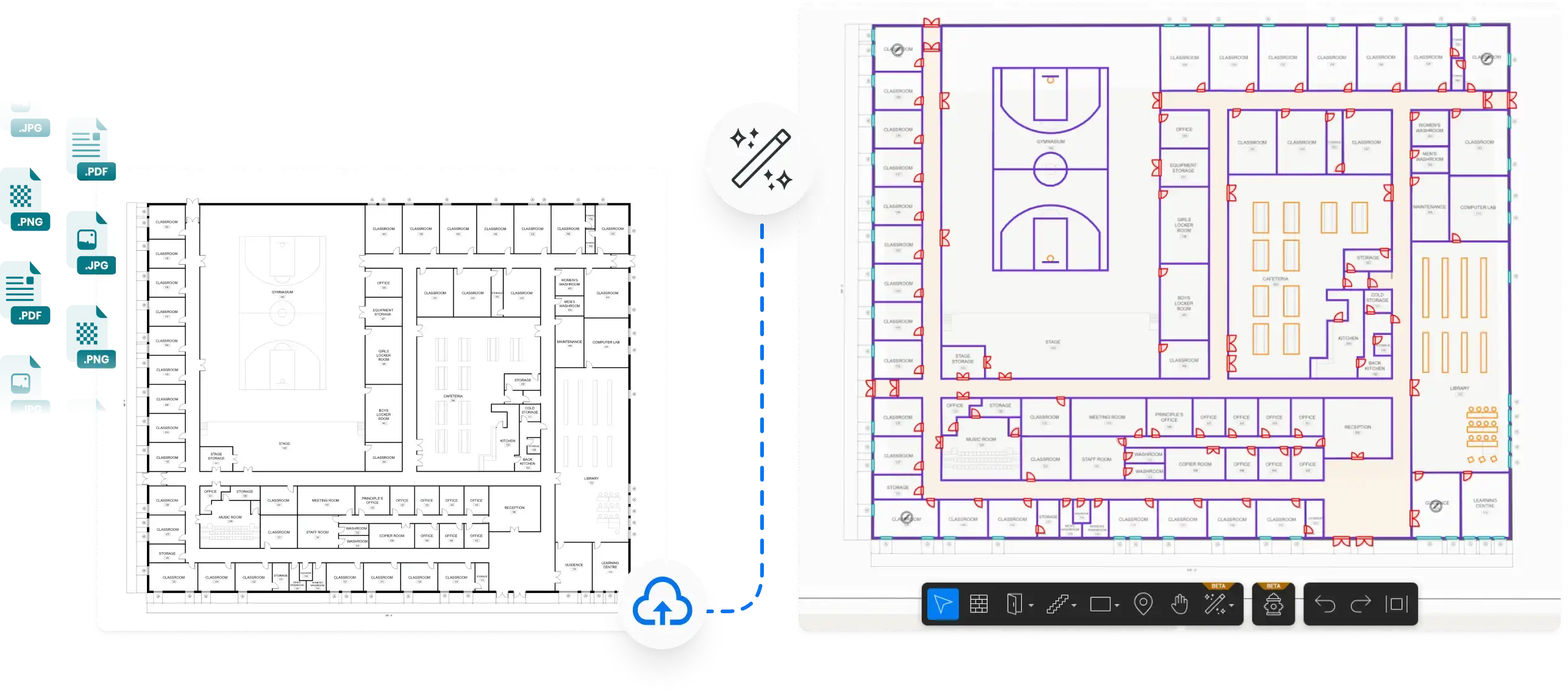
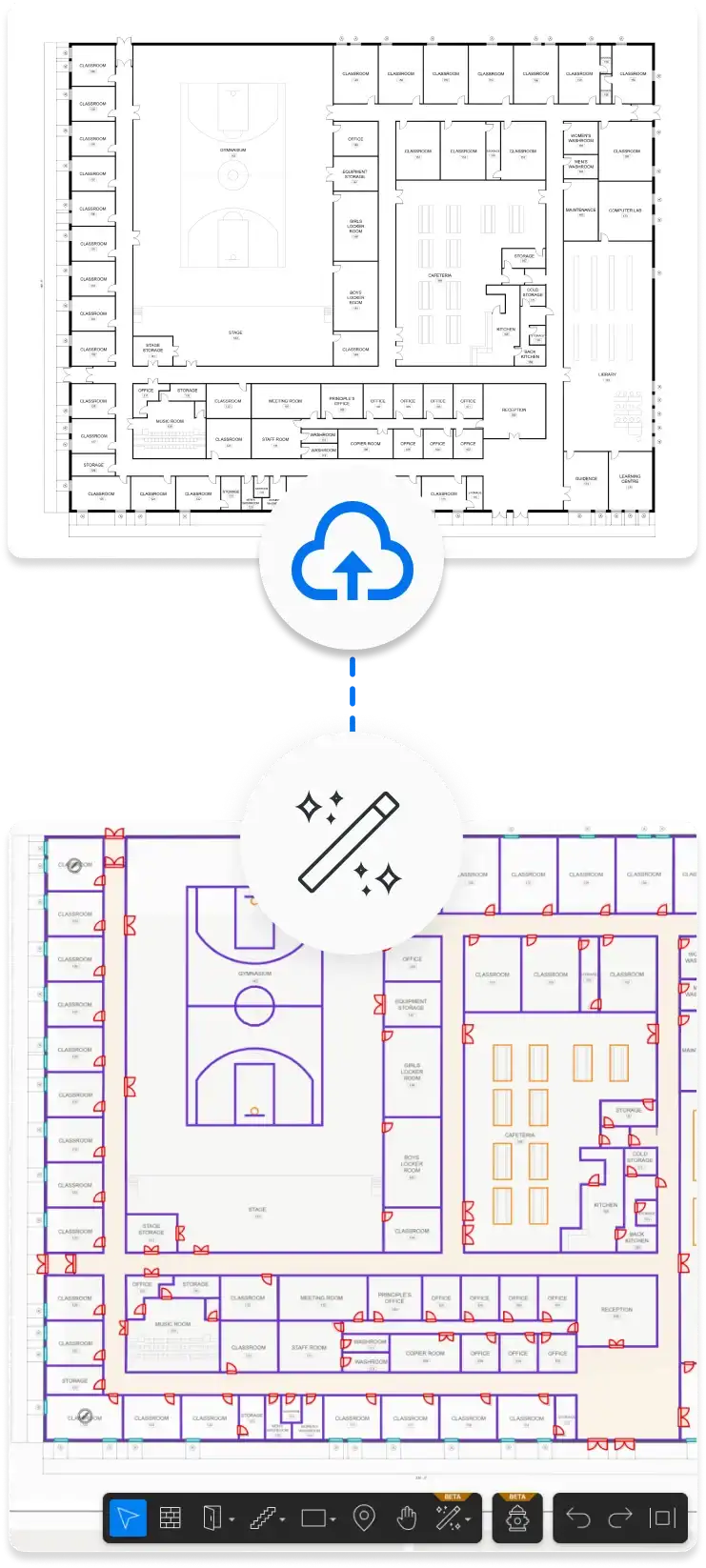
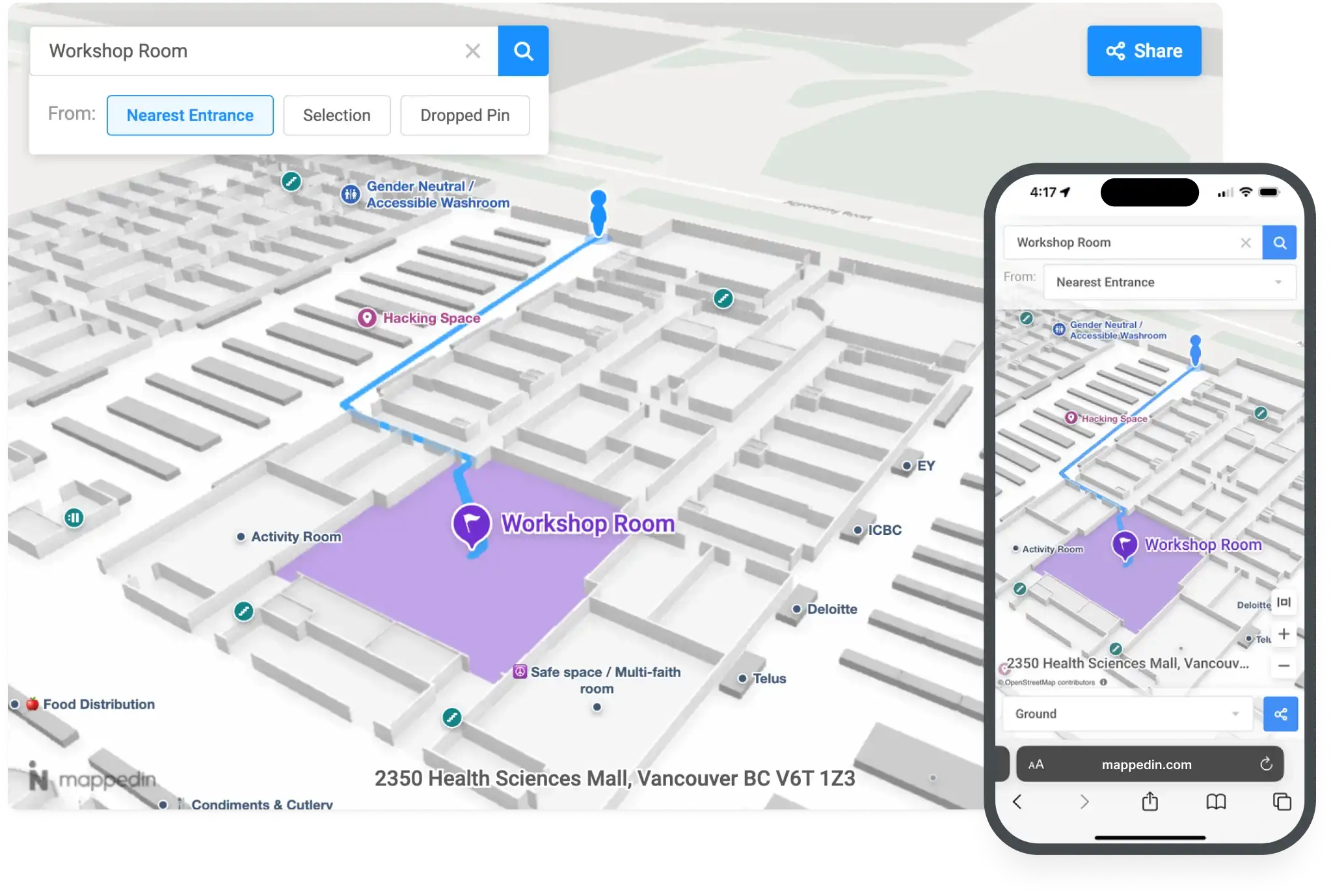
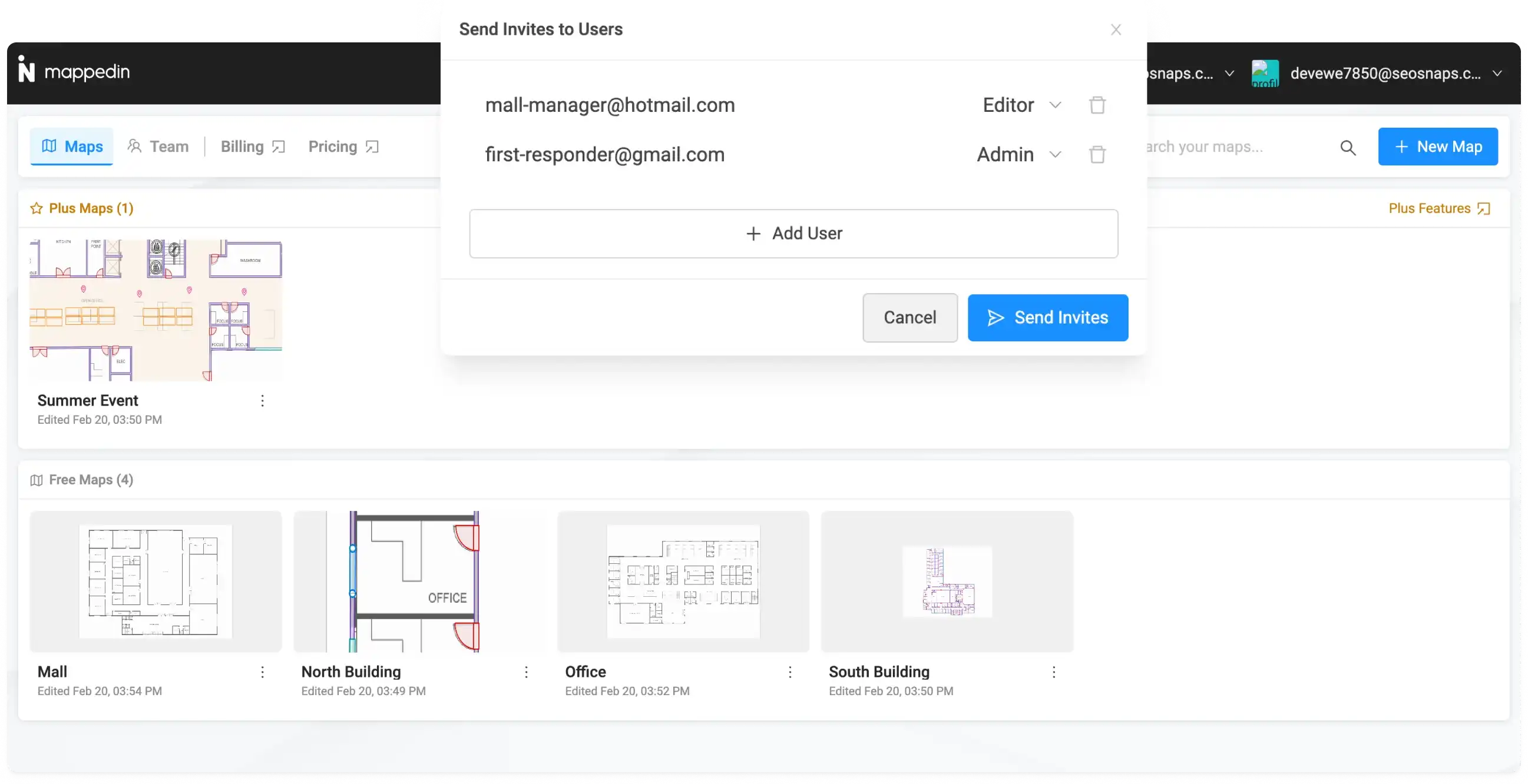
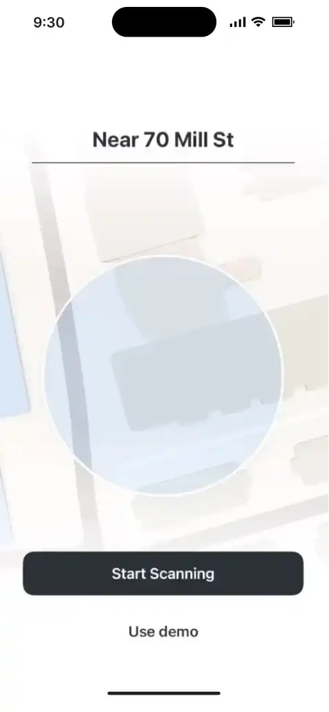
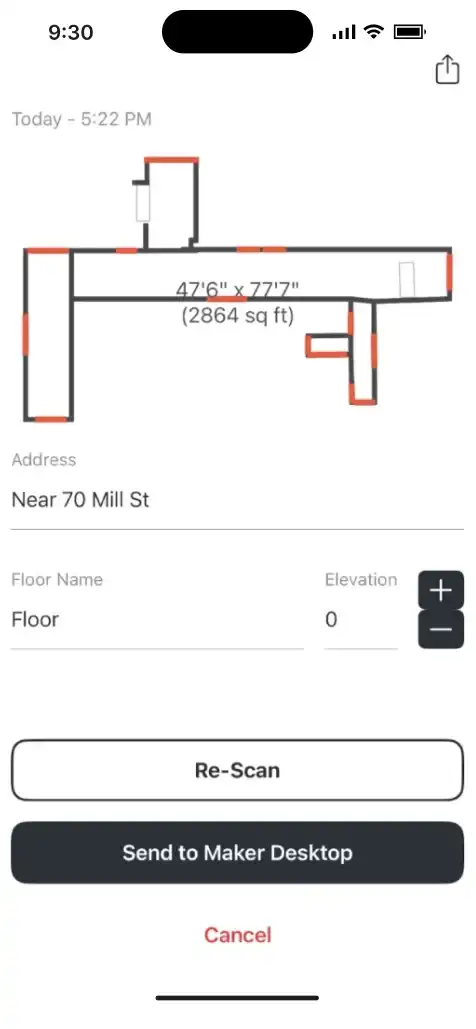
Easily upload floor plan files or images and use AI to quickly make and edit your maps.
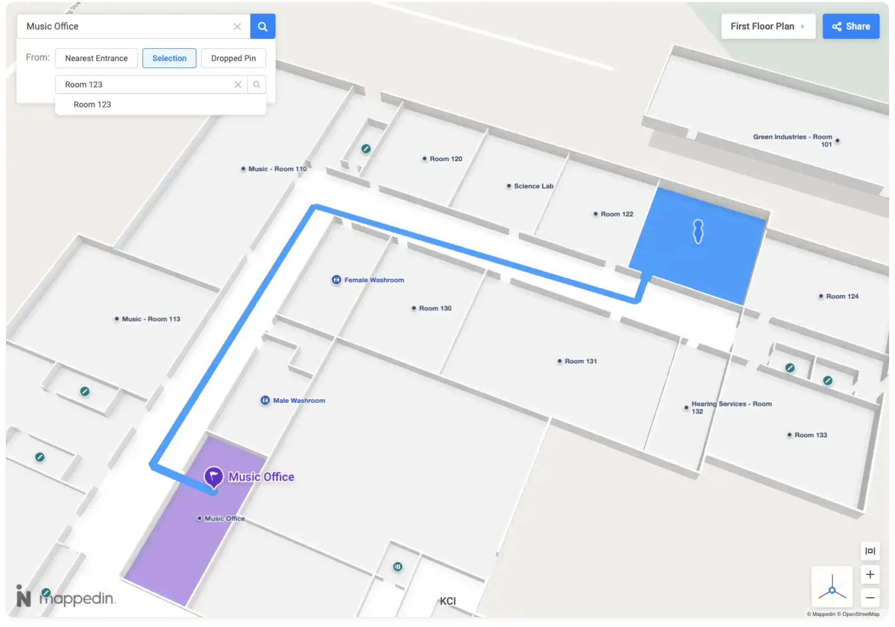
Automatically provide indoor navigation with every map you create.
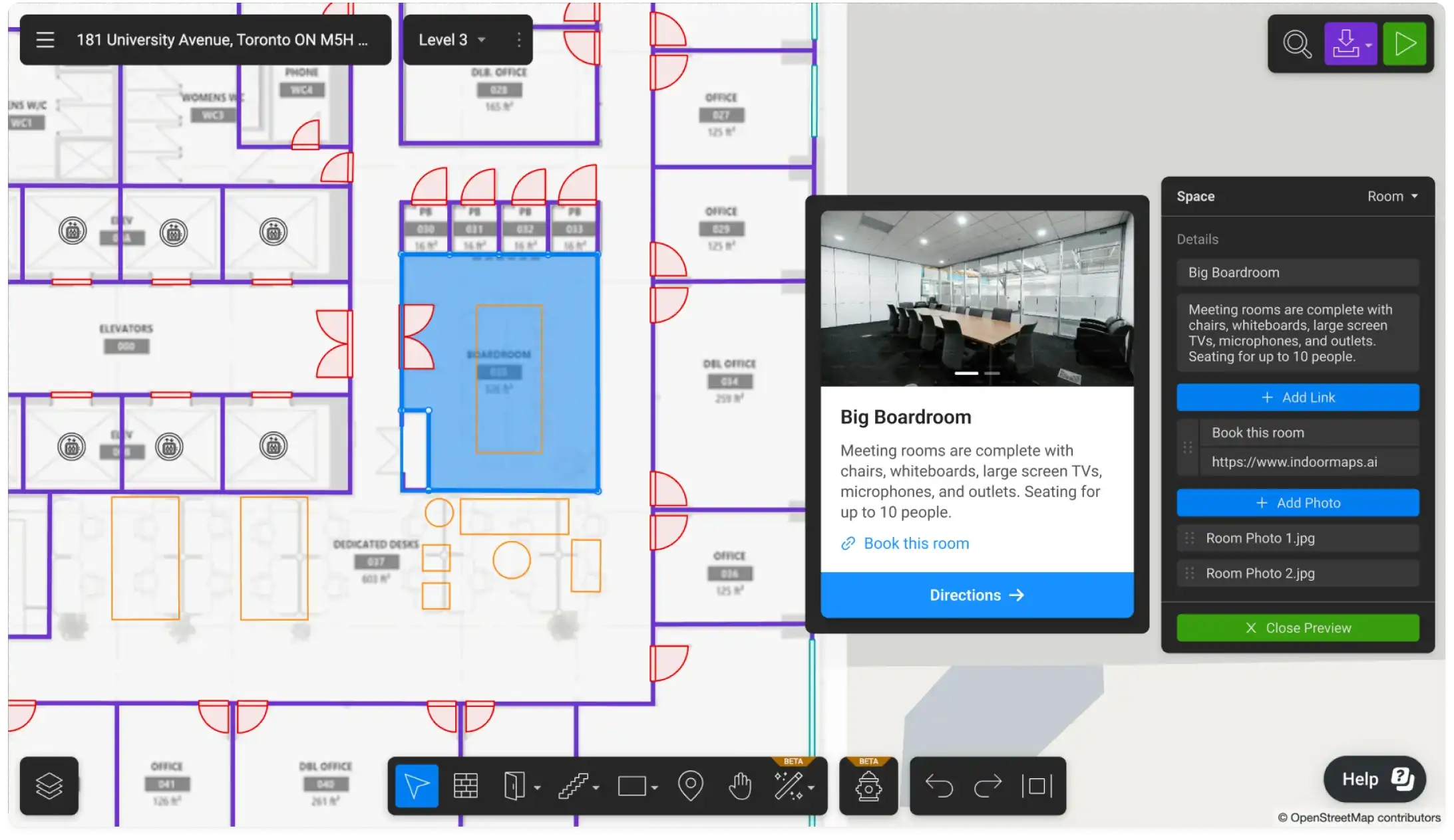
Flexibly enrich and edit your maps to include features, labels, and more.
Instantly share your beautifully rendered, interactive 3D maps across formats and devices.
Continuously add, remove, and re-publish your map content with the latest information.
Optimize and increase the efficiency of your enterprise with complete indoor experiences for enterprises across markets.
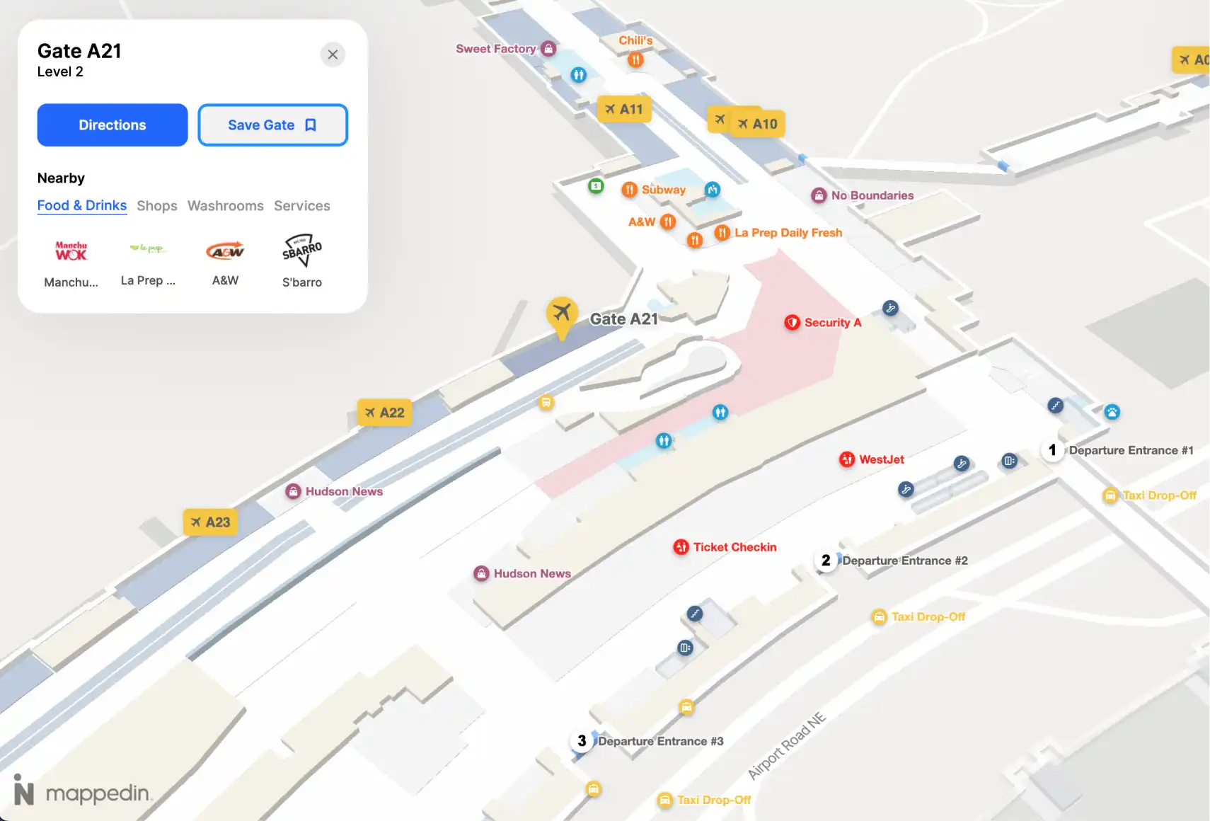
Airports
YYC Calgary International Airport wanted to assist travelers in navigating through the airport with an interactive, 3D wayfinding map with integrated real-time flight data, security wait times, and rich location data.
Explore Mappedin for AirportsEvents
Offices
Stadiums
Malls
Airports
Events
Offices
Stadiums
Malls
YYC Calgary International Airport wanted to assist travelers in navigating through the airport with an interactive, 3D wayfinding map with integrated real-time flight data, security wait times, and rich location data.
Explore Mappedin for AirportsBuild the indoor experience you want with our Mappedin SDKs.


An open standard for many mapping tools.
Embed interactive maps into websites and apps in minutes.
Download maps directly and use in your apps.
Comprehensive set of tools and libraries to build 3D maps.
Render maps in MapLibre, MapBox, Deck.gl and more.
Works with website builders and other apps.
Export maps to IMDF, PDF, Shapefile, and other formats.
Export to SVG, OBJ, gITF, and Shapefile for more uses.
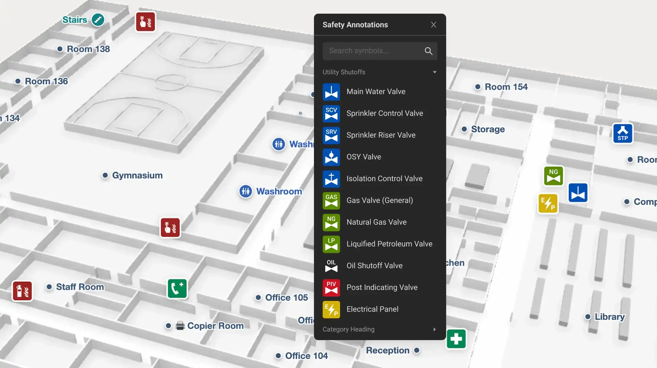
Mappedin is committed to removing the barriers to timely, effective, and efficient technology that helps protect and save lives.
The Mappedin Maps for Good program meets the safety and security needs of first-response organizations, such as firefighters and academic institutions, such as K-12 schools.
Qualified organizations receive no-to-low cost indoor mapping depending on needs.
Idaho National Laboratory
“This is the most important tool for saving first responders and victims lives in the past 50 years.”
Michael J Fagel, PhD
Critical Infrastructure Analyst, INL, National & Homeland Security Directorate