

Hospitals are living ecosystems, the microorganisms of which are constantly on the move.
Infusion pumps wander between floors, wheelchairs collect in the wrong wing, and a nurse can lose twenty minutes hunting for a bed that was moved overnight. Real-time location systems, called RTLS, exist to answer a single question: where is this thing right now?
RTLS attaches small tags or badges to assets, staff, and sometimes patients, then tracks where each one moves across a hospital campus. That tracking relies on radio signals, infrared, ultrasound, or Bluetooth, depending on the vendor. The result is a continuous stream of coordinates for every tagged object.
What is RTLS?
At its core, RTLS is a tracking technology, not a map. It locates tagged objects and reports their position to an operator watching a dashboard. The most common uses in hospitals break down by what carries the tag.
Asset tracking is the bread and butter of hospital RTLS. Biomed and healthcare technology management teams tag infusion pumps, ventilators, wheelchairs, and specialty beds so they can:
- See where equipment is
- Cut search time
- Route maintenance more efficiently
Staff locating works the same way for badges, helping nursing leadership see coverage across floors and reducing the time spent paging someone who is already two floors away.
Patient safety applications add another layer. Wandering and elopement monitoring uses a tag on a patient at risk of leaving a unit, while hand hygiene monitoring tracks whether staff entering a room trigger the dispenser sensors.
How RTLS works
Real-time location systems in healthcare are indoor tracking architectures. Battery-powered tags or badges sit on patients, staff, or equipment, fixed receivers collect wireless signals, and a positioning engine turns those signals into room-, bed-, bay-, or chair-level data. That data then appears in dashboards or downstream systems that clinical and operational teams already use, including EHR workflows through HL7 FHIR-based exchange when the deployment is designed that way, as described in the technical overview of healthcare RTLS architecture.
The phrase real-time matters, but not in a marketing sense. In a hospital, “real-time” means the location data is fresh enough to support a task before the task stops being useful. A duress badge that updates too slowly does not help much, and a patient-elopement alert that arrives late loses operational value.
How the RTLS tech stack fits together
Think of every RTLS deployment as a relay race. The tag starts the run, receivers capture the signal, the positioning engine interprets it, and the software hands the result to the people who need it. If one leg is weak, the whole race suffers.
Tags, receivers, engines and screens
The tag is the runner with the baton. It might sit on a badge clip, a pump, or a wheelchair, and it has one job, send a wireless identifier often enough for the rest of the system to work. The receivers or exciters mounted across the building act like checkpoints, catching those signals as they move through the facility.
The positioning engine is where raw signal becomes useful location. It decides whether something is in a room, at a bay, or near a chair, and it does that by applying the deployment's rules and sensor layout. The final layer is the software, the dashboards, maps, or workflow tools where a nurse, security officer, or technician sees and acts on the data.
The two numbers hospitals should define first
The first number is accuracy, which can mean room-level, zone-level, or sub-meter precision depending on the use case.
The second is update latency, which is how stale the data can be before it stops being useful. A duress alert, for example, needs a very different response window than a monthly utilization report.
Those two decisions shape the physical design. More accuracy usually means denser sensor coverage, more complexity, and tighter tag battery trade-offs. Less demanding use cases can tolerate simpler layouts, longer battery life, and lower cost.
A practical hospital rollout often uses a platform like Mappedin's indoor positioning to make location data legible on maps and in workflows, but the same rule applies no matter the vendor. The system has to fit the clinical problem first, then the radio stack second.
Comparing BLE, UWB, RFID and WiFi for healthcare
Hospitals usually do better when they stop asking which RTLS technology is “best” and start asking which one matches the decision they need to make. A pump that needs to be found somewhere on a unit doesn't require the same precision as a duress badge that has to narrow down where help is needed. The trade-off is always the same, accuracy versus cost versus operational burden.
Where each RTLS option fits
BLE
BLE often works well for staff badges, patient wayfinding, and room-level workflows because it sits in a practical middle ground. It has a broad device ecosystem and can support useful location visibility without pushing infrastructure as hard as more precise options.
UWB
UWB is the choice people reach for when they want sub-meter precision. That makes sense for hands-free equipment tracking, highly accurate location confirmation, and some safety applications, but the trade-off is a higher infrastructure and tag burden.
RFID
RFID, both passive and active forms, tends to fit high-volume asset tagging where battery replacement would become tedious or expensive at scale. It's often used where the question is not exact position, but whether an asset is present, moved, or missing from a known area.
WiFi
Wi-Fi can be attractive because hospitals already have it, but convenience isn't the same as fit. It's usually weaker on accuracy and update rate than technologies built specifically for indoor location.
How is RTLS different from indoor mapping and blue-dot navigation?
Three ideas often get tangled together in hospital management conversations. Each of them solves a unique problem for a hospital.
RTLS
RTLS locates tagged objects and reports their position to operators. The person holding a badge does not see anything; a clinician at a workstation sees a coordinate on a screen.
Blue-dot navigation
Blue-dot navigation locates a phone and shows the person holding it where they are, in real time, on a map. This is the familiar "you are here" experience from consumer navigation apps, now applied inside buildings.
Indoor mapping
Indoor mapping is the spatial layer both can sit on. It is the digital floor plan that renders a building as something a human can read, with rooms, corridors, and destinations labeled and searchable.
The key insight is what these terms don't overlap. On it's own, a map an't tell you where a moving object is, just as a location system alone can't tell a person how to get somewhere. When hospitals run into confusion, it is usually because one system has been asked to do another's job.
What to look for when evaluating an RTLS system
When an RTLS evaluation starts, most teams get drawn into accuracy specs and miss the operational cost drivers. Four things deserve attention.
- Accuracy and refresh rate matter, but only against what the use case actually requires. Finding a ventilator in a room does not need centimeter precision; the same tag hardware that is overkill for that may still be the right choice for hand hygiene.
- Infrastructure is the hidden cost. Tags, readers, and power all need to be installed and maintained. Beacon-based systems are the most common offender here because they lock a health system into a specific hardware approach, and ripping them out later means redoing the whole project.
- Integration matters more than most vendors admit. If the RTLS stream can't feed the EHR or the nurse call system, its value shrinks fast. And maintainability is what decides whether the system still works two years in.
- Ask whether the map underneath can have multiple uses. If the digital map layer you build for asset tracking can't also power visitor navigation, you will pay for mapping twice.


Unlock better patient experience with interactive wayfinding
For most patients, the care experience doesn't begin in the exam room. It begins in the parking garage, at a lobby directory, or on a phone screen. This guide gives Patient Experience leaders a practical framework for turning wayfinding from a persistent pain point into a coordinated, measurable program.
How to use Mappedin with RTLS systems
Mappedin supplies the map layer, not the tracking. Mappedin on its own doesn't track assets, it renders the tracking. When a health system already has RTLS hardware in place, the Mappedin platform provides the map canvas that turns that vendor's coordinate stream into something a technician can actually act on, instead of a list of raw coordinates or a static floorplan image.
The platform is positioning-agnostic. If a hospital is building its own mobile app, it can use whatever indoor positioning system it wants, whether that is Bluetooth, Wi-Fi, or something else, and pass the user's location into the map. There's no requirement to adopt a specific beacon vendor to get the visual layer.
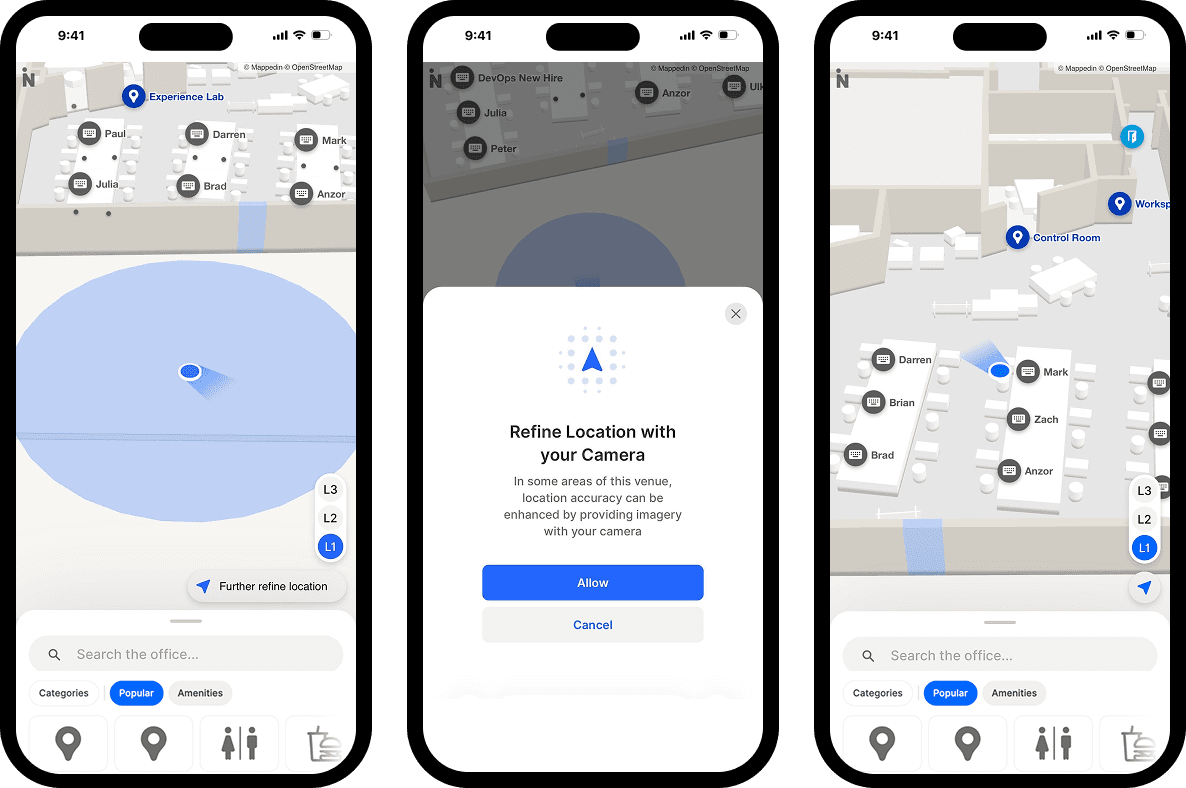
This same map also carries the visitor-facing side of the building. At Princess Alexandra Hospital, Mappedin maps power an AI kiosk experience built with PRSONAS iHealthAssist. The kiosks average around 800 questions a month and roughly 40 hours of interaction across five languages, including British Sign Language, with about 35% of those interactions being wayfinding requests.
— Chuck Rinker, CEO of PRSONAS
The asset-tracking stream and the patient-facing directions can run on the same map, each doing its own job for its own person.
Frequently asked questions
What is RTLS in a hospital?
RTLS is a system that tracks the location of tagged assets, staff, and sometimes patients in real time using radio, infrared, ultrasound, or Bluetooth signals.
How is RTLS different from GPS?
GPS relies on satellites and stops working indoors, where signal can't reach. RTLS uses signals designed for indoor spaces and reports positions to operators, not to a phone holder.
Does RTLS help patients find their way?
Not directly. RTLS tracks tagged objects and reports to operators. Patient wayfinding needs a visitor-facing map, searchable directions, and turn-by-turn guidance, which is a separate layer.
What does RTLS cost to install?
The cost is dominated by tags, readers, and power infrastructure, not software. Beacon-heavy designs are more expensive to install and to change later, since the hardware is fixed in place.
Can RTLS and wayfinding use the same map?
Yes. Both can run on a single indoor mapping layer like one provided by Mappedin, which is what lets a hospital reuse its floor plans instead of mapping the campus multiple times.
Do I need beacons for RTLS?
Not necessarily. RTLS can use Bluetooth, Wi-Fi, ultra-wideband, infrared, or ultrasound. The right choice depends on the use case, and a positioning-agnostic map layer lets you switch without rebuilding.


Share