

A fan holding a fold-out paper map can't ask the map which way the dugout is, or whether the team store sits closer to Section 108 or Section 112. At the same time, stadium staff repeat the same directions all day while the newest, biggest-budget attractions get walked past.
Off days only accentuate the problem. Tour groups, sponsors and new hires walk the same concourses holding a printed map, with no way to see what's open, what sits behind a closed door, or how long a route will take. Someone has to lead every group in person, because signage only labels a space.
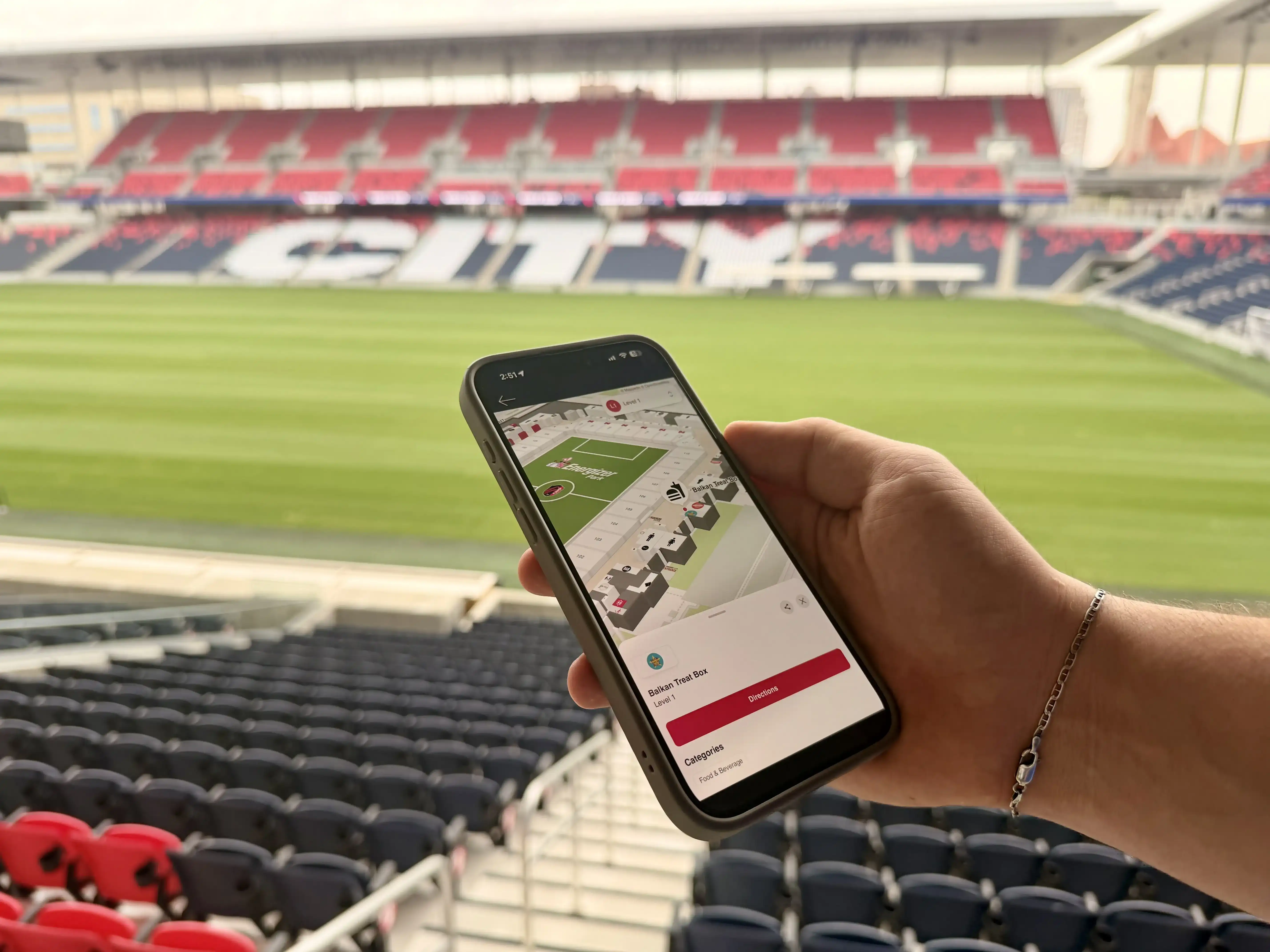
A live map answers the question in the moment. It moves stadium signage onto a phone, ties it to what's happening in the building, and lets a guest find what they need without flagging down an usher.
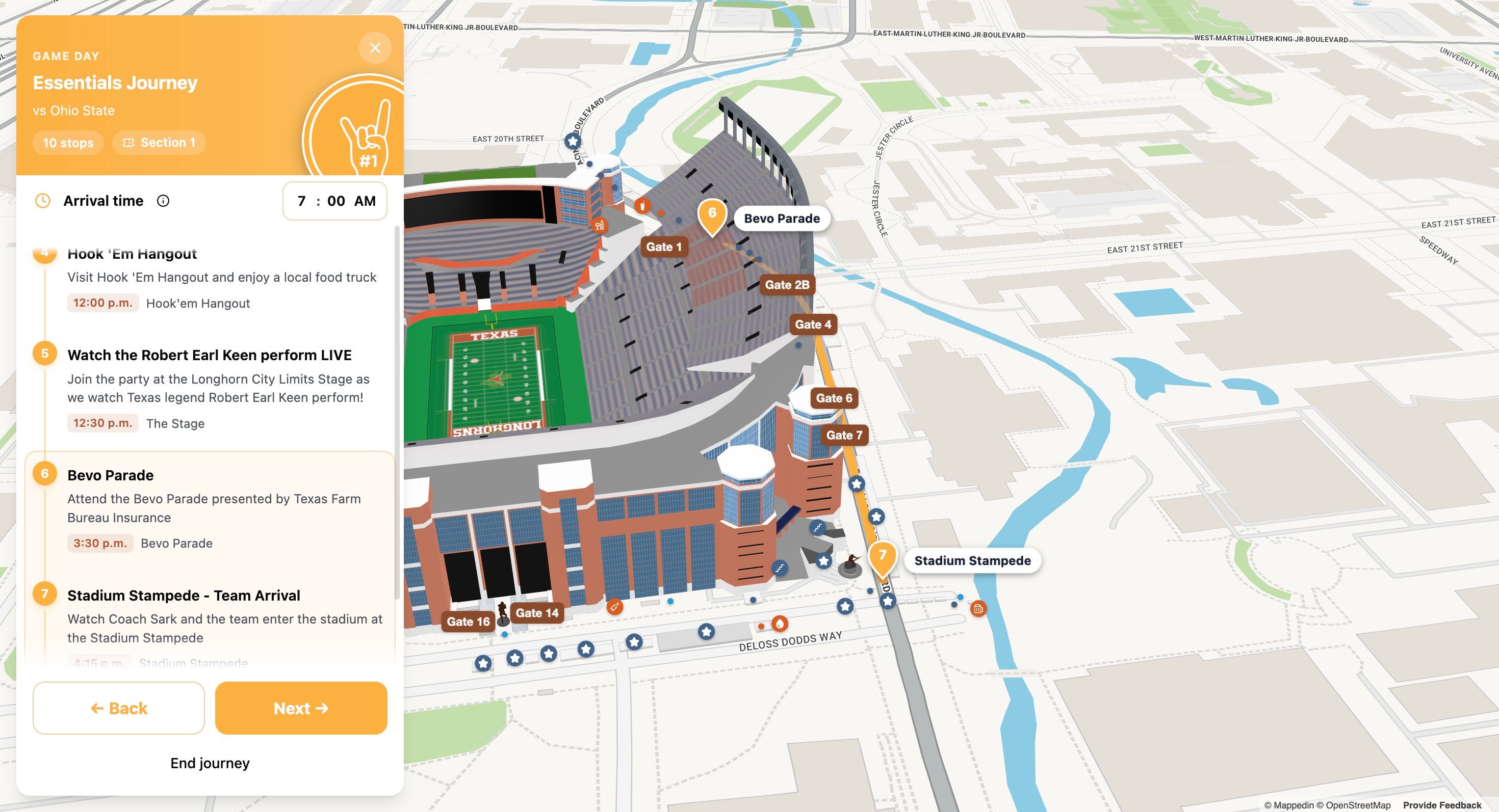
Explore the interactive stadium demo to try a self-guided tour on a working map. →
Why does static stadium signage degrade fan experience?
Fixed signs assume a building never changes. A venue that adds a food stall, closes a concourse for construction, or moves a tour meeting point leaves its printed signage out of date by morning.
In-venue staff carry the same load. A Marketing or Fan Experience team that wants guests to find the club museum, the trophy display or a sponsor activation has to route people there by word of mouth. Missed attractions are a signage problem before they become a staffing problem.
What does a live map add to your stadium signage?
A live map swaps a printed panel for a searchable, zoomable model of the venue. Every gate, section, restroom, first-aid station and food partner sits on one map, and that map changes the moment the building does.
Mappedin connects the map to the systems a venue already runs, from ticketing to concessions to the event schedule. A custom self-guided tour app sits on top of it, and changes are shipped in weeks, not years.
The same map serves both jobs. On matchday it answers questions about restrooms, concessions and accessible routes, and on a quiet Tuesday it walks a tour group past the tunnel, the museum and the trophy case.


Lumen Field’s 20 point NPS score increase and 11.8M fan interactions with one digital map
Lumen Field needed wayfinding that behaved like the iconic and innovative venue itself: dynamic, connected, and always current. Mappedin delivered a single source of truth, one map powering an omnichannel fan experience on game day, across multiple tenants.
What changes on the map for a self-guided tour?
Before a tour runs, the venue decides what the route should show. Those stops become pins a guest can search, tap and route to within the building, on event days and off days alike.
- A welcome stop at the main gate or a chosen entrance.
- The players' tunnel, locker-room viewing area or field access point.
- The club museum, trophy case or hall of fame wall.
- Concessions and the local food partners the venue wants fans to find.
- Restrooms, first aid, water stations, elevators and step-free routes.
- Sponsor activations and photo moments worth counting.
Each pin ties to a real place in the building, so routes change without reprinting a sign. When a sponsor rotates or a new exhibit opens, the marketing team edits the map instead of the wall.
Build a self-guided stadium tour, step by step
The build follows the same pattern whether the venue is an arena, a ballpark or a football stadium. Most of the work happens before anyone opens the app.
- Start from the venue's floor plan. Supply a CAD file, a PDF export or a previous map, and Mappedin builds the base map at scale.
- Mark the route. Decide the order of stops, from the gate to the tunnel to the museum to the final photo spot.
- Add each stop as a pin. Give it a name, a photo and a short description so a guest knows what they're walking toward.
- Publish to the app and the web. The same map can live in the venue's app, open from a link, or scan from a QR code on existing signage.
- Walk it yourself. Test the route on a phone inside the building before a guest does.
- Keep it current. Update pins as stands close, sponsors rotate or exhibits change, with nothing to reprint.
Steps 4 and 5 decide whether the map replaces a sign or just joins it. A route that works on a phone in the concourse is the difference between a guest who explores and a guest who asks.
What do fans and staff get out of it?
Results show up in the numbers a venue already tracks. St. Louis CITY SC runs its interactive map at CITYPARK, a 22,500-seat stadium with 25+ local food partners on the map. The data speak for itself:
- 84% satisfaction
- 31,900+ map searches
- Up to 150% higher food partner sales when a partner is elevated within the interactive map
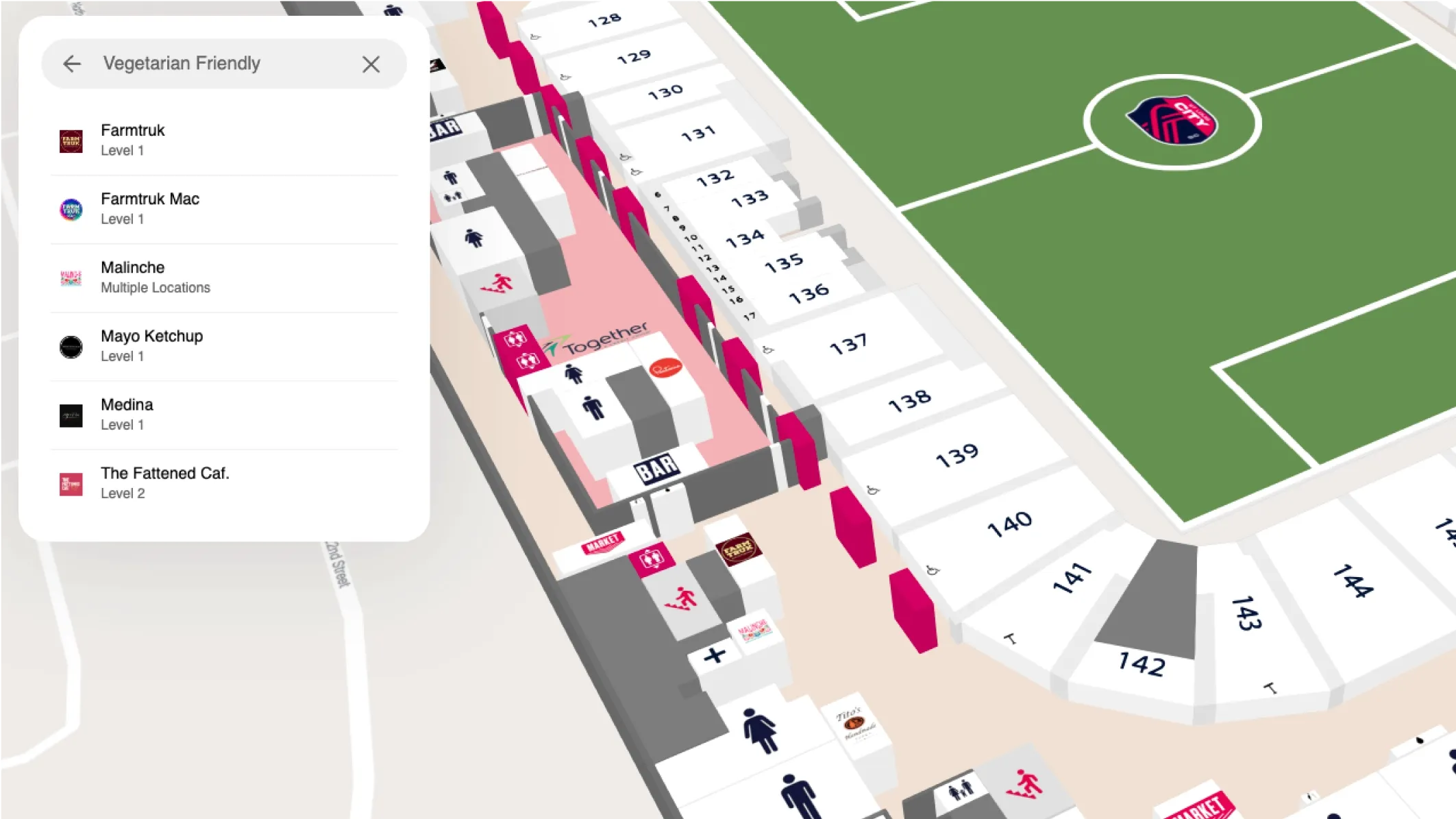
Search drives the discovery. St. Louis CITY SC found that 73% of food partner interactions begin with search, which tells the club that fans go looking for something specific rather than browsing. Guests who search for the tunnel or the trophy case announce what they came to see, and the map answers them.
— Aaron Brewer, St. Louis CITY SC
Staff feel the change first. Every guest who routes themselves to a restroom or the tunnel is one fewer person stopping an usher, and a self-guided tour means a guide can be redeployed instead of assigned.
Frequently asked questions about stadium signage
What's the difference between stadium signage and an interactive map?
Static signage labels a location. An interactive map answers a question: where it is, whether it's open, and the fastest route there. It carries everything a sign would, plus the direction a sign can't give.
Can one map run event-day wayfinding and off-day tours?
Yes. The same map holds gameday destinations and tour stops, and the venue chooses which set of pins is visible by day or by event. A fan at a match and a visitor on a Tuesday tour open the same map.
Do fans have to download an app to take a self-guided tour?
Not always. The map can live inside the venue's existing app, open from a web link, or scan from a QR code on a physical sign. App install is a choice, not a gate.
How long does it take to build a self-guided stadium tour?
Map creation runs in weeks, not years. A venue supplies its floor plan and a list of stops, and the tour goes live with those stops pinned, searchable and routed.
How do you keep a tour current when the venue changes?
Edit the map, not the sign. When a stand closes, a sponsor rotates or a new exhibit opens, the change shows up in the app the same day.
How do you measure whether a tour worked?
Track searches, stop opens, route completions and the fan-satisfaction score your venue already reports. A map that lifts NPS and shortens queues has earned its place in the signage budget.
Can a self-guided tour carry sponsors and premium spaces?
Yes. Sponsor activations, premium clubs and photo moments become stops like any other, and the marketing team can see which ones get opened. That turns a sponsorship into a measurable placement.
Getting started with interactive stadium signage
Pick the stops a guest would miss without help: the tunnel, the museum, the one food stall nobody finds alone. Map those first, put them on the signage fans already scan, and let the app walk them the rest of the way. Start with one map.
To see it on your own floor plan, book a demo with the team and walk through what a self-guided tour looks like for your venue.

Share