

A lost visitor rarely complains about the map. They complain about the venue, the brand, or the event, because the venue is what they remember after walking past the wrong entrance, missing a tenant, or circling for a restroom. For the operations team, that moment usually turns into a desk interrupt, a safety concern, or a missed chance to move someone toward a store, gate, or seat.
That is why venue wayfinding belongs in the same conversation as operations, revenue, and visitor experience. Mappedin's State of Venue Experience report found that:
That kind of friction shows up in places operators already track, like dwell time, return visits, and support workload. A navigation issue can lead to recurring operating cost.
Venue wayfinding: An operational priority
A guest lands in an airport, crosses a concourse, and still can't tell whether the next turn leads to a gate, a connector, or a dead end. A shopper reaches a mall directory and sees the tenant they need, but not the path that gets them there. A parent at a stadium asks three staff members for the same direction and still arrives late. That pattern is familiar because the problem is no longer rare, and it's not limited to one venue type.
The practical cost starts with confusion, then spreads into operations. Every extra minute a visitor spends searching is a minute not spent shopping, boarding, attending, or checking in. It also increases pressure on staff at information desks and front-of-house points, because people default to asking a person when the map fails them. In a venue where tenant exposure, concessions, or premium experiences matter, that friction can reduce revenue opportunities without leaving a clean line item.
Looking for an indoor wayfinding solution to power visitor navigation, simplify operations, and improve venue analytics? Book a custom demo of Mappedin →
The operational leader's approach to wayfinding
The strongest reason to treat this as a live system is that venues change constantly. Rooms get renamed, tenants rotate, corridors close, and event layouts shift. A static sign can still look polished while pointing people to the wrong place.
That is why venue wayfinding needs to be governed like an operational service, not refreshed like décor. The moment the map becomes stale, the visitor journey gets noisy, and the venue pays for it in interrupts, missed exposure, and slower movement through the space.


What is venue wayfinding?
Venue wayfinding is the system that helps people orient, choose a route, follow it, and confirm they reached the right place. That system includes signage, maps, symbols, colors, and digital tools, but the visitor's mental process comes first. A sign on a wall only matters if it supports a decision that the person is already trying to make.
The cleanest model breaks navigation into five stages:
- Orientation
- Route decision
- Route monitoring
- Destination recognition
- Post-arrival reorientation
First, the visitor figures out where they are. Then they choose a path, watch for cues while moving, confirm the destination when they arrive, and finally decide what to do next once they get there. The last step matters more than people expect, because a visitor who arrives at the right place still needs to know whether to check in, queue, or continue deeper into the venue
A simple example: Venue wayfinding at an airport
An airport gate is not just a destination. It's the end of a route that may include a train transfer, a level change, a security checkpoint, and a final corridor with multiple branching choices. If any one of those steps is unclear, the person may still reach the right terminal but lose confidence along the way.
That's why the discipline is broader than signage placement. A venue can have attractive arrows and still fail if the underlying map model is wrong, if the route logic ignores accessibility constraints, or if the destination names on the kiosk don't match what staff say at the desk.
The strongest operational takeaway is simple. Wayfinding is a visitor journey with visible and invisible parts, and the visible sign is only one of them.
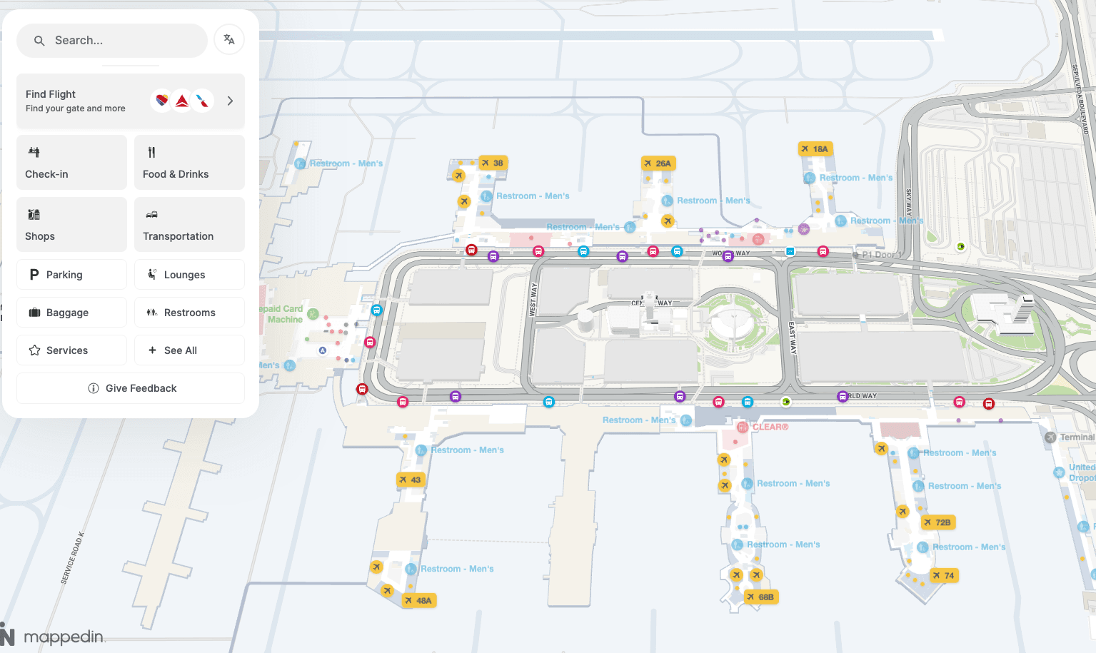
From static signage to digital wayfinding systems
The market data shows that venue wayfinding has moved into enterprise territory.
That kind of growth usually signals a category becoming part of core infrastructure.
For operators, the shift changes how the work gets bought and managed. Printed signage lives in a cycle of redesign, approval, production, and installation. Digital systems replace that with a live content model that can update search, routing, and destination names without waiting for the next print run. That matters because the operational challenge is surfacing right information everywhere, all at the same time.
Why speed changes the economics
Once a venue moves to a cloud CMS, a change can be published in minutes rather than the 6 to 8 weeks often required for printed signage updates, and recurring update costs can fall to zero after the digital system is in place. The practical difference is bigger than convenience. It changes how fast a venue can react to tenant moves, event changes, and closure notices.
A digital wayfinding model also changes ownership. The map becomes something operations, leasing, event planning, accessibility, and security can all rely on, instead of a file handed to print vendors once a quarter. That is why the market's growth matters. It suggests buyers are treating navigation as living infrastructure that has to stay accurate across channels, not as a project with a finish line.
The clearest trade-off is governance. A digital system only helps if the source of truth stays clean. If the underlying content drifts, the venue can distribute bad data faster than it could ever print bad signs.
Core components of a modern wayfinding stack
A modern stack starts with the map itself, because everything else depends on that model. The indoor map is the venue's structural database. It holds the points of interest, paths, level changes, entrances, and the relationships between them, so routing logic knows what is connected and what is not.
The map, the search layer, and the path logic
Search is the query layer on top of that database. A visitor types “restroom,” “gate,” or a tenant name, and the system has to match that intent to the right destination category and location. If the content model is clean, search can surface the right result even when the visitor does not know the exact venue terminology. If it is messy, the person gets a zero-result query and asks a staff member instead.
Routing logic handles the journey itself. It decides whether the shortest path is also the right path, whether a visitor needs an accessible route, and how to avoid closed corridors or restricted areas. That is why accurate topology matters so much. The graph has to reflect the actual site, not just the architectural plan, or the system may route someone through a door that no longer opens.
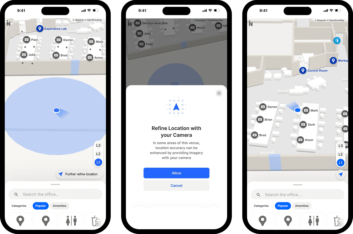
Positioning, surfaces, and integration
Indoor positioning, often described as the blue dot, gives the visitor real-time location context. It acts like the indoor equivalent of GPS, which helps with turn-by-turn guidance, but it can also support staff workflows like asset or people location where that feature is enabled. On the presentation side, kiosks, web embeds, and mobile views all need to reflect the same source content, or the venue ends up with parallel maps that disagree.
That's where SDKs and APIs matter. They let the map appear inside a custom app, a partner tool, or a branded venue experience without rebuilding the routing engine from scratch. LiDAR capture can help with space capture, and standards like IMDF or Microsoft Places sync keep the venue model aligned with other systems that already hold location data.
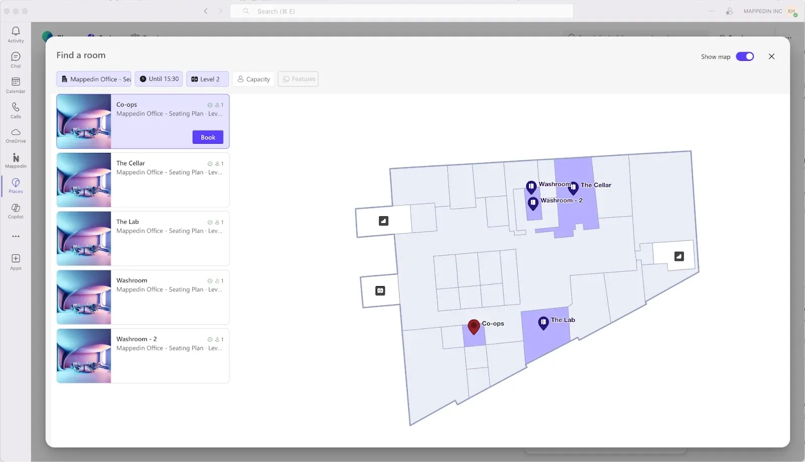
How update speed changes the economics of wayfinding
The economics show up after launch, when the venue changes. A printed system makes every edit expensive in time and labor because the content has to move through design, print, and installation. A digital wayfinding system changes the same information once and pushes it everywhere it needs to go.
That difference matters most in venues with churn. Airports reassign spaces, malls rebrand tenants and stadiums reshape layouts for events. If the map is tied to a single channel, each of those changes creates a mismatch somewhere else. If the map is managed as shared content, the update can cascade across kiosks, web, mobile, and printed exports instead of drifting out of sync.
Governance is the hidden cost center
The content model becomes an enterprise asset. Destination names, categories, accessibility attributes, and route logic should all live in one governed layer so teams are not hand-editing separate versions for each touchpoint.
That also matters for accessibility. If an elevator goes out of service, the reroute should update everywhere at once so visitors using accessible paths do not get a different answer at each screen.
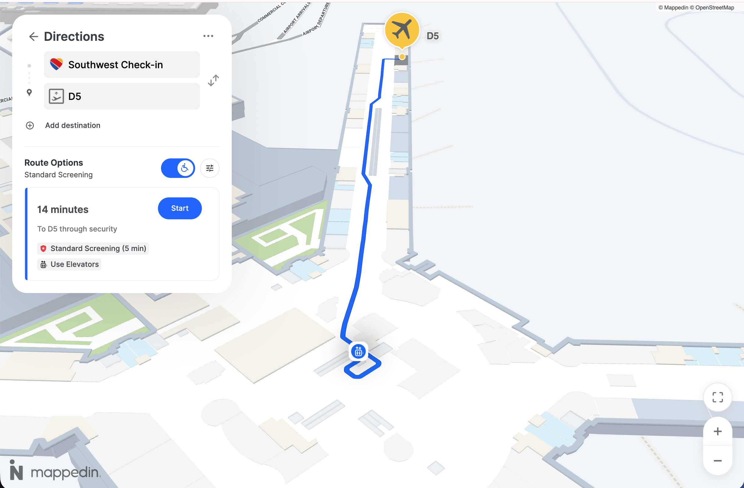
The update pipeline also changes who needs to be involved. Facilities, tenant management, event ops, and accessibility teams all have a stake in accuracy, which means the workflow needs role-based access and review discipline. Content should flow across touchpoints and that analytics should track search, route starts, completions, and zero-result queries for ongoing optimization wayfinding signage.
That governance lens is the major trade-off with digital systems. They reduce lag, but they also make mistakes more visible if the underlying process is weak. The venue that wins here is usually the one that treats updates like a controlled workflow, not a design task handed off after hours.
3 ways airports, malls, and stadiums use wayfinding
Airports care about time-critical movement. A traveler has to get from curb to check-in, through security, to the gate, and sometimes across multiple levels or transport links. In that setting, the map serves both the traveler and the operator, because a clearer route reduces missed connections, confusion at bottlenecks, and staff interruptions near transfer points. Analytics matter here because they can reveal where people hesitate or backtrack.
Malls use the map differently. The visitor is often trying to find a tenant, compare options, or locate a service, which means search quality and tenant discoverability carry more weight. The map is also a revenue surface, because stores, promotions, and featured destinations can all benefit from being surfaced in context. A mall director usually cares about tenant exposure, directory usage, and whether visitors reach the right spaces without escalating to staff.
Stadiums and arenas have the sharpest event-day churn. Layouts change based on the show, security perimeters move, and accessibility paths may have to flex with entry routes or capacity controls. That makes the map part of crowd movement, not just guest convenience.
The difference shows up in the metrics each operator would put in a review:
- Airports: wayfinding support near transfers, bottleneck visibility, and route completion to gates.
- Malls: search demand, tenant discovery, and exposure for promotions or leasing stories.
- Stadiums: entry flow, section finding, and how quickly guests reach concessions, restrooms, or exits.
For event-heavy venues, it also helps to think about seating and access as a routing problem, not just a charting problem. A useful companion resource is practical seating chart tips, especially when layouts change from show to show.

How smart malls turn foot traffic into sales
Malls aren't dead. But the strategies behind driving mall revenue? They're critically out of date. This guide makes the case for the one tool most operators have systematically underestimated, and shows exactly how to use it to drive revenue at every stage of the visit.
Implementation best practices that prevent costly mistakes
The first mistake many teams make is trusting a drawing instead of the physical site. A verified spatial model needs every point of interest, entrance, level connection, door clearance, and accessibility constraint cataloged before launch, then checked against the actual building. If the model is wrong, the route engine can be accurate in theory and still fail in practice.
A phased rollout reduces that risk. Starting with one wing, one floor, or one event gives the team a smaller environment to watch for routing errors, support tickets, and content issues. That approach is slower at the beginning, but it usually protects the launch from becoming a sitewide troubleshooting exercise.
A rollout checklist
- Validate the space first. Walk the venue and confirm what the map says against what people can reach.
- Review accessibility early. Accessible routes should be checked before launch, not patched afterward.
- Instrument the content. Search, route starts, completions, and zero-result queries need tracking so teams can see what visitors cannot find.
- Set access controls. Role-based permissions keep edits aligned with responsibility.
- Plan for scale. Multi-building portfolios need a content pipeline that does not collapse when a second site comes online.
That sign-placement rule still matters even in digital environments, because wayfinding is usually hybrid. People move between kiosks, web pages, mobile screens, and printed cues. If the decision point arrives before the instruction does, the venue has already lost the moment.
Metrics, vendors and what to measure after launch
A wayfinding system should answer to the same question every quarter.
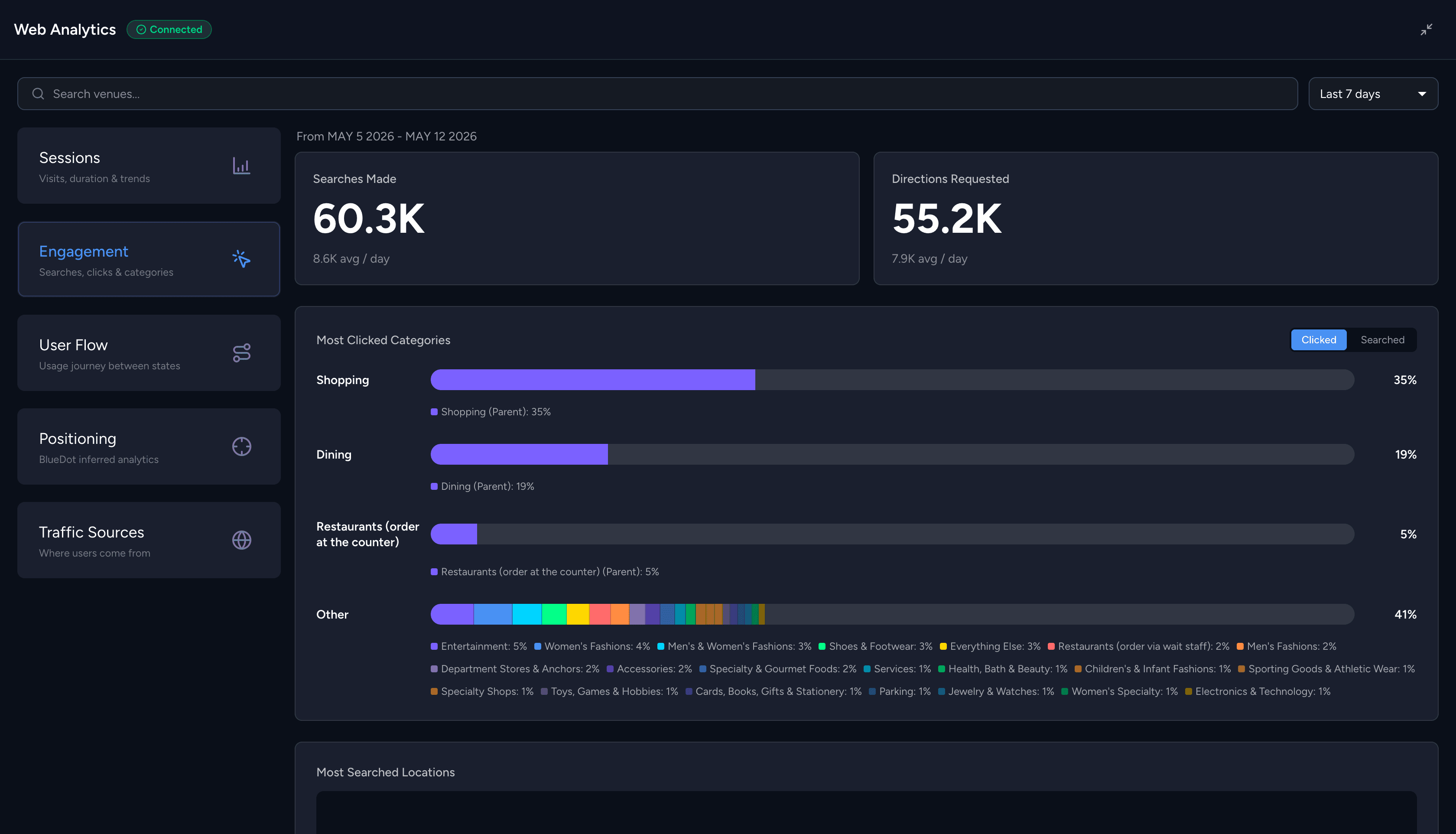
The cleanest way to judge that is to look at search demand, route starts and completions, and zero-result queries. Those three signals show what visitors are trying to do, where they give up, and which destinations the content model is missing.
- Search demand tells the operator what people expect to find.
- Route starts and completions show whether the chosen path is usable.
- Zero-result queries are often the most useful because they expose gaps in naming, taxonomy, tenant setup, or destination coverage.
If visitors keep searching for something that does not exist in the system, staff will end up answering the same question in person.
What else to watch
Desk ticket volume matters because it shows whether the map is reducing human interruptions. Post-visit surveys are useful for the same reason, especially when they ask whether the venue was easy to get around instead of just whether the visit was enjoyable. Those are softer signals, but they fill in the operational picture when paired with the usage data.
Wayfinding vendor evaluation
Vendor evaluation should stay grounded in the same components covered earlier. The map quality has to be strong enough to support routing. The content governance model has to handle updates without drift. Accessibility depth matters, not as a checkbox, but as part of route accuracy. Positioning, integration surface, analytics, and security posture all deserve review too.
A useful test is whether the platform treats the map as a shared source of truth across teams or as a feature sitting on a website. The first model supports operations, accessibility, leasing, security, and visitor experience at the same time. The second model usually creates another silo that needs cleanup later.
For teams comparing options, Mappedin is one of the platforms in this category that combines mapping, navigation, positioning, and analytics in a single venue-focused stack. Other vendors may excel in adjacent parts of the workflow, so the better procurement question is which system can keep the venue accurate as it changes, not which one has the flashiest demo.


Share