Start Here
Emergency maps provide first responders with accurate, up-to-date building layouts and locations of exits, stairways, safety equipment, and hazardous materials to enable effective emergency preparedness, disaster response, and risk assessment during critical situations. Digital indoor mapping technology solves the challenge of outdated paper floor plans by offering real-time mobile maps, allowing response teams to pre-plan strategies, navigate unfamiliar buildings efficiently, and collaborate on emergency management.
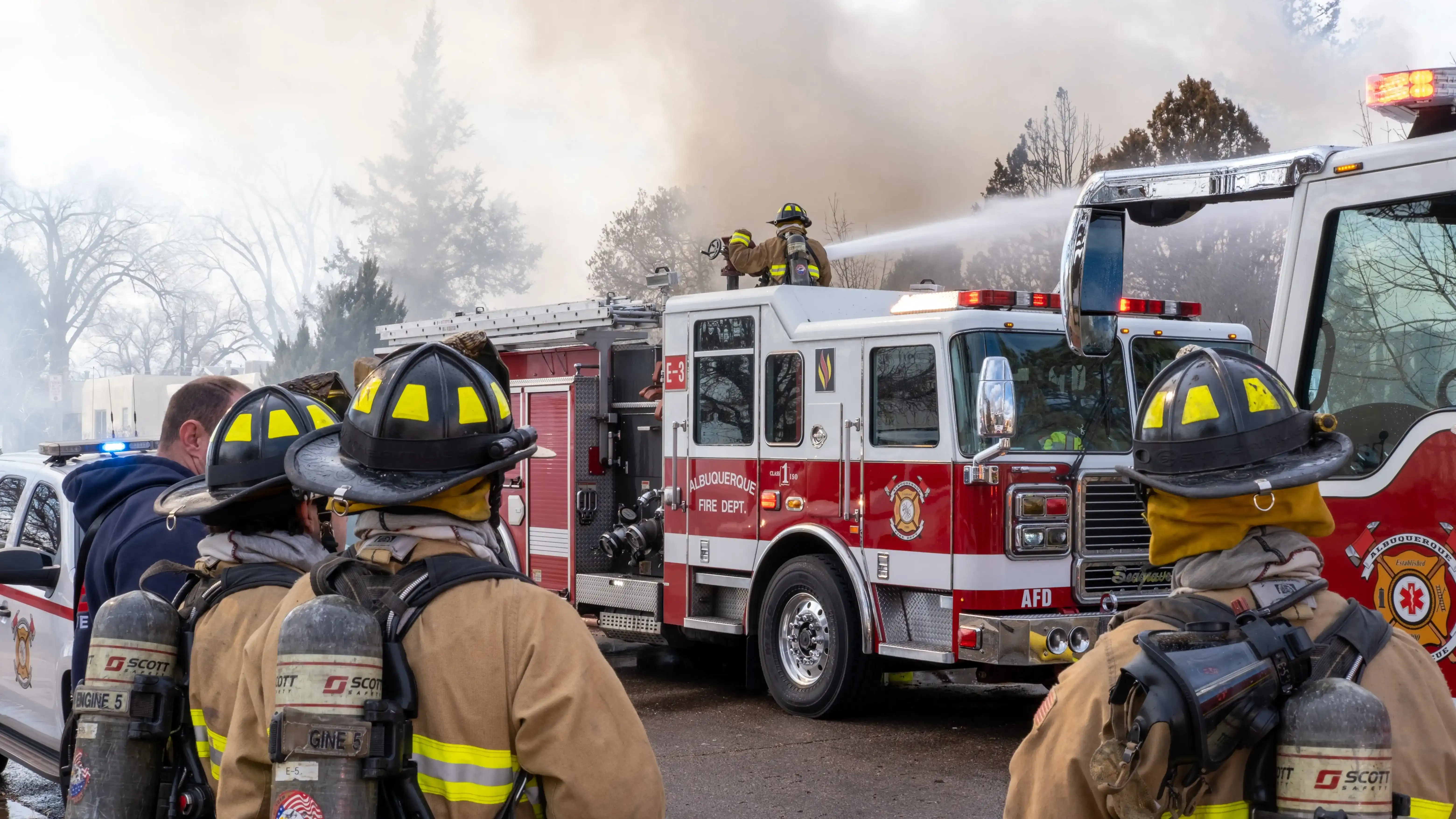
Have you ever wondered why precise indoor maps are crucial for emergency preparedness and response efforts? To begin with, they act as invaluable tools for first responders and firefighters, granting them the ability to pre-plan, understand floor plan layouts, know where safety equipment is located, and swiftly and efficiently navigate buildings, ultimately ensuring safety precisely when and where it's needed most.
Join us as we delve into the extensive importance of these maps and discover why they are indispensable for protecting our communities.
What is an emergency map?
Successful emergency preparedness and response starts with an accurate indoor map. When firefighters, police officers, paramedics, and rescue teams arrive at a location, they often face the challenge of navigating unknown territory. Now, imagine the impact if these first responders could familiarize themselves with the building's layout before reaching the scene – not only could it save invaluable time, but more importantly, it could save lives.
Emergency maps take center stage in bolstering response and relief efforts by providing crucial insights into a building's interior. These up-to-date maps offer a wealth of information, including the locations of exits and entrances, safety equipment, hydrants, hazardous materials, potential obstacles, accessibility features, and other vital details that can be indispensable for first responders as they arrive at an emergency scene.
How digital maps help with emergency management
First responders frequently encounter a common challenge: the unavailability of up-to-date building maps within their designated response areas. When they do have access to floor plans, they are often outdated or presented in formats that are difficult to read. This predicament significantly impacts their situational awareness during emergency situations, rendering them ill-equipped to navigate unfamiliar buildings.

Digital indoor maps emerge as a vital solution, equipping emergency responders for effective emergency management. These digital counterparts provide responders with precise and comprehensive insights into building layouts, the location of essential resources such as water supplies and utility shutoffs, and even details regarding hazardous materials stored within a property. By harnessing the power of these maps, first responders can navigate emergencies with increased confidence and efficiency, aiding in their ability to respond quickly and effectively in time-sensitive situations.
Risk assessment
En route to an emergency call, it's hard for first responders to know what to expect. Are there additional threats they're not aware of? Are they choosing a strategy that exposes them to increased danger? With so much uncertainty, emergency management planning must include an assessment of potential risks and hazards to maximize everyone's safety.
With accurate digital maps readily available, these professionals can effectively outline the best way to respond to an emergency. This invaluable tool provides all the vital location information needed to navigate buildings safely, locate essential safety equipment, and identify potential risk factors that could pose harm. For instance, if there's an accident in a high-rise building, responders can avoid elevators out of service and plan evacuation routes accordingly.
Disaster management
Emergencies happen all around the world, from natural disasters such as floods, earthquakes, and hurricanes, as well as man-made incidents, accidents, and criminal attacks. While we can't avoid them completely, we can do the next best thing: prepare and develop emergency plans for disaster response.

Map tools help with disaster management by enabling rescue teams to efficiently prepare for and respond to disasters. Digital maps enable rescuers to navigate a scene more effectively, identify risks and hazards, locate safety zones, establish secure entry and exit points in buildings, and carefully plan evacuation routes. This simplifies crisis preparedness, expedites disaster response efforts, and increases the likelihood of successful outcomes. All of this is possible because digital maps equip response teams with comprehensive building information before they even arrive at the scene.
Response teams
One of the most significant advantages of using digital maps is accessibility—firefighters, police officers, and paramedics alike can access building information anytime, anywhere. Flipping through binders of paper floor plans takes up a lot of unnecessary time that could be spent helping others in high-stake scenarios. Fortunately, indoor mapping technology enables first responders to pull up the information they need from mobile devices in no time.

Digital indoor maps are a great solution that quickly brings your department up to speed on building layouts, enables collaboration on the same document from separate mobile devices, and distribute the updated plan to different departments on-the-go. This makes it easy for response teams to promptly find what they need and understand what they're walking into at a moment’s notice.
Accurate records increase safety
It’s clear that emergency response teams frequently encounter problems related to the accessibility of accurate, up-to-date maps. Firefighters might show up to a burning building bearing a paper map of its interior that is not up to date and doesn't account for all the interior changes that took place in the interim. Alternatively, they might spend valuable time searching for and deciphering difficult-to-read floor plans. Unfortunately, the absence of spatial accuracy poses a major risk to everyone involved.
Maintaining accurate mapping data is essential to effective emergency preparedness and response. Schools, offices, shopping malls, and all other venues are constantly changing. When building interiors change, floor plans should also change. To ensure that departments have correct information at all times, they need reliable user-friendly mapping applications that make updating and maintaining documents faster and more simple.
Reference maps
When maps are outdated or lack georeferencing to real-world coordinates, first responders face significant challenges in locating their targets. For example, police officers responding to an emergency in a mall's food court might be misled if the map inaccurately places the food court. Such discrepancies can lead to unnecessary delays and even injuries that could have been prevented with accurate reference maps. In emergency situations, having up-to-date location data is essential to ensure that emergency services consistently possess the most current information.

Geospatial data
In addition to reference maps, geospatial data must also be reliable and up-to-date for emergency and disaster response. While responders must know where things are, they also need to be aware of details that aren’t typically captured in a paper-based pre-plan. For instance, it's useful to see all the entry and exit points of a building, but it's also important to note if an entrance or stairwell is blocked off. Without this accurate data collection, response efforts could be hindered.
If existing geospatial data isn't updated when things are shuffled around and moved to different locations, this also poses a significant risk. If there are hazardous materials stored on a property, and the incident commander doesn't know that they've been moved to a particular location, they may unintentionally make decisions that expose first responders to heightened danger. With updated geographic information systems (GIS) data, departments and emergency managers are better equipped for risk assessment and management.
Evacuation map requirements
Evacuation map requirements also play a vital role in ensuring the safety of individuals during emergencies. These maps must provide clear and concise information about escape routes, assembly points, and emergency equipment. Compliance with local regulations and standards is essential to meet evacuation map requirements.
Moreover, these maps should be easily accessible, up-to-date, and easily understood by everyone, regardless of their familiarity with the building. By fulfilling these requirements, organizations and building owners can enhance the safety and preparedness of their premises, enabling effective evacuation procedures during critical situations.
Mappedin
We recognize the need for intuitive and readily accessible indoor mapping tools, especially for first responders, schools, and communities. Through working with safety organizations and partners, we learned that having up-to-date indoor maps was often difficult to access, completely missing, or creating them was overly complicated.
That’s why we’ve developed Mappedin—to address this gap and enable anyone to create accurate and useful indoor maps. Mappedin offers a transformative way to digitize and maintain building maps with ease, ensuring accurate and accessible information when you need it the most.
Digitize paper blueprints
Using Mappedin, emergency responders can upload blueprints or raster floor plans in PNG and JPG formats and allow the application to automatically digitize them. By automating the conversion of paper-based floor plans to a digitized format, every first responder organization will have simplified, standardized maps.
Going digital with pre-plans will improve emergency management and operations while also increasing safety. Emergency managers and departments can quickly assess existing data sets from any web or mobile device, keep pre-plans updated and accurate, and cross-reference other crucial documents at any given time.
Annotate building pre-plans
Once building maps are digitized in Mappedin, permitted users can add annotation symbols to the map. First responders can use a library of standard symbols from the NFPA which covers access features such as escalators and stairs, fire ratings, general systems, hazards, utility shutoffs, water systems, ventilation, and more. Mappedin serves as a single source of truth, offering a central management location for all your data, making it a breeze to collaborate and consolidate an effective pre-plan before arriving at the scene of an emergency.
Access up-to-date maps for emergency response
Emergency response teams can rely on accurate digital maps to better understand building layouts and how the space is being used well in advance of arriving at an emergency. There's no ambiguity about which pre-plan version to follow, as location information is updated on the map in real-time. This ensures that visualizing building layouts, pinpointing the most efficient response strategies, analyzing risks and hazards, and ultimately preparing for emergencies becomes more straightforward and efficient.
How to implement emergency response maps
Locating crucial information like building access points or stairwells can take valuable time for first responders, and even when found on the map, there's no assurance of the map's currency.
In emergencies where time is of the essence, having the most up-to-date mapping data at your fingertips is critical.
When lives are on the line, accurate information is paramount. With Mappedin, departments are equipped with an easy-to-use tool for sharing up-to-date digital maps with response teams, ensuring they always have the right information at hand. Start Mapping today and learn more about our solutions for fire departments.
Share