YYC Calgary International Airport
Navigate YYC from curb to gate, with real-time flights, security wait times, and multilingual routing.

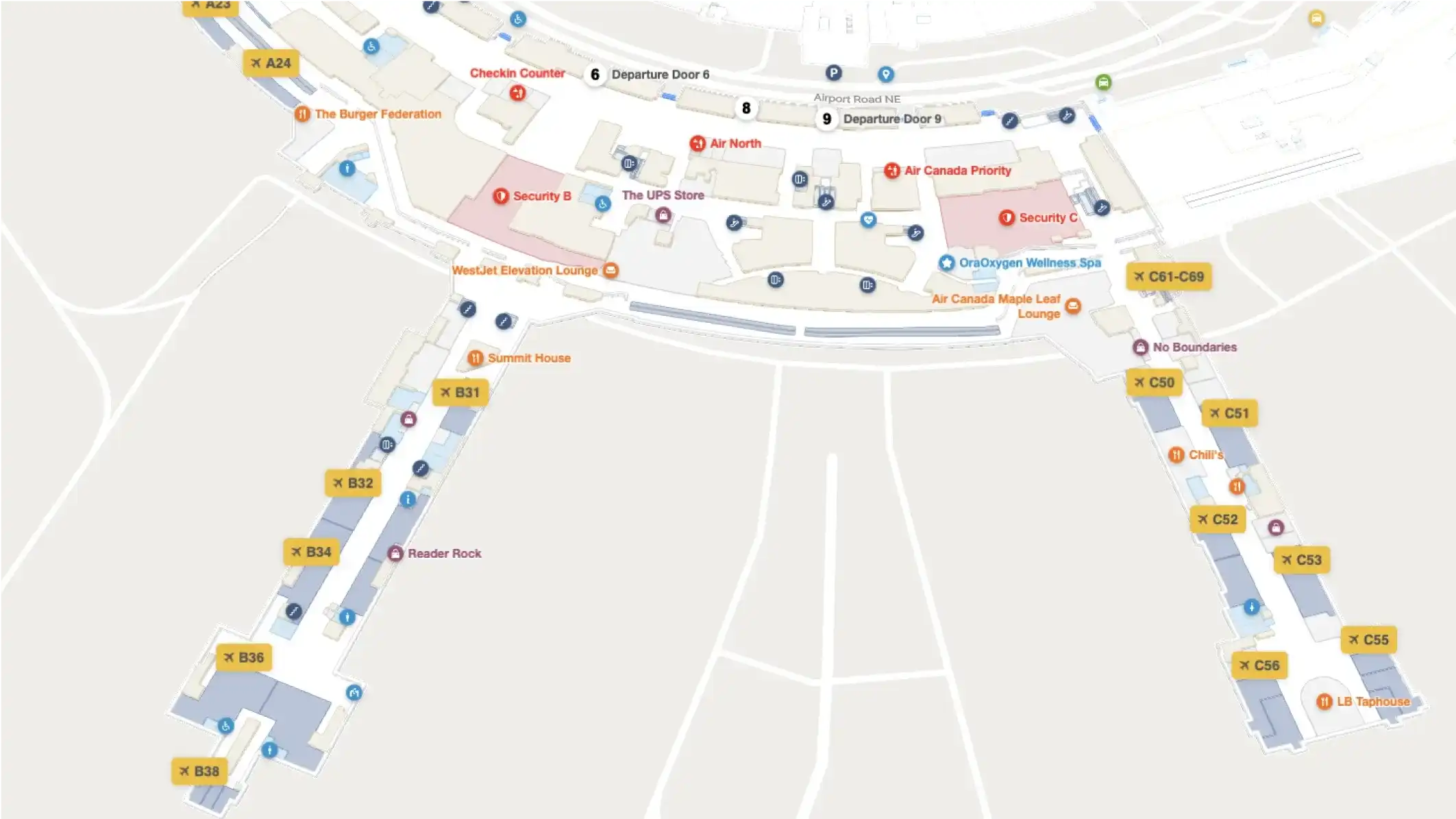
Navigate YYC Calgary International Airport from parking lot to gate including every terminal, concourse, security checkpoint, retail store, and dining option. Use the interactive map to look up your gate with live flight status, find the nearest amenity to your departure area, or plan your route with precise walking times. Available in English and Canadian French, on any device.
About YYC Calgary International Airport
YYC Calgary International Airport is operated by The Calgary Airport Authority and serves as the primary aviation gateway to Calgary, Alberta and to the Canadian Rockies beyond. The airport welcomes more than 18 million travellers annually, making it one of Canada's busiest airports and a critical hub for both domestic connections and international arrivals from North America, Europe, and Asia Pacific.
The airport's scale and layout create genuine navigation complexity. Passengers move between a domestic terminal and an international terminal, managing connections, security queues, baggage claim, ground transportation, and a full retail and dining concourse, often under time pressure and, for many international visitors, in an unfamiliar language.
The Calgary Airport Authority partnered with Mappedin to replace a static floor plan with a fully interactive, 3D indoor map. The solution delivers:
- Precise walking times between any two points in the airport
- Real-time flight updates with gate changes and boarding status
- AI-powered conversational navigation and geo-aware travel updates
- Security wait times
- Category-based search for retail and dining, including mobile ordering links directly from the map
The map also highlights parking lot locations and helps returning travellers remember exactly where they parked.
For staff and volunteers, the map adds a powerful operational layer: YYC's White Hat Volunteers, the airport's iconic guest service team, can generate complex multi-stop routes and share them with passengers instantly via QR code, no technical knowledge required.
"This launch deepens our long-standing innovation partnership with Mappedin and extends their mapping technology to include a real-time, generative AI solution. Our relentless drive to exceed passenger expectations and achieve operational excellence is fueled by technologies like Mappedin’s that enable airport-wide integration and scale. Together, we’re delivering solutions that are valuable to passengers and more efficient for staff across every screen and digital touchpoint."
— Bart Smith, GM Corporate Services & IT Business Partners, Calgary Airports
Why interactive wayfinding matters here
Gate changes, security queue fluctuations, and temporary concourse closures happen daily at a hub serving millions of passengers. When that information isn't surfaced at the moment a passenger needs it, they miss their gate, skip a retail opportunity, or tie up a volunteer for five minutes answering a question the map should have answered. The Calgary Airport Authority built its wayfinding on Mappedin so every update, from flight status, and gate changes to new tenants, reflects immediately across web, mobile, and kiosk without an IT ticket.
Details
- The Calgary Airport Authority
- Calgary, Alberta, Canada
- YYC Calgary International Airport website

