

Campus and healthcare facilities are under growing pressure to do more with their indoor mapping investment. According to Mappedin's State of Venue Experience report, 53% of visitors experience at least one navigation problem per visit—they can't find a restroom, an exit, or a department—and nearly 1 in 4 say they've wasted time searching for things or places within a venue in the last six months.
For a hospital where a patient is late for imaging, or a university where a prospective student can't find the admissions office, that wayfinding friction has real consequences.
Concept3D has been a familiar name in campus mapping for years, namely in higher education. But as campuses and healthcare systems demand more from their wayfinding platforms like real-time updates, accessibility compliance, infrastructure-free positioning, and tools that serve both visitors and operations teams, some university and hospital management teams are finding it falls short.
In this article, we'll compare the top Concept3D alternatives across the capabilities that matter most to student and patient experience teams responsible for wayfinding across large, complex campuses.
Curious to see what modern campus mapping could look like for your school or healthcare campus? Contact us today for a tailored demo. →
What to look for in a campus or healthcare mapping solution
Based on what matters most to facilities managers evaluating indoor mapping platforms, four capabilities consistently drive the buying decision:
Map accuracy and the speed of keeping it current
Campus and hospital environments change constantly, from construction projects and department relocations to seasonal closures and temporary wayfinding for events.
Most legacy platforms require manual map updates that take days or weeks, leaving visitors with outdated routes at exactly the wrong moment. A strong solution gives administrators the ability to update maps in real time, with AI-assisted tools that dramatically reduce the time it takes to reflect physical changes.
Accessibility and regulatory compliance
Hospitals are legally obligated to support visitors with mobility challenges, and universities face increasing scrutiny around ADA and WCAG compliance.
Stair-free routing, screen reader support, and multilingual navigation aren't optional features in these environments, but rather, they are requirements of an inclusive campus experience. Many platforms claim accessibility support but fall short on the details: WCAG 2.1 AA certification, step-free route algorithms, and genuine multilingual coverage across 40+ languages.
Positioning without hardware infrastructure
Beacon-based indoor positioning sounds appealing until you're deploying it across a million-square-foot hospital complex or a distributed university campus.
Hardware procurement, installation, battery maintenance, and ongoing calibration add cost and operational overhead that facilities teams rarely have budget for. Beacon-free positioning, using existing Wi-Fi and sensor data, delivers the same turn-by-turn experience without the infrastructure burden.
A platform that serves operations, not just visitors
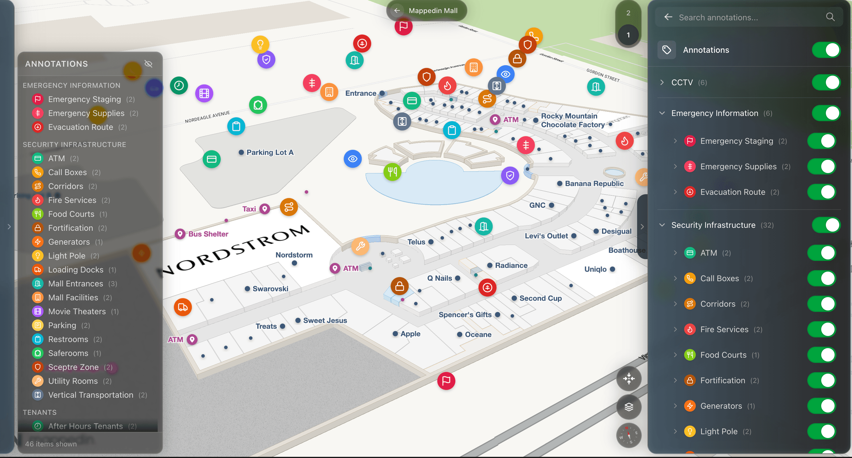
The most forward-thinking facilities teams are thinking beyond visitor navigation. They're also thinking about how their map data can support security, emergency management, and space utilization.
A dual-purpose platform that shares the same map layer across marketing and operations creates efficiency that single-purpose wayfinding tools simply can't match.
Mappedin
Mappedin is an indoor mapping and digital wayfinding platform purpose-built for large, complex indoor-outdoor venues, including hospitals, universities, airports, malls, and stadiums.
It's the platform behind enterprise deployments at LAX, Simon Property Group, Grand River Hospital, Bowie State University, and Mohawk College, and it's designed to serve both the visitor-facing and operational sides of a facility from a single map layer.
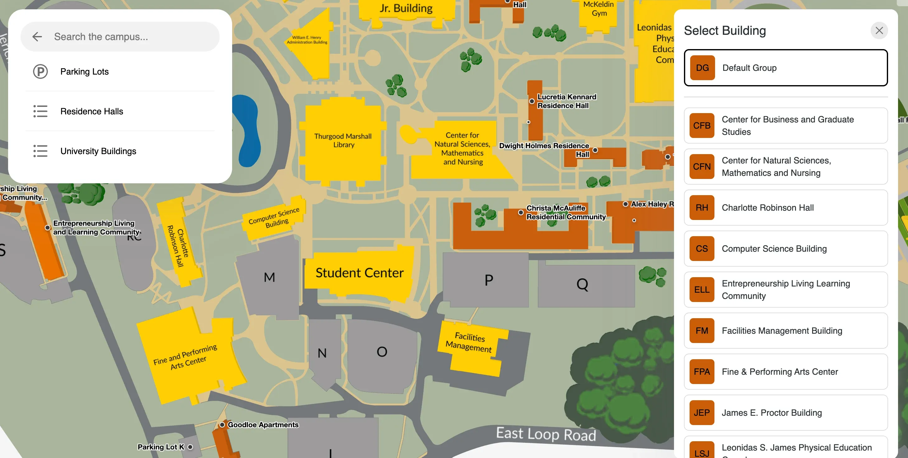
Easy, AI-powered map creation and updates
Mappedin uses AI-assisted map creation tools that significantly reduce the time it takes to build, launch, and update indoor maps. Rather than relying on manual GIS workflows or vendor-managed update processes, facilities teams can make changes directly in Mappedin's CMS—updating room names, rerouting around construction, or adding new amenities — and have those changes reflected in the live map in minutes.
For campuses and hospitals where floor plans shift regularly, this is a meaningful operational advantage. A facilities manager overseeing a hospital wing renovation doesn't have to file a support ticket and wait. They can simply update the map, publish, and visitors get accurate routes.
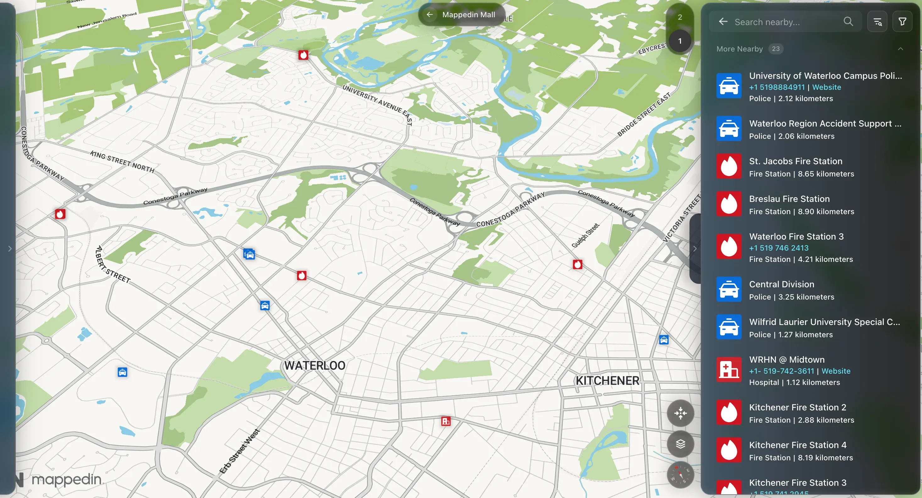
Beacon-free indoor positioning
Mappedin delivers turn-by-turn indoor navigation without requiring any beacon hardware. Using existing infrastructure like Wi-Fi access points, building sensors, and device data, the platform provides accurate indoor positioning across complex multi-building campuses and large hospital footprints.
For healthcare and campus environments, this matters for two reasons.
- The upfront cost of deploying beacons across hundreds of thousands of square feet is prohibitive.
- The ongoing maintenance burden (replacing batteries, recalibrating positioning, managing device inventories, etc.) falls to facilities teams that are already stretched. Beacon-free positioning eliminates both problems while delivering the same quality navigation experience.
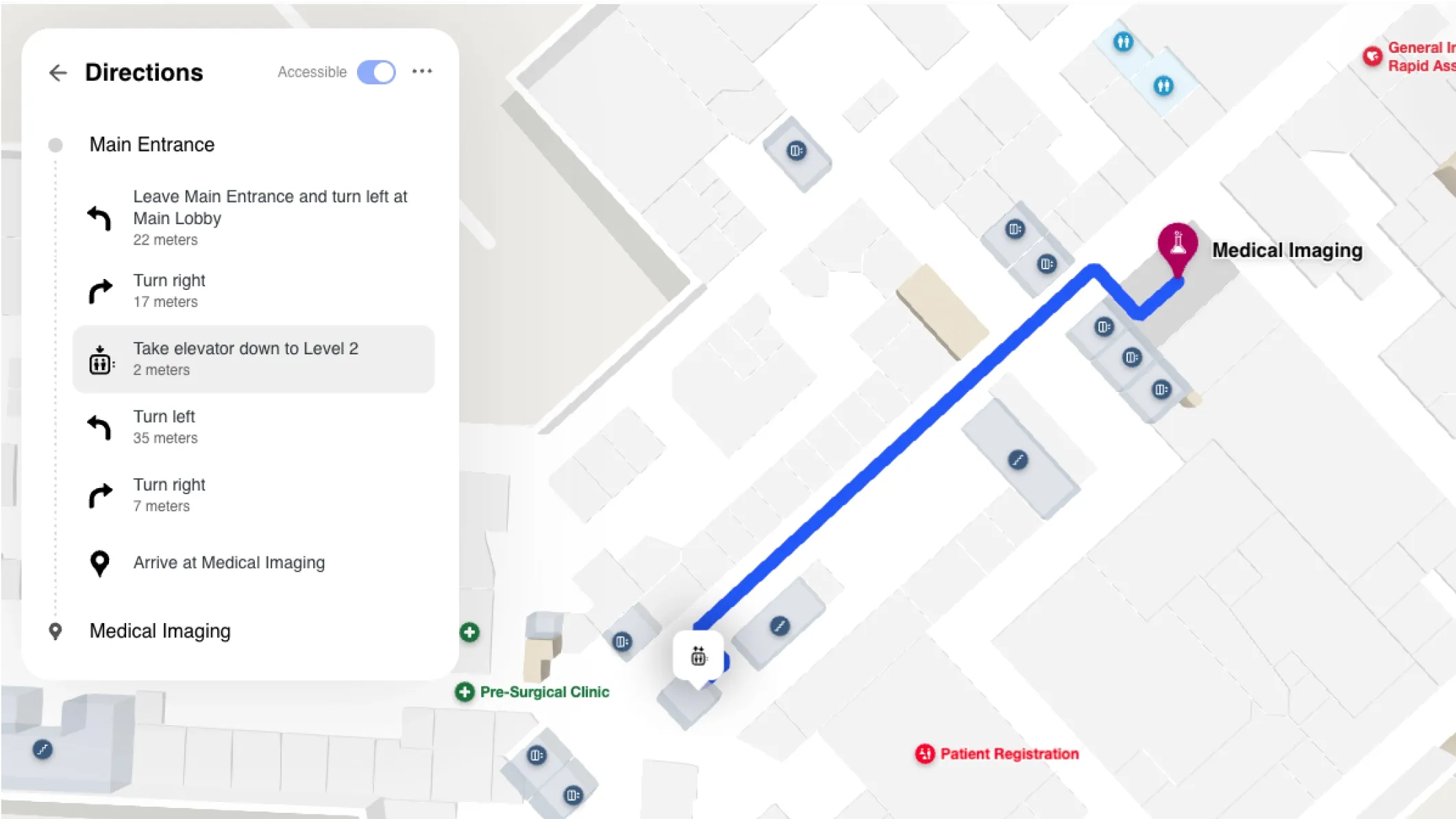
WCAG 2.1 AA accessibility compliance
Mappedin is WCAG 2.1 AA certified, with stair-free routing, screen reader support, and navigation in 40+ languages. For healthcare facilities serving diverse patient populations, and for universities with legal accessibility obligations, these capabilities are a compliance requirement that can expose institutions to risk if it's missing.
Stair-free routing is particularly critical in hospital settings, where patients with mobility challenges need routes that avoid stairs and escalators. Mappedin's routing engine surfaces these alternatives automatically, without requiring the visitor to know to ask. Multi-language support ensures that non-English-speaking patients and international students can navigate without friction.
Visitors who feel supported by accessible navigation are also more likely to recommend the venue:
— Mappedin, State of Venue Experience report
Dual-purpose platform for marketing and operations
Mappedin's platform is designed from the ground up to serve both functions from a single map layer. The same spatial data that powers visitor-facing navigation can be used by security teams for emergency management, by facilities managers for space utilization and asset tracking, and by operations leads for incident response.
One major airport attributed tens of thousands of dollars in incremental parking revenue to Mappedin's digital venue layer—a concrete example of how an operational map investment can generate measurable commercial return. That kind of outcome isn't available from a platform built only for visitor navigation.
How other campus mapping solutions compare to Concept3D
Concept3D
Concept3D is a mapping and virtual tour platform that has built a strong presence in the higher education market. Its core product combines interactive campus maps with 360-degree virtual tour capabilities — a combination that works well for university admissions and marketing use cases where prospective students want to explore a campus remotely.
Key features
- Interactive campus maps with search and point-of-interest filtering
- 360-degree virtual tour integration for prospective student engagement
- Basic wayfinding and directions
- Content management tools for campus administrators
Where Concept3D fits well
Concept3D is a solid choice for universities focused primarily on admissions marketing and prospective student engagement. Its virtual tour capabilities are genuinely differentiated in that context.
Where Concept3D falls short
Concept3D's wayfinding capabilities are relatively basic compared to platforms built for operational complexity. It lacks robust tenant engagement tools, directory monetization features, and the dual-purpose operational layer that campus operations and healthcare facilities increasingly require.
Its roadmap and support model are oriented toward academic marketing teams—which can be ideal for brand and marketing, but not facilities or operations departments.
MazeMap
MazeMap is a Norway-based indoor mapping and navigation platform with a strong presence in European universities and hospitals. It offers solid wayfinding capabilities for multi-building campus environments and has built a reputation for detailed indoor floor plan coverage.
Key features
- Multi-building campus and hospital navigation
- Room booking and space management integrations
- Wayfinding kiosk support
- Open API for custom integrations
Where MazeMap fits well
MazeMap is a credible option for European institutions with complex multi-building campuses and an existing relationship with their enterprise sales team. Its space management integrations add operational value beyond basic navigation.
Where MazeMap falls short
MazeMap's North American presence and support infrastructure are limited compared to Mappedin's. Its accessibility compliance and multilingual coverage are less robust, and it lacks the commercial monetization layer (tenant engagement, directory revenue) that healthcare and mixed-use campuses are increasingly interested in.
MapsPeople (MapsIndoors)
MapsPeople is an indoor mapping platform that operates primarily through a MapsIndoors SDK, enabling developers and enterprise customers to embed indoor navigation into their own applications. It serves a broad range of verticals including healthcare, airports, and corporate campuses.
Key features
- SDK for custom application development
- Integration with Google Maps and Apple Maps for outdoor-to-indoor handoff
- Wayfinding and room booking capabilities
- CMS for map content management
Where MapsPeople fits well
MapsPeople is a strong option for institutions that have development resources and want to build highly customized indoor navigation experiences within their own app ecosystem. Its SDK approach gives technical teams significant flexibility.
Where MapsPeople falls short
The SDK-first model means that non-technical facilities managers face a steeper implementation path. Out-of-the-box map products require more configuration than turnkey solutions like Mappedin, and the platform's North American healthcare and campus reference base is thinner.
Frequently asked questions about Concept3D alternatives & campus mapping
What is the best Concept3D alternative for campus mapping?
For campuses that need more than admissions marketing — including operational wayfinding, accessibility compliance, and real-time map management — Mappedin is the strongest alternative. Mazemap is a credible option for European institutions, and MapsPeople suits teams with development resources.
Does Concept3D work for hospitals and healthcare facilities?
Concept3D is primarily designed for higher education, and its feature set reflects that. Healthcare facilities typically require step-free routing, WCAG accessibility compliance, multilingual support, and operational tools that Concept3D does not currently offer. Platforms like Mappedin are purpose-built for healthcare wayfinding complexity.
What indoor mapping platforms support WCAG 2.1 AA compliance?
Mappedin is WCAG 2.1 AA certified with documented step-free routing, screen reader support, and navigation in 40 languages. Most other indoor mapping platforms have not confirmed WCAG 2.1 AA certification, making Mappedin the strongest choice for institutions with legal accessibility obligations.
Do indoor mapping platforms require beacon hardware?
Not all of them. Mappedin delivers turn-by-turn indoor navigation without any beacon infrastructure, using existing Wi-Fi and sensor data.
Many competing platforms including those using Bluetooth Low Energy (BLE) beacons require hardware procurement, installation, and ongoing maintenance. Beacon-free positioning significantly reduces total cost of ownership for large campus and healthcare deployments.
How long does it take to deploy an indoor mapping platform on a large campus?
With Mappedin's AI-assisted map creation tools, most venues can go live significantly faster than with traditional GIS-based workflows. Exact timelines depend on the size and complexity of the floor plan, but Mappedin's onboarding process is designed for facilities teams without dedicated GIS staff.
Can indoor mapping software serve both visitors and operations teams?
Yes, and the best platforms are designed specifically to do this. Mappedin's dual-purpose architecture means the same map data that powers visitor navigation can be used by security, facilities, and operations teams for space management, emergency response, and asset tracking.
Single-purpose wayfinding tools require separate systems for operational use cases.
What should a facilities manager look for when evaluating Concept3D alternatives?
Prioritize four capabilities: the speed and ease of keeping maps current, the depth of accessibility and compliance features, whether the platform requires hardware infrastructure, and whether it can serve operational teams beyond visitor navigation. These are the areas where the greatest differences between platforms emerge.
Get started with campus mapping
Concept3D built its reputation in higher education, and for universities focused on admissions marketing and virtual campus tours, it does that job well. But for facilities managers who need their indoor mapping platform to support operational complexity—accessibility compliance, real-time map maintenance, beacon-free positioning, and tools that serve more than just visitor navigation—it may fall short of what modern campus and healthcare environments require and expect.
Mappedin, on the other hand, delivers all four of those capabilities in one platform, without hardware requirements, with WCAG 2.1 AA certification, and with a dual-purpose architecture that grows with your team's needs.
Alternative solutions like MazeMap and MapsPeople serve specific segments well, but neither matches the combination of accessibility depth, implementation speed, and operational versatility that Mappedin offers for North American campus and healthcare buyers.
Curious to see Mappedin for yourself? Try it now →
Related resources:
Share