Indoor mapping turns a static floor plan into a digital, interactive representation of a building's interior that can power navigation, positioning, safety, and analytics. Outdoors, we've had turn-by-turn directions for two decades. Indoors, most venues still hand out paper directories or a wall map with a "you are here" sticker. Indoor mapping closes that gap.
This guide covers what indoor mapping actually is, the technologies that make it work, where it's used, and how to think about the different software options available, so you can evaluate what's right for your venue, whether that's a hospital, airport, stadium, or shopping center.
What is indoor mapping?
Indoor mapping is the process of converting a building's floor plan into a digital, interactive map that supports navigation, wayfinding, indoor positioning, and spatial data collection. Instead of a flat, static image, an indoor map is a searchable, routable model of a space designed to plot a path from the entrance to a specific gate, a specific hospital department, store, or amenity and update in real time when something changes.
Indoor mapping is the foundation for a few related capabilities:
- Wayfinding: helping people find and navigate to a destination
- Indoor positioning: determining where a person or asset is inside a building (GPS doesn't work reliably indoors, so this requires separate technology)
- Digital directories: searchable listings of tenants, departments, or points of interest
- Spatial analytics: understanding how people and assets move through a space


Digital indoor maps vs. static maps
A static map like a printed directory, a PDF floor plan, or a wall-mounted "you are here" sign shows a layout but can't respond to the person looking at it. It can't reroute around a closed corridor, highlight the nearest accessible restroom, or update when a tenant moves. It's also expensive to keep current: every renovation, lease change, or new exhibit means reprinting.
A digital indoor map is built from structured spatial data rather than a flat image, which is what makes it interactive. Practically, that means:
- Updates: A static map means a manual reprint or redesign every time something changes; a digital map is edited in a CMS and published instantly
- Personalization: A static map shows the same layout to everyone; a digital map can route by accessibility needs, points of interest, or role (visitor vs. staff)
- Data: A static map generates nothing; a digital map captures foot traffic, search terms, and popular routes
- Real-time changes: A static map can't reflect a closure or construction as it happens; a digital map updates live
- Multi-venue consistency: A static map has to be redone per location; a digital map runs on one platform and one map model, deployed everywhere
This distinction matters because a lot of buildings think they have an indoor map when what they have is a static image uploaded to a website, which explains why visitors still struggle to find their way even when a map exists.


How does indoor mapping work? Positioning technologies compared
Creating an indoor map starts with digitizing a floor plan — through dedicated indoor mapping platforms or self-serve mapping tools that convert CAD, DWG, PDF, or image files into an interactive model. AI-assisted mapping can now detect walls, doors, stairs, and room labels automatically, which cuts a process that used to take weeks down to minutes.
Once a venue has a digital map, the next question is usually indoor positioning: how do you know where someone actually is inside the building?
Since GPS signal degrades indoors, venues rely on other technologies, each with different tradeoffs:
- BLE beacons — low-power Bluetooth beacons placed throughout a venue, accurate to roughly 3–5 meters; a cost-effective, widely supported fit for retail, malls, and museums
- Wi-Fi RTT / fingerprinting — uses existing Wi-Fi access points to triangulate position, accurate to roughly 3–8 meters; a good fit for venues with dense Wi-Fi infrastructure already in place
- UWB (Ultra-Wideband) — radio pulses measured with time-of-flight precision, accurate to 10–30 cm; best suited to healthcare, security, and asset tracking, where precision matters
- Geomagnetic positioning — maps a building's unique magnetic field signature, accurate to roughly 1–3 meters; useful for large venues that want to avoid installing hardware
- Computer vision/AI — camera or LiDAR-based spatial recognition, with accuracy that varies by deployment; an emerging option for use cases needing visual context
- QR/marker-based — static codes placed at fixed points, giving point-in-time positioning only; a low-budget or temporary option
Most venues don't need the highest-precision option available; they need the one that matches their use case. A stadium guiding fans to a seat has very different accuracy requirements than a hospital tracking a mobile asset cart. This is one of the more common mistakes venues make: over-investing in positioning precision they don't need, or under-investing in it for a use case (like security response) where it matters a lot.
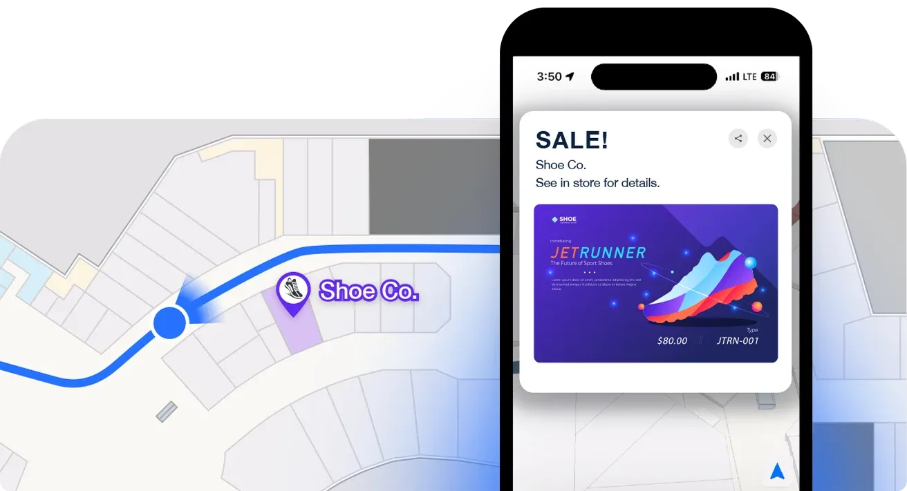
Beyond positioning, indoor mapping platforms typically provide:
- Turn-by-turn directions inside and between buildings
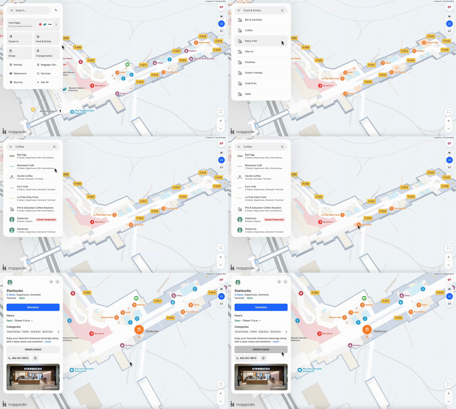
- SDKs and APIs for embedding maps into existing apps, kiosks, or systems
- A CMS so non-technical teams can update maps, tenants, and points of interest without redeploying code
- Data management for organizing and analyzing spatial data over time
Not sure which positioning technology fits your venue? Talk to the Mappedin team about matching accuracy, budget, and hardware needs to your use case.
Where is indoor mapping used?
Any venue with a complex or hard-to-navigate layout can benefit from indoor mapping. A few of the most common applications:
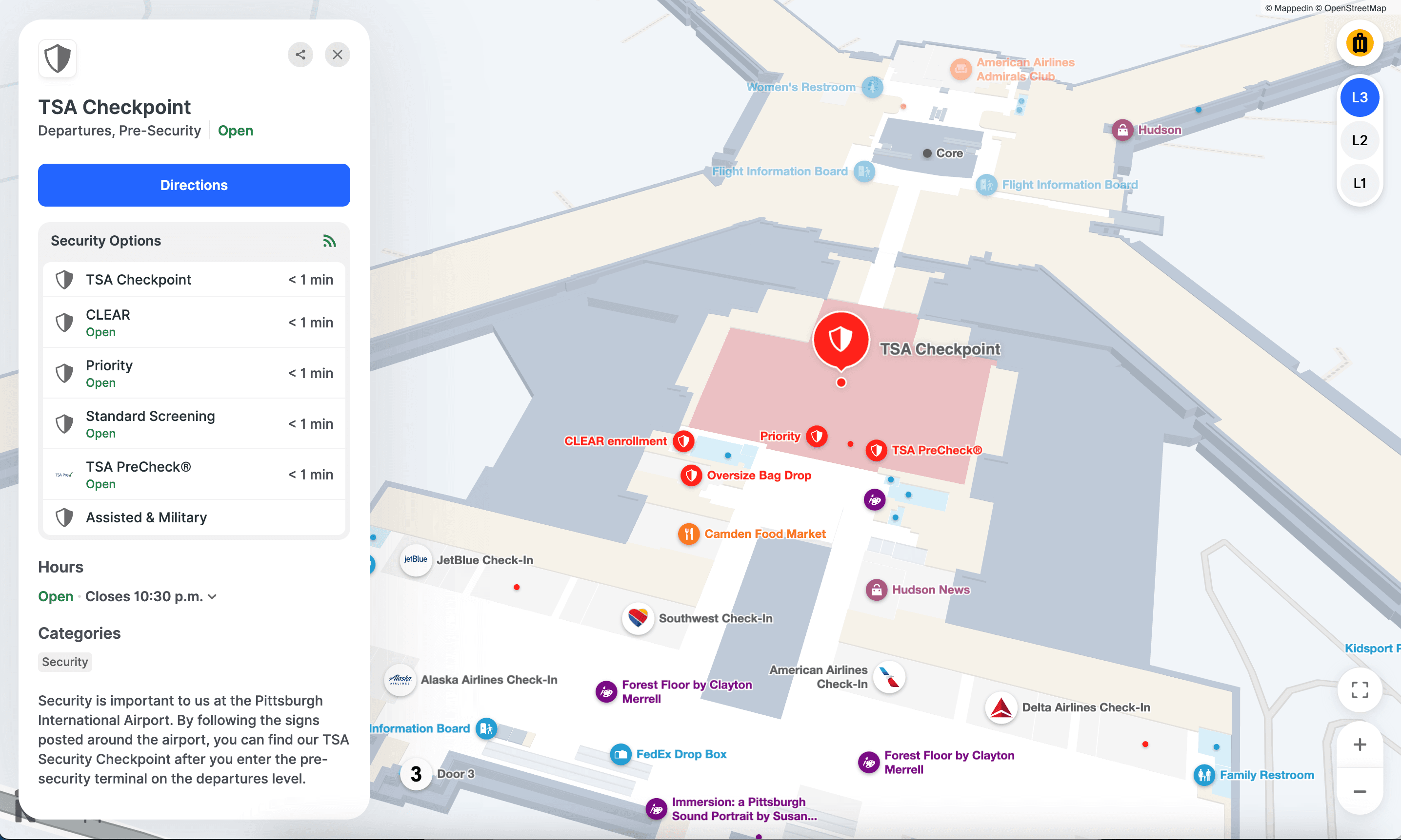
Airports
Passengers navigating unfamiliar terminals, tight connection windows, and multiple concourses benefit heavily from real-time wayfinding, and airport operations teams use the same underlying map for asset and staff coordination.
Healthcare facilities
Multi-building hospital campuses are consistently ranked among the hardest indoor spaces to navigate, and late or lost patients have real operational and clinical consequences.
Retail and shopping centers
Indoor maps drive discovery of tenants shoppers didn't know were there, extend dwell time and double as a monetizable directory and advertising surface.
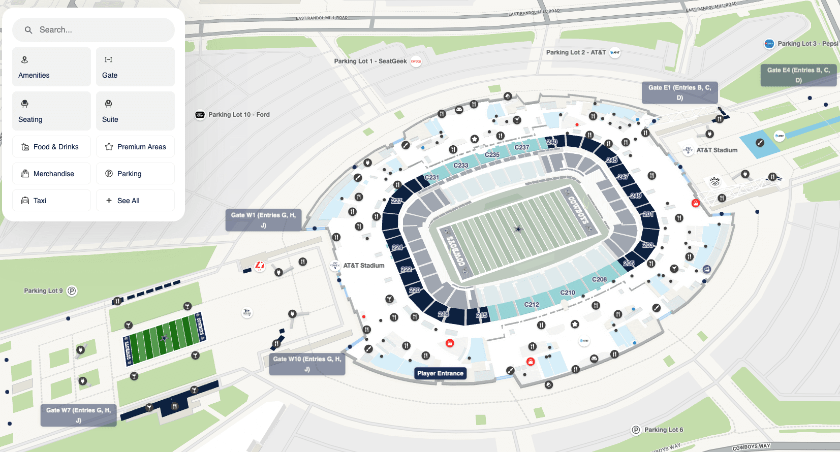
Stadiums and entertainment venues
Guest services and security operations teams both rely on the same map: one to route fans to seats, concessions, and accessible entrances; the other to coordinate incident response and patrol routes across a large, high-density venue.
Corporate campuses and commercial real estate
Wayfinding, desk booking, and space utilization all run on the same underlying spatial data, especially across multi-building or multi-tenant properties.
Casinos and resorts
Sprawling, intentionally maze-like floor plans that are great for gaming revenue are bad for guest experience. Indoor mapping bridges that gap without changing the physical layout.
Benefits for guests and venues
For guests, a good indoor map means effortless navigation, faster route planning, and the ability to discover points of interest they wouldn't have found otherwise. According to Mappedin's State of Venue Experience Report:
For venues, the benefits extend beyond guest satisfaction:
- Operational efficiency: facilities and operations teams get a live view of space utilization
- Revenue opportunities: better discovery drives foot traffic to retail, dining, and sponsor spaces; directories can become a monetizable media surface in their own right
- Emergency preparedness: accurate indoor maps support faster, more coordinated emergency response
- Data-driven decisions: foot traffic, search terms, and popular routes reveal how a space is actually used, not just how it was designed


How smart malls turn foot traffic into sales
Malls aren't dead. But the strategies behind driving mall revenue? They're critically out of date. This guide makes the case for the one tool most operators have systematically underestimated, and shows exactly how to use it to drive revenue at every stage of the visit.
Indoor mapping software: What to look for
Not every venue needs the same thing from an indoor mapping platform, but a few factors consistently separate solutions that get adopted from ones that stall after launch:
- Ease of updates: Can a non-technical team update the map without a developer?
- File compatibility: Does it accept your existing CAD, DWG, or PDF floor plans, or does it require redrawing from scratch?
- Multi-floor and multi-building support: Especially relevant for hospital campuses, airports, and large commercial properties
- SDK/API flexibility: Can it embed into an app or system you already have, rather than replacing it?
- Positioning technology support: Does the platform work with the positioning method that fits your accuracy and budget needs (see comparison above)?
Options range from building it in-house, to open-source tools like OpenStreetMap's indoor tagging schema, to general-purpose platforms like Google Maps or Mapbox adapted for indoor use, to purpose-built platforms like Mappedin.
Each approach trades off cost, control, and time-to-deploy differently. In-house builds typically take 6–18 months and $300K–$1M+ before launch, while purpose-built platforms can go live in days to weeks.
The right choice depends on your team's technical capacity, timeline, and how core indoor mapping is to your business versus a supporting capability.
Key takeaways
- Indoor mapping converts static floor plans into interactive, digital maps that support navigation, positioning, and analytics.
- Digital maps differ from static ones primarily in their ability to update in real time and generate usage data.
- Indoor positioning requires separate technology from GPS. BLE, Wi-Fi RTT, UWB, geomagnetic, and computer vision each suit different accuracy and budget needs.
- Nearly every complex venue type from airports, hospitals, and stadiums to retail, corporate campuses, and casinos can benefit from indoor mapping, though the priority use case differs by vertical.
- Venues get measurable benefits: Mappedin's research found indoor map users are far more likely to easily discover venues and points of interest than the general population.
FAQs about indoor mapping
What is the best way to do indoor mapping?
The right approach depends on venue size, budget, and technical resources. Dedicated indoor mapping platforms offer the fastest path from floor plan to interactive map; self-serve tools work well for smaller or single-site venues; in-house builds make sense only when indoor mapping is core to the product itself.
Where is indoor navigation used?
Indoor navigation is used across airports, hospitals, stadiums, shopping centers, corporate campuses, casinos, and educational institutions — essentially any space where visitors or staff need to find their way through a complex layout.
How accurate is phone GPS indoors?
GPS accuracy drops significantly indoors because satellite signals are blocked by building materials. Indoor positioning technologies like BLE, Wi-Fi RTT, and UWB are used instead, with accuracy ranging from room-level (several meters) to sub-meter, depending on the technology.
What's the difference between indoor mapping and indoor positioning?
Indoor mapping is the digital representation of a space (i.e., the map itself). Indoor positioning is the technology that determines where a person or object is located within that map. You need mapping to have a map at all; you need positioning to power a "blue dot" or real-time location on it.
How much does indoor mapping software cost?
Costs vary widely by approach: free or low-cost self-serve tools exist for basic needs, while enterprise platforms with full positioning, analytics, and multi-venue support typically range from tens of thousands to low hundreds of thousands of dollars annually, depending on venue size and features. In-house development is usually the most expensive path once engineering time is factored in.
Is Google's indoor mapping free?
Google Maps allows businesses to upload a static indoor floor plan for free, but it doesn't provide turn-by-turn indoor navigation, real-time positioning, or a CMS for managing content. It's a static display feature rather than a full indoor mapping solution.
Related resources:
Share