

In May 2007, Google Street View launched with a deceptively simple idea: What if you could see a street before you walked down it?
Almost two decades and more than 12 million mapped miles later, that idea has reshaped how humans relate to physical space. But much like the maps, it stopped at the front door.
Today, that changes with Mappedin RealView.
See where you're going before you get there
Picture this: you have a connecting flight in 45 minutes at an airport you've never been to. Or you're trying to find a specific store in a mall you last visited three years ago. Or it's game day and 60,000 people are all heading to the same building at the same time. In all three cases, you're relying on signage you haven't seen yet and a mental map you don't have.
Mappedin RealView gives people a photorealistic, ground-level preview of any indoor location, directly from the map, before you step inside. The value is clearest when unfamiliar environments create stress, bottlenecks, or missed opportunity.
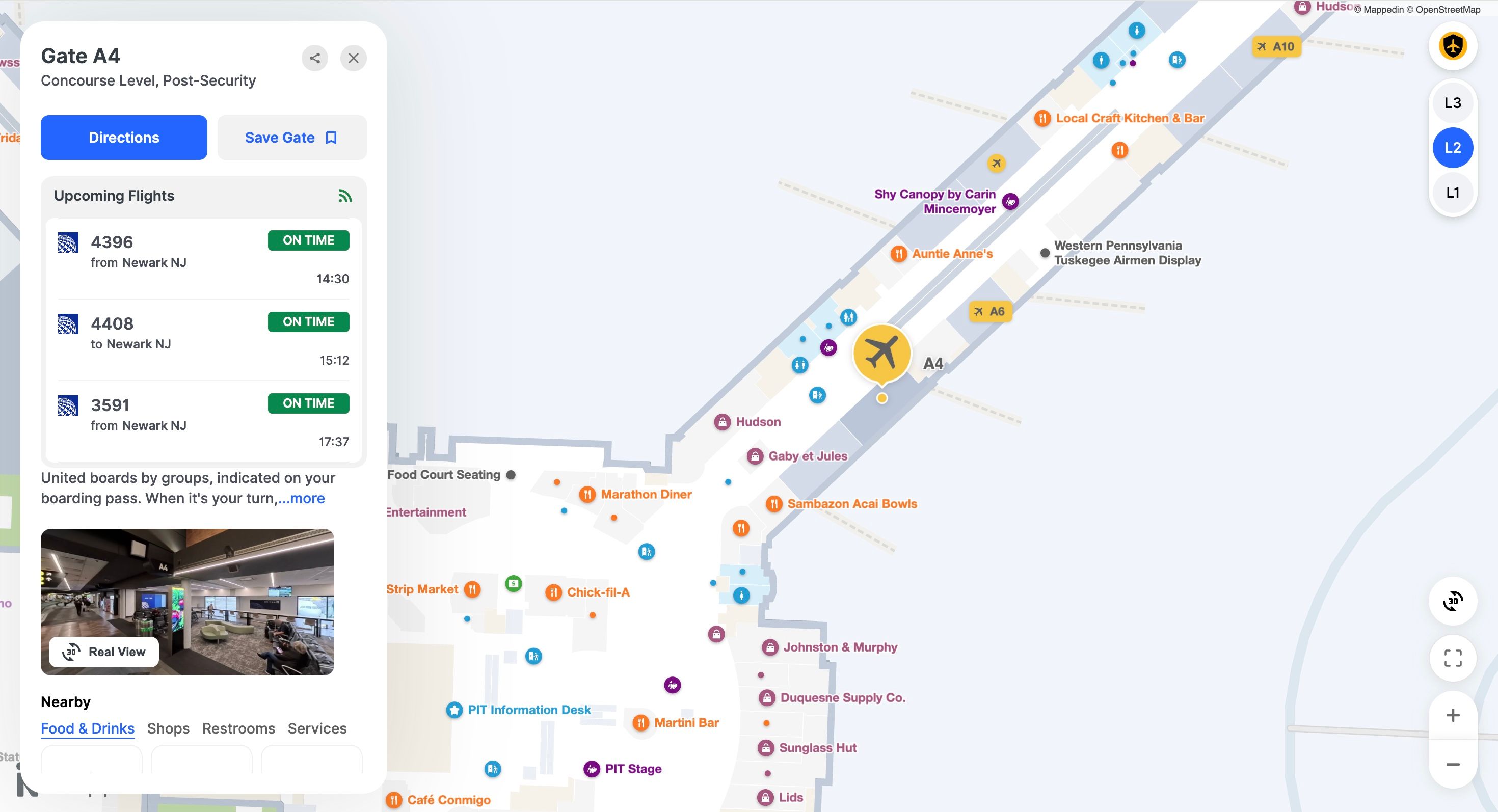
Airports & Train Stations
Traveller anxiety is real. RealView lets passengers preview their route, confirm their gate, and identify landmarks before they land, turning the unfamiliar into the expected.
Malls & Shopping Centers
Virtual browsing enables passive discovery. Guests exploring the map may spot a store they didn't know existed, turning a wayfinding session into a visit.
Sports Stadiums
Preview your section entry, concession stands, and restrooms before the game starts. Fewer bottlenecks. Faster entry. A better game-day experience from minute one.
These use cases are not exhaustive, but share a common thread: they replace visitor anxiety with visual confidence. When you've already "been there" virtually, the first real visit feels like a return and that’s a powerful experience to deliver.
What is Mappedin RealView?
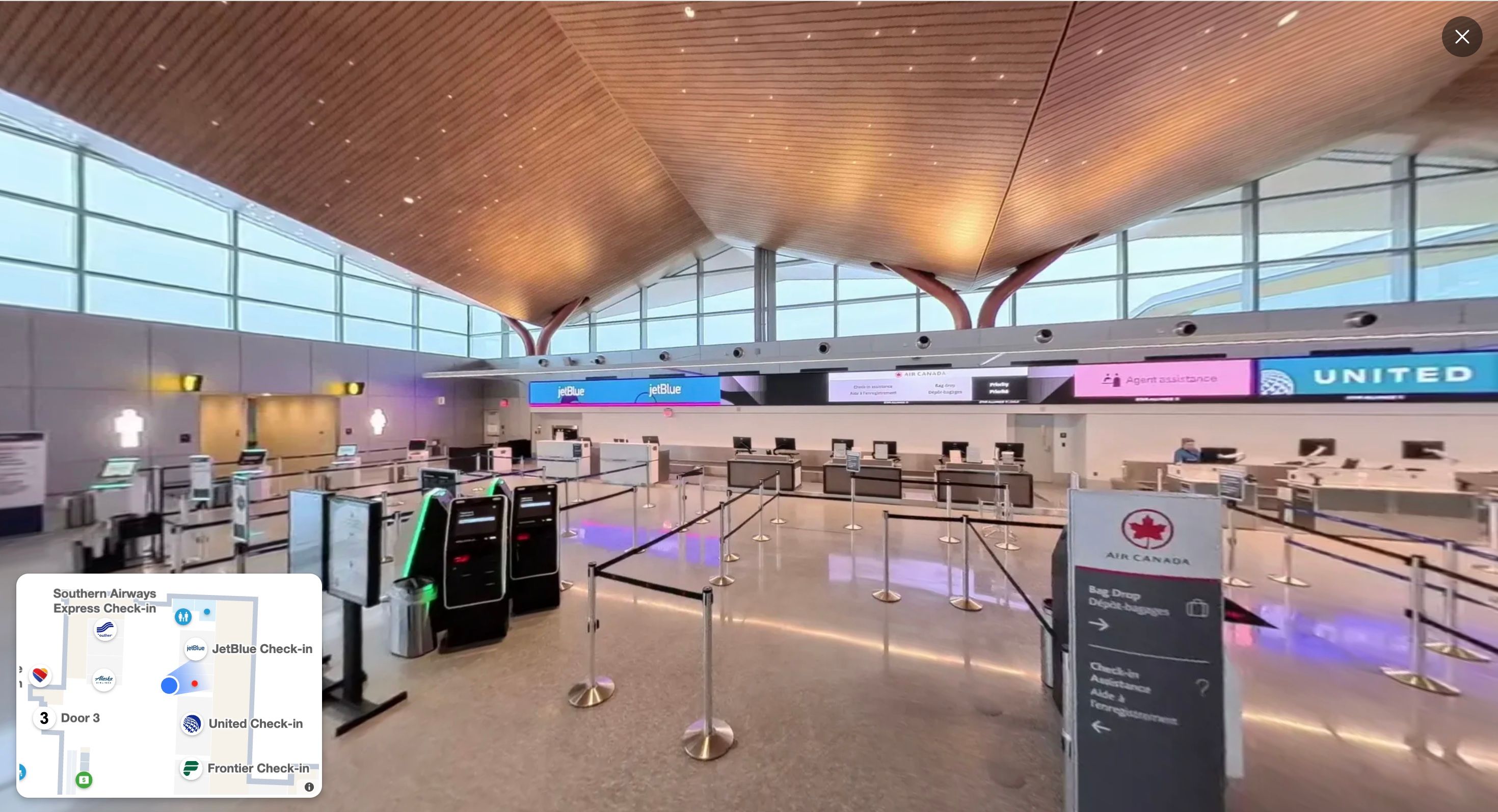
Mappedin RealView brings immersive, 360-degree panoramic imagery to indoor locations. Think Google Street View or Apple Look Around, but built exclusively for the indoors. It gives people a photorealistic, ground-level view of an environment, helping them orient themselves and navigate with confidence before they even arrive.
Once a building is scanned and the video is uploaded and processed, RealView appears as a thumbnail in the Location Profile, accessed by selecting any specific location on an indoor map. Each profile displays a preview of the 360-degree imagery alongside key location details: descriptions, operating hours, and related links. Tap in, and you're standing there.
Privacy is built into the process from the start. Mappedin automatically detects and blurs all faces captured during scanning, and only anonymized data ever reaches our servers. All spatial data is transmitted and stored using industry-standard encryption, so venues and their visitors can trust that what's captured stays protected.
What’s particularly interesting is that a scan of your environment can now be completed using a consumer-grade 360-degree camera, making the process straightforward and accessible for any building or venue, not just those with dedicated facilities teams, sophisticated camera equipment or surveying budgets, dramatically lowering the barrier to entry.
Visual positioning and the broader 3D opportunity
RealView is the guest-facing expression of a deeper capability. The same 3D scans that power panoramic imagery also enable visual positioning — the ability to determine a user's precise location and orientation within a space using computer vision — rather than relying solely on Wi-Fi or Bluetooth infrastructure.
This matters because indoor positioning has historically been one of the hardest problems in our industry. GPS doesn't always work indoors. Infrastructure-based solutions require ongoing maintenance. Visual positioning sidesteps these dependencies by letting the environment itself serve as the reference, matching what a camera sees against a known 3D model of the space.
The democratization of 3D scanning technology happening right now – consumer cameras capable of producing survey-grade imagery at a fraction of traditional costs – means we're entering a period where comprehensive indoor coverage finally becomes economically viable at scale.
RealView is both a product and a signal of that shift.
— Bart Smith, GM Corporate Services & IT Business Partners, Calgary Airports
The indoors — finally in (a 360-degree) view
When Street View launched, it didn't just make navigation easier. It changed how people relate to places they'd never visited, creating comfort, sparking curiosity, and lowering the activation energy for showing up somewhere new. That's the shift we believe RealView brings indoors.
We've spent years building the infrastructure layer of indoor mapping:
- The digitization of floor plans
- The map rendering engine
- The data models
- The routing algorithms
- The SDKs that power wayfinding at scale
RealView is what that infrastructure looks like to the person standing in the lobby, wondering where to go. It's the moment where maps become real.
We're just getting started. If you're a building or venue operator interested in bringing RealView to your space, we'd love to hear from you.


Share