Where virtual meets reality.
RealView unlocks a new way to experience and manage the indoors, from helping people find their way, to virtual property tours, to remote facilities management, all from a single 360-degree scan and indoor map.
Find a space
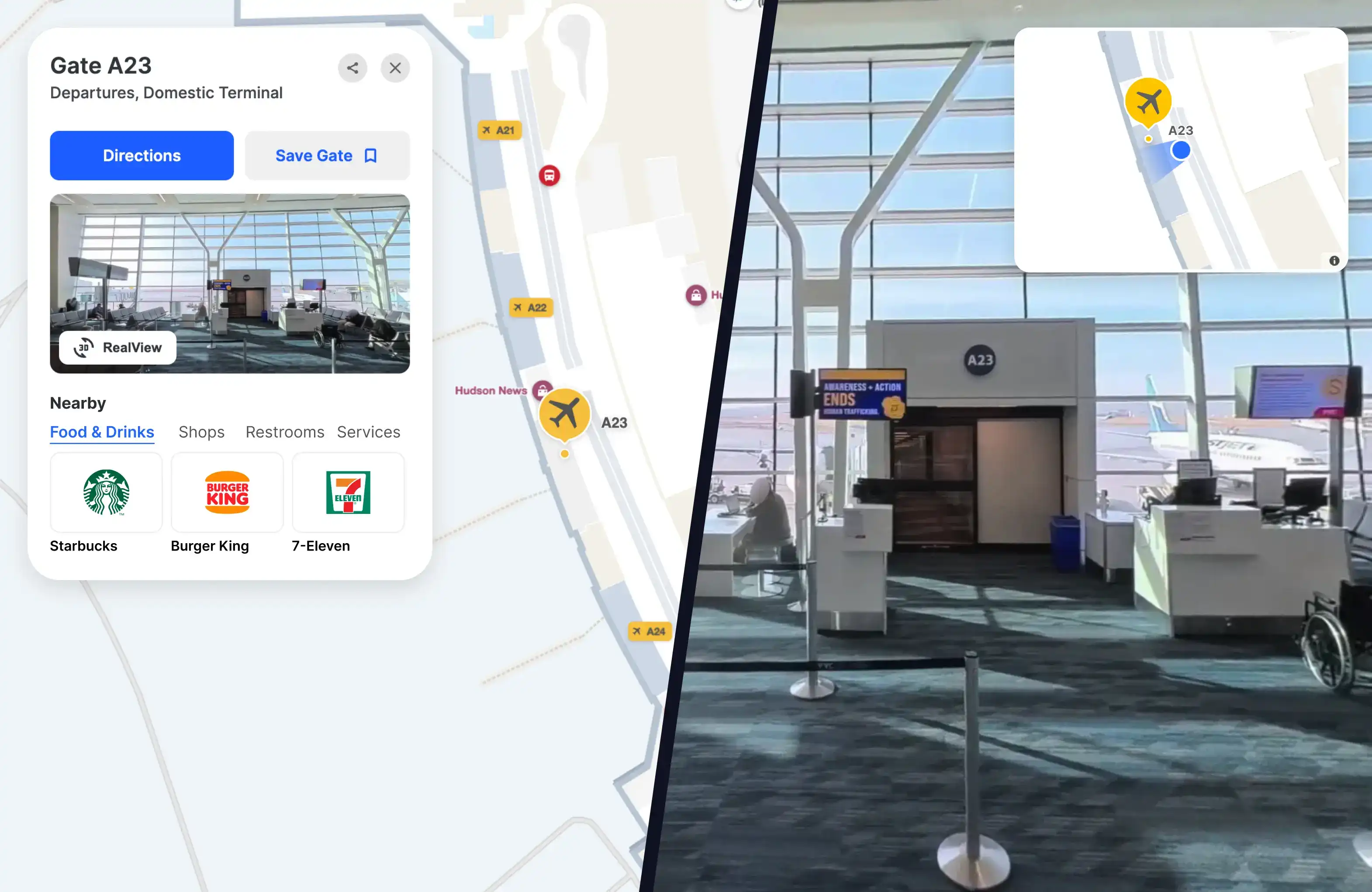
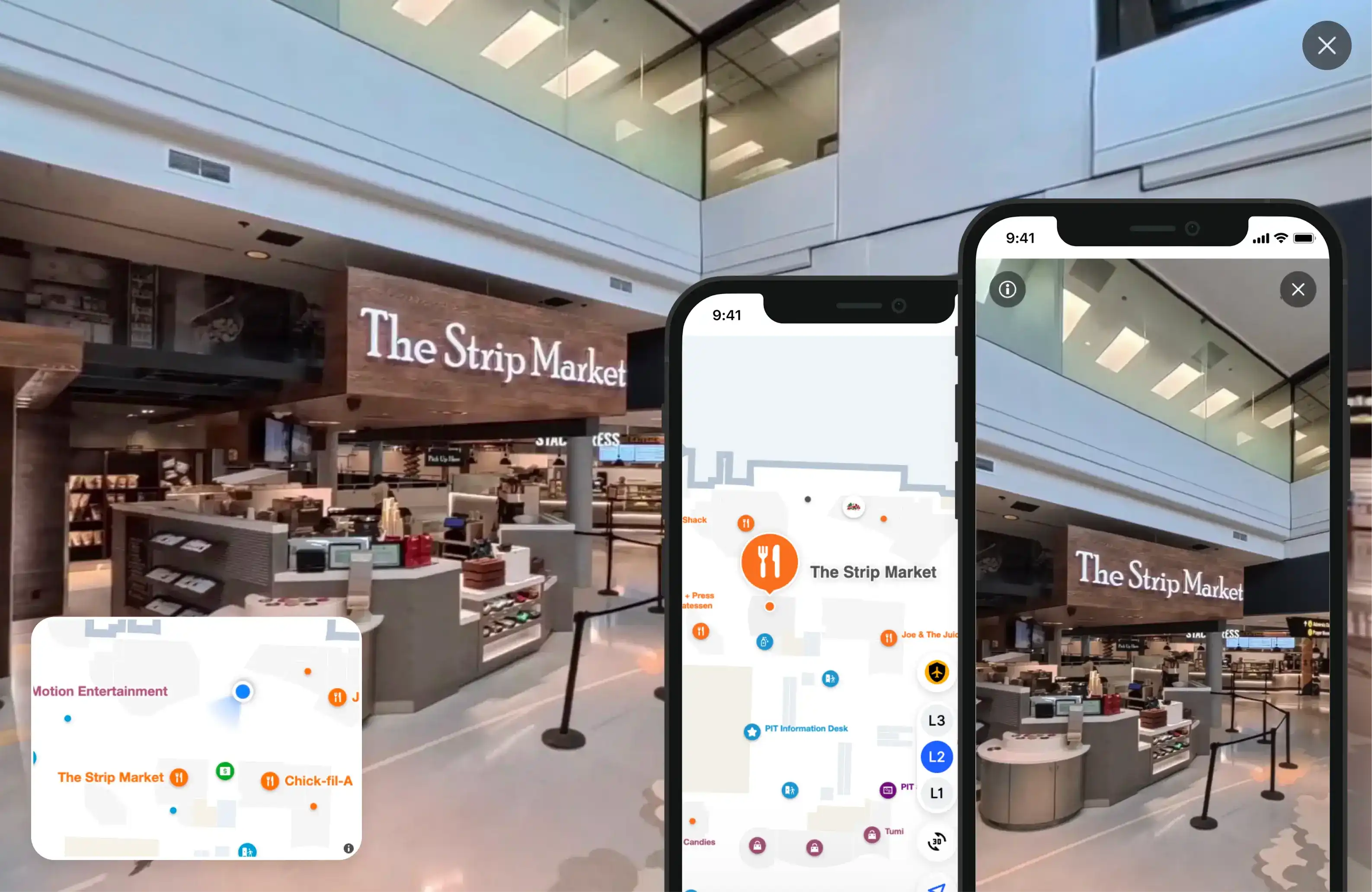
Know exactly where you're headed. Pair descriptions, operating hours, and rich location information with a 360-degree preview of the space. It's everything a customer needs to navigate the indoors with efficiency and confidence.

Everything you need to bring your indoor maps to life.
RealView gives you powerful indoor imagery and precise views of the indoors without the expensive camera equipment or lengthy setup.


Our partnership with Mappedin has always been about removing uncertainty for passengers. RealView takes that to a new level. When travellers can see the terminal as it truly looks, they arrive prepared, confident, and ready to enjoy everything YYC has to offer.


Frequently asked questions
What is Mappedin RealView?
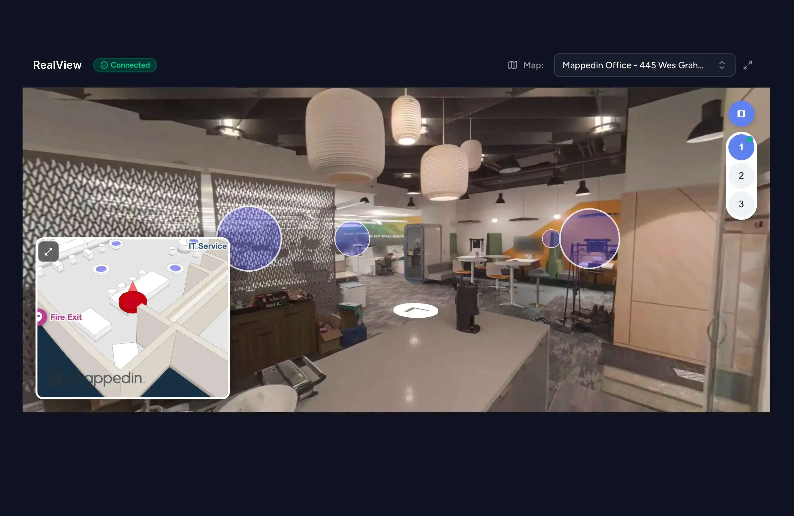
Mappedin RealView brings immersive, 360-degree panoramic imagery to indoor locations. Think Google Street View or Apple Look Around, but exclusively for the indoors. It gives people a photorealistic, ground-level view of your environment, helping them orient themselves and navigate with confidence before they even arrive.
Where does RealView appear on an indoor map?
RealView appears as a thumbnail in the Location Profile, which is accessed by selecting a specific location on the indoor map. Each profile displays a preview of the 360-degree imagery alongside key location details such as descriptions, operating hours, and related links.
How do you capture 3D scans of an indoor environment?
A scan of your environment can be captured using a consumer-grade 360-degree camera, making the scanning process straightforward and accessible for any indoor environment. The Mappedin team can also come onsite to handle the entire scanning process.
How is RealView different from traditional virtual tour software?
Traditional 3D scanning and virtual tour software is engineered for dimensional precision, supporting engineering, construction, and planning. Mappedin RealView is purpose-built for wayfinding, capturing rich, immersive 360-degree imagery to support intuitive navigation.
What can a single 3D scan enable in Mappedin?
A single 3D scan unlocks a range of powerful capabilities, enhancing wayfinding, enabling visual positioning, assisting leasing teams, and supporting operational workflows.
How do you ensure privacy and data protection?
Only anonymized data ever reaches our servers. Mappedin automatically detects and blurs all faces and spatial data is transmitted and stored using industry-standard encryption.