

A hospital visitor is late for an appointment and sees a blue dot hovering between two corridors. A retail manager wants to know which checkout area is moving faster, while a conference attendee is searching for a specific breakout room.
In each case, the venue may already have Wi-Fi coverage, but connectivity and positioning aren't the same thing.
The distinction shapes every Wi-Fi location project. Existing access points can provide a practical starting layer, yet signal reflections, device compatibility, building changes, and calibration determine whether the result supports broad zone guidance or dependable blue-dot navigation. A venue technology team therefore needs to evaluate confidence and stability, not just a single accuracy figure.


Why venues choose positioning with Wi-Fi
Wi-Fi is often one of the first indoor positioning options considered because the venue already operates it. Reusing that network can avoid installing a separate radio layer, running new power, or adding dense ceiling hardware. It can also let the positioning system share part of the venue's existing technology and support both visitor-facing guidance and operational analytics.
That makes Wi-Fi a useful baseline, but not automatically a complete solution. A network designed to keep phones and point-of-sale devices online may not have the access-point geometry, signal consistency, or device support needed for reliable location estimates.
Operators need to ask whether the current network was designed for coverage only or for location-sensitive applications as well.
For example:
- A shopping center can use positioning data to understand zone occupancy and dwell patterns.
- An airport can connect a location fix to terminal wayfinding.
- A hospital can use a position estimate to help visitors find the correct department, while still applying conservative fallback behavior when the estimate becomes uncertain.
The baseline versus purpose-built alternatives
Wi-Fi's main advantage is its combination of existing infrastructure and broad potential device coverage. BLE beacons can provide useful proximity cues, but they add a hardware inventory and maintenance program. UWB can support sub-meter positioning in suitable environments, but dedicated anchors and compatible devices raise the deployment threshold. Computer vision can be powerful for mapped spaces and analytics, yet it introduces camera, privacy, and processing considerations.
The right comparison depends on the consequence of an error. If a visitor only needs to know which zone contains a service desk, Wi-Fi may be enough. But if a workflow requires a precise asset location, something like beacons or UWB may justify its additional infrastructure.
The rest of the evaluation comes down to three questions:
- How the radio measurements become a location
- How much the environment changes those measurements
- How the resulting coordinate connects to a map and a business workflow
How positioning with Wi-Fi works
Wi-Fi positioning isn't one technique. It describes several ways a phone or tag can use nearby access points to estimate where it is. The differences matter because each method makes a different compromise between measurement quality, infrastructure, device support, and ongoing maintenance.
RSSI fingerprinting
Received Signal Strength Indicator, or RSSI, fingerprinting works like recognizing a room from its particular mixture of smells, echoes, and background noise. During a survey, a team records signal readings at known locations. The system stores those readings as a radio map, then compares a device's live measurements with the stored patterns.
If a phone hears several access points at particular strengths, that combination may resemble the fingerprint recorded near a pharmacy entrance, elevator lobby, or gate lounge. The system selects the closest matching pattern. A single signal isn't enough to identify a precise point, but the combined pattern can distinguish one part of a building from another.
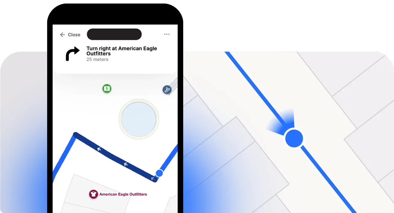
The weakness is that the stored pattern can age. Furniture, partitions, crowds, tenant fit-outs, and access-point settings can change the radio environment. Fingerprinting therefore trades relatively accessible hardware requirements for survey and maintenance work.
Trilateration
Trilateration treats access points like known peaks around a lost hiker. The system estimates the device's distance from several access points, then searches for the point where those distance estimates intersect.
With RSSI-based trilateration, distance is inferred from signal attenuation rather than measured directly. Walls, reflective materials, human bodies, and multipath can make the same signal strength correspond to different physical distances. The geometry may look simple on a diagram, but an atrium or crowded retail floor can produce unstable estimates.
Trilateration can still be useful when a venue has well-placed access points but lacks a detailed fingerprint survey. It can also act as a supporting or fallback method, especially when a system combines it with map constraints or other phone sensors.
Wi-Fi RTT and FTM
Wi-Fi Round-Trip Time, or RTT, changes the measurement from signal strength to travel time. The phone and access point exchange a precisely timed frame, and the system converts the round-trip duration into an estimated distance. The analogy is closer to echolocation than to recognizing a smell.
IEEE 802.11mc introduced Fine Timing Measurement (FTM) for this type of ranging.
Research describes RTT and FTM systems achieving about 1 to 2 meters in homes and offices in reviewed deployments, with a 2026 hybrid RTT-RSS study reporting 0.6-meter accuracy on a real-world building-floor dataset and 80% of estimates below 1 meter under mixed conditions.
RTT also has requirements:
- Access points must support FTM
- Client devices must expose the relevant capabilities
- Operating systems don't provide identical pathways
Android 9 and later support Wi-Fi RTT APIs on compatible hardware, while iOS uses a different location framework and doesn't offer the same general-purpose RTT workflow.
A production system often blends fingerprinting, trilateration, RTT, inertial sensors, and map constraints. The goal isn't to select a fashionable method, but to produce a location estimate with an honest confidence level.
Fingerprinting vs. trilateration vs. RTT
The three methods differ most in what they require the operator to maintain.
- Fingerprinting depends on a radio map.
- Trilateration depends on useful access-point geometry and a workable signal-to-distance model.
- RTT depends on compatible hardware and devices that can perform time-based ranging.
Research over more than a decade shows why Wi-Fi remains relevant while its limitations persist. A 2015 IEEE survey identified Wi-Fi fingerprinting as one of the field's two major research directions, and a 2016 comparison reported:
A separate comparison reports 98% room accuracy under its test conditions, so operators should treat published results as method- and dataset-specific rather than interchangeable guarantees.
What the comparison means for operators
Fingerprinting usually offers the broadest hardware path because it can work with existing access points, but its survey burden grows with venue size and environmental complexity. Trilateration can be a good fallback, yet RSSI-to-distance conversion becomes noisy in reflective buildings.
RTT offers a stronger accuracy ceiling, but only for the portion of the device fleet and infrastructure that supports it.
Apple device workflows deserve separate validation because Apple's Core Location pathway for indoor positioning differs from Android's direct RTT support. A venue serving guests on mixed devices shouldn't evaluate RTT only with a small set of compatible test phones.
Accuracy, drift and the calibration burden
A venue can launch with a convincing blue dot, then see it place visitors on the wrong side of a corridor after a kiosk moves or shelving is rearranged. Published accuracy describes a test environment. Operators inherit a living building, where temporary partitions, changed access-point transmit power, furniture, crowds, and network adjustments can alter the radio pattern.
The key operational risk is drift.
The system still returns coordinates, and the dot may move smoothly, but its confidence has weakened. A small position error can send a visitor toward the wrong corridor branch or an adjacent tenant. Wi-Fi positioning is a confidence-and-stability problem, not only an accuracy problem.
Treat the survey as recurring work
A site survey should test whether the radio pattern supports real decisions, not merely whether a device can see Wi-Fi.
Organize testing around the places and conditions that affect the visitor experience:
- Real walking paths: Check entrances, corridors, elevators, stairs, queues, and approaches to destinations.
- Boundary points: Test parallel corridors, neighboring storefronts, room thresholds, and transitions between floors.
- Busy conditions: Compare quiet periods with crowds, queues, and temporary event layouts.
- Device diversity: Include the phones, scanners, tablets, and tags the venue expects to support.
- Change triggers: Record tenant moves, furniture changes, access-point replacements, and network retuning.
Research describes RSSI variation from ambient conditions and device configuration as an accuracy problem, while identifying existing Wi-Fi infrastructure as a reason to use the technology. The review of Wi-Fi-based indoor localization outlines that trade-off.
Decide between a refresh and a full re-fingerprint
A building change does not always require rebuilding the entire radio map. A localized change near one tenant or access point may call for a focused validation pass. A major floor reconfiguration, network redesign, or repeated failures across several zones can justify a broader survey.
Assign ownership before launch. Facilities may know about physical changes, networking may track access-point changes, and the digital team may see complaints first. A shared process prevents each group from assuming another team is watching for drift.
RTT can reduce dependence on signal-strength fingerprints by measuring time of flight, but reflective surfaces and blocked paths still affect results. One study reported:
The FTM and RSSI comparison shows why method choice must account for the building, device fleet, and maintenance effort.
Calibration belongs in the operating budget as staff time, testing, and change management. Price calibration labor realistically, then compare it with the cost of a cheaper deployment that no longer matches the physical venue.
Pairing Wi-Fi positioning with indoor maps and wayfinding
A coordinate isn't useful to a visitor until the application knows what that coordinate means. The positioning layer may return a point on a floor, but the map and routing system must connect it to a hallway, storefront, gate, room, elevator, or accessible path.
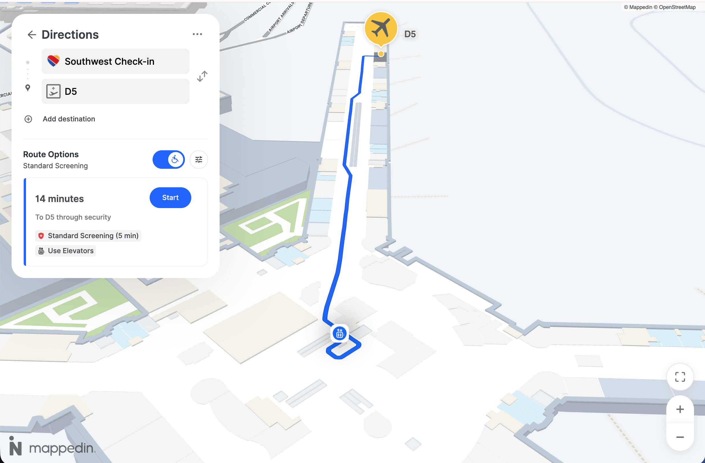
That connection usually starts with a venue graph. The graph represents walkable paths and relationships between spaces. A position callback from an indoor positioning provider can be associated with a floor and graph location, then used to place the blue dot on the map and calculate a route to a selected destination.
From location fix to route decision
A wayfinding system typically performs several interwoven tasks:
- Map matching: The raw coordinate is constrained to a plausible floor and walkable area.
- Route calculation: The engine chooses a path based on entrances, barriers, stairs, elevators, accessibility rules, and destination availability.
- Progress updates: As the visitor moves, new position callbacks update the route and turn instructions.
- Business logic: The venue can attach zone triggers, operating conditions, or notifications to relevant areas.
A point that falls slightly outside a corridor doesn't necessarily need to be shown exactly as measured. Snapping it to the nearest valid path can make the experience more understandable, provided the system also tracks uncertainty and avoids pretending that the estimate is precise.
Fallback is part of the user experience
Signal quality can drop near thick walls, service areas, elevators, reflective surfaces, or crowded spaces. When confidence falls below the threshold required for aisle-level or doorway-level guidance, the application should reduce its promise rather than continue displaying a falsely precise dot.
Fallback behavior might change the experience to:
- Zone guidance: Identify the correct terminal, floor, department, or retail area.
- Landmark routing: Direct the visitor toward a known POI like an elevator, reception point, or intersection.
- Manual confirmation: Ask the visitor to confirm a landmark or starting point.
- Sensor fusion: Combine Wi-Fi with inertial movement, BLE, map constraints, or another positioning source.
The operational benefit is trust. A system that communicates a broad but dependable location can remain useful when a high-precision estimate would be misleading. Existing platforms like Mappedin can consume positioning callbacks through SDKs and APIs, but the positioning provider remains a distinct part of the overall stack.
Want to see how Mappedin indoor positioning can work at your venue? Book a demo →
Privacy, device support and operational risk
When implementing WiFi positioning, operators might ask:
A visitor's phone may support RSSI scanning but not RTT ranging. Another device may expose location through a different operating-system framework. Older hardware can limit the achievable result, while app permissions and background restrictions can interrupt updates. That creates a direct operational risk: a pilot using managed, recent devices may not represent the guest fleet.
Privacy starts with purpose
A venue should separate individual wayfinding from aggregate analytics. A visitor who requests directions may consent to location updates for that experience. A zone-occupancy dashboard may need only aggregated data and a shorter retention period.
The governance questions should be explicit:
- Data purpose: Is the system assisting a person with wayfinding, measuring zones, or supporting both?
- Identifier handling: Does the system store a device or user identifier, or only a temporary location session?
- Retention: How long does the venue keep raw location events?
- Access control: Which teams and vendors can view individual or aggregated data?
- Consent: How does the application request, record, and withdraw permission under applicable rules such as GDPR, CCPA, and local requirements?
MAC randomization and opt-in scanning can affect how a system identifies or observes devices. A privacy review should therefore involve legal, security, product, and network teams before implementation decisions become difficult to change.
Operational risk matrix
The 2025 survey literature treats broad device support and deployment maturity for Wi-Fi Location and IEEE 802.11mc FTM as unresolved considerations, not solved assumptions. A recent review of device support and hybrid positioning also reports a hybrid study with a 6.95-meter mean Wi-Fi error and a 4.26-meter standard deviation, showing why Wi-Fi alone may not provide consistent enterprise-grade service across conditions.
Redundancy doesn't necessarily mean duplicating every sensor. It can mean using map constraints, inertial data, zone-level fallback, and operational monitoring so one weak signal source doesn't take down the entire experience.
Choosing an approach and planning your next step
A venue can make an initial decision by scoring four practical conditions.
1. Start with the device fleet
If most supported phones and managed devices can use RTT, RTT deserves a pilot. If the fleet is mixed or largely unknown, fingerprinting offers a more predictable baseline because it doesn't depend on every client supporting time-based ranging.
2. Examine the signal environment
An open concourse may behave differently from a dense retail floor with metal fixtures, reflective walls, and frequent layout changes. The more complex the radio environment, the more important it becomes to test uncertainty at actual decision points rather than rely on a headline average.
3. Match the method to the dwell pattern
Short wayfinding sessions can tolerate a coarse starting position if the route quickly snaps to a known corridor. Long-stay analytics needs stable zone assignment and consistent handling of devices that move in and out of coverage. A method that looks adequate for navigation may not automatically produce reliable occupancy interpretation.
4. Price calibration labor honestly
- Fingerprinting is a conservative default where device coverage matters and the venue can support recurring surveys.
- Trilateration can make sense where access points already provide useful geometry and the accuracy requirement is modest.
- RTT is worth testing where compatible hardware, device support, and environmental conditions align.
A focused pilot should compare reported coordinates with surveyed coordinates across representative paths and difficult boundaries. The project team can use a two-day pilot with three access points and ten test points, then decide whether the results justify a full calibration sweep. The important outputs aren't just average accuracy. They include confidence stability, device-by-device behavior, update latency, floor transitions, and fallback performance.
A mapping and wayfinding platform like Mappedin can consume Wi-Fi-derived positions and turn them into blue-dot navigation, route guidance, analytics, and zone-triggered experiences. The venue should evaluate that layer separately from the positioning provider, so the map stays useful even if the radio strategy changes.
Related resources:


Share