

Start Here
Blue dot navigation for airports uses indoor positioning systems to provide real-time location tracking and turn-by-turn directions from parking to gates (and everything in between), enhancing the passenger experience through seamless indoor-outdoor wayfinding. This technology offers enhanced navigation, accessibility, and proximity marketing capabilities while providing airports with valuable analytics on passenger flow and behavior. Blue dot navigation on indoor maps works with mobile devices and can also seamlessly connect passengers from digital directories.
Passengers step off a plane, pull out their phone, and watch the blue dot that guided them through traffic to the airport suddenly drift, jump, or disappear. The satellite signals that worked perfectly on the drive in bounce off steel, concrete, and glass, turning a reliable navigation tool into a liability inside the terminal.
For airport IT and digital innovation teams, this is the starting point for every indoor positioning conversation. Passengers expect the same turn-by-turn experience they get on city streets. Delivering it inside a multi-terminal complex requires understanding why GPS fails indoors and what technologies can replace it.
Why GPS alone doesn't work inside airports (and what replaces it)
Airport terminals are some of the most "GPS hostile" environments on earth. The factors are structural, not fixable with better software.
Satellite GPS signals operate at frequencies that struggle to penetrate dense building materials. Steel framing, reinforced concrete floors, and the thick glass curtain walls common in modern terminal designs all attenuate the signal before it reaches a phone's receiver. By the time a passenger is inside the terminal, their phone is picking up fragmented, reflected signals from satellites that may not even be in the right part of the sky.
This creates two specific problems:
- Signal attenuation means the phone receives weaker signals or none at all.
- Multi-path interference happens when those signals bounce off walls, floors, and ceilings before reaching the receiver, causing the calculated position to jump by dozens of meters or land on the wrong floor entirely.
GPS alone can't determine which floor a passenger is on, which is a critical failure in an airport with multiple concourse levels.
The result is the familiar experience every traveler has had: a blue dot that seems to be tracking them in the parking lot, then goes haywire the moment they walk through the terminal doors.
Indoor positioning technologies solve this by replacing satellite signals with location methods that work inside buildings. The main approaches include Bluetooth Low Energy (BLE) beacons, Wi-Fi-based indoor positioning, Ultra-Wideband (UWB), and visual positioning systems. Each works differently, and the tradeoffs between them matter a lot when an airport is deciding what to deploy across millions of square feet.
How Mappedin approaches indoor positioning
Mappedin doesn't use or require any particular IPS technology. Customers use the IPS of their choice based on their venue, device mix, and accuracy requirements. Mappedin SDKs provide APIs that allow an app to pass the user's location into the map experience, where it's then used to display the blue dot and provide directions.
Learn more about indoor positioning with Mappedin →
Comparing blue dot positioning technologies
Choosing an indoor positioning technology for an airport comes down to four factors: accuracy, infrastructure requirements, maintenance burden, and device compatibility. Here is how the main approaches compare.
BLE beacons
BLE beacons use small battery-powered devices installed throughout the building. They broadcast signals that phones use to estimate position based on signal strength. Beacons can achieve reasonable accuracy in controlled conditions, but the practical realities at airport scale are challenging.
A large terminal can require hundreds or thousands of beacons to achieve adequate coverage. Batteries need replacing every few years across all of them, which means ongoing maintenance costs and labor. Beacons also require a native app to function, since the phone needs to actively scan for beacon signals. On the passenger side, active beacon scanning drains device battery faster.
WiFi based indoor positioning
WiFi positioning uses existing wireless infrastructure to estimate location. Apple's indoor positioning works wherever there is 2.4 GHz Wi-Fi coverage, which covers most modern airports. Android requires specific wireless access points that are RTT (Round-Trip Time) enabled, which means coverage can vary between platforms.
Wi-Fi positioning typically achieves 3 to 5 meters (10 to 16 feet) of accuracy. It does not require installing new hardware if the right access points are already in place, but accuracy depends heavily on the density and quality of the wireless infrastructure.
Ultra-Wideband (UWB)
UWB offers the highest accuracy of the mainstream approaches, sometimes down to 10 centimeters. But UWB requires specialized hardware infrastructure throughout the building, and relatively few consumer devices support it. The cost of deploying UWB across an entire airport terminal makes it impractical for most operators.
Visual positioning (VPS)
VPS uses the phone's camera to determine position by matching what the camera sees against a pre-mapped 3D model of the venue. VPS typically achieves 1 to 2 meters (3 to 6 feet) of accuracy, better than Wi-Fi IPS and comparable to or better than beacons. The key advantage is that it requires no installed hardware in the building. A passenger opens the map, scans their surroundings, and the blue dot appears. The tradeoff is that VPS works best in areas with distinct visual features and adequate lighting.
For airport operators evaluating these options, the practical question is:

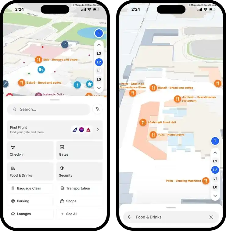
How Keflavík Airport and Icelandair partnered on a seamless passenger wayfinding experience
By aligning their digital ecosystems through Mappedin, KEF and Icelandair have created a unified experience that helps travelers navigate confidently, streamlines operations behind the scenes, and unlocks new opportunities for shared commercial growth.
Real airport outcomes with blue dot navigation
The technology conversation matters, but airport leaders also need to see what happens when indoor positioning meets real passengers in a real terminal.
Calgary International Airport (YYC)
YYC deployed Mappedin to guide passengers from parking through the terminal, with features including bilingual wayfinding, accessible navigation, and QR code sharing that lets staff and volunteers generate directions for travelers in seconds. The airport's White Hat Volunteers use the system to help passengers navigate complex multi-floor routes and share them via a simple QR code scan.
— Bart Smith, General Manager, The Calgary Airport Authority
The YYC deployment demonstrates something important about blue dot navigation in practice. The technology isn't just about showing passengers a dot on a map. It is about giving the entire airport ecosystem, from volunteers to retail staff to the passengers themselves, a shared tool for solving the navigation problem.
Pittsburgh International Airport (PIT)
The PIT team has taken a complementary approach. Through its xBridge Innovation Center, PIT partnered with Mappedin to deploy RealView, which provides 360-degree previews of the terminal so passengers can familiarize themselves with the environment before they arrive.
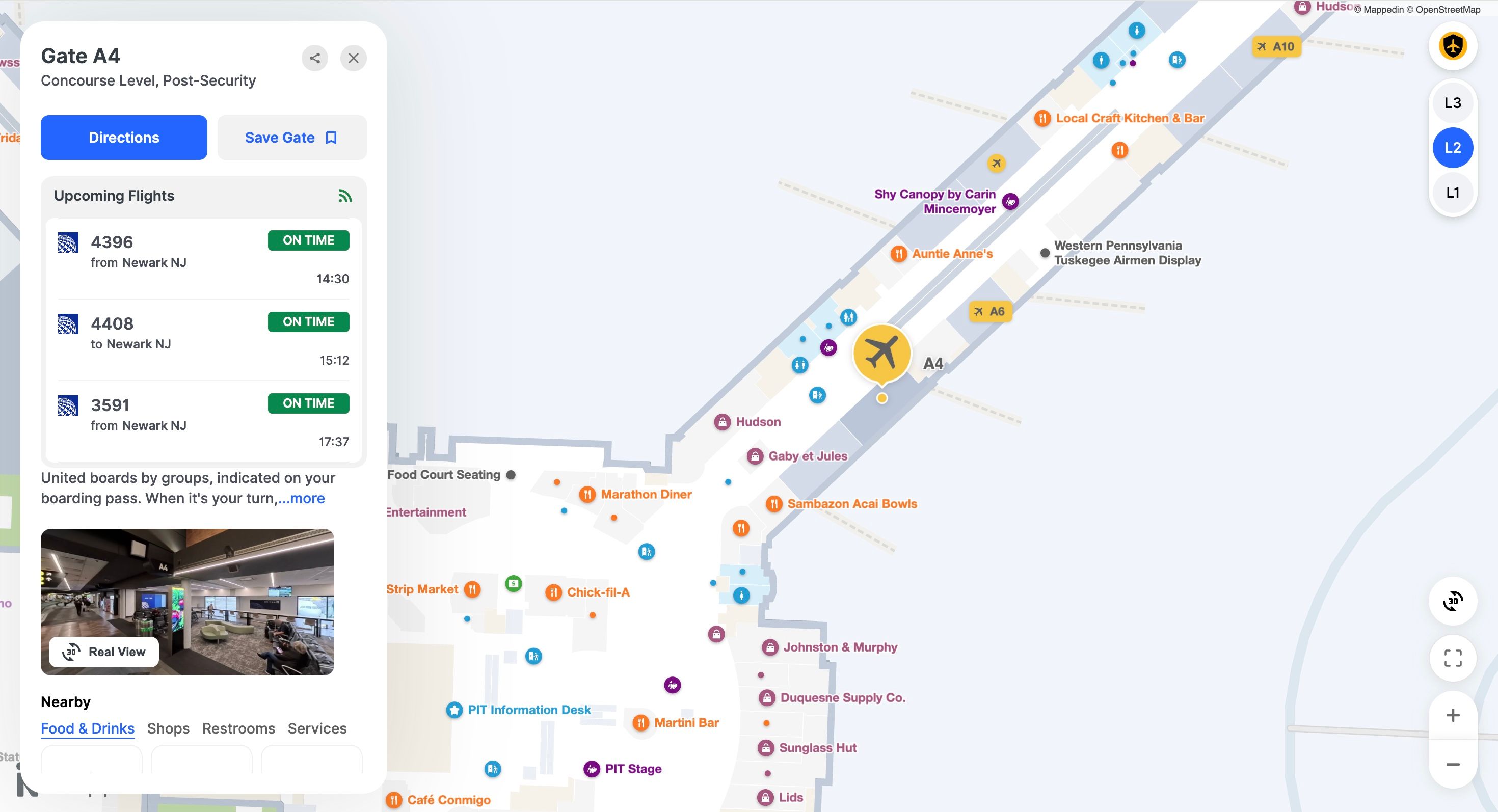
RealView, while it doesn't replace blue dot navigation, reduces the anxiety that comes from not knowing what a terminal looks like. Passengers who can preview their route are more confident when they arrive, and the blue dot becomes a confirmation of what they have already seen rather than a cold start.
Keflavík International Airport and Icelandair (KEF)
This partnership went further, creating an industry-first unified indoor mapping partnership. Centralized data from parking to gates gives passengers a single source of truth for their entire journey through the airport, with both the airport and airline operating from the same map data.
How airports connect blue dot navigation to ground transportation
Blue dot navigation doesn't stop at the terminal exit. For passengers, the airport journey includes getting to and from the airport, and the handoff between indoor wayfinding and ground transportation is where many navigation systems break down.
A passenger who successfully navigated from their gate to baggage claim still needs to find their rideshare pickup zone, the rental car shuttle stop, or the transit station. Airport shuttles, parking lots, and public transit connections are often located across multiple levels or in separate structures, and the signage is frequently unclear.
Mappedin addresses this by integrating transit data and flight data directly into the map.
- Real-time departure and arrival information helps passengers make decisions about timing.
- Transit data shows real-time bus, train, subway, and shuttle availability.
- Flight data surfaces gate assignments, baggage carousel information, and departure times.
This means a passenger can see that their gate has moved, adjust their route through the terminal, and then navigate directly to the ground transportation option that matches their schedule, all from the same map.
For airport shuttle operators, this integration reduces the number of passengers who miss their connection because they could not find the right pickup point. For the airport, it reduces the staff burden of directing lost passengers to transit stops. The blue dot that guided a passenger from gate to baggage claim can also guide them to the correct curb for their specific shuttle or rideshare service.
What to look for when evaluating indoor positioning for an airport
The most important thing for airport operations teams to know about choosing the right positioning system is selecting the right one that works for the most passengers with the least ongoing burden on their IT team.
A few principles hold across deployments:
- Positioning should work without requiring passengers to download an app, because most won't.
- It should function across both iOS and Android, even if accuracy varies by platform.
- It should not require installing and maintaining hundreds of battery-powered devices across a terminal.
- It should connect to the broader airport experience, including ground transportation, flight information, and accessibility routing, rather than existing as a standalone dot on a map.
The technology will continue to evolve. Visual positioning accuracy will improve as more airports deploy 3D mapped environments. Wi-Fi standards will advance. But the decision framework stays the same: choose the approach that covers the most passengers, costs the least to maintain, and connects to the systems an airport already runs.
For airports evaluating blue dot navigation today, the combination of infrastructure-free visual positioning, web-based delivery, and integrated transit and flight data represents the most practical path to giving passengers the indoor navigation experience they already expect from every other part of their journey.
Related resources:


Share